Friday, September 29, 2006

Swing Time For Temps

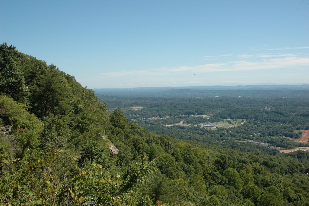
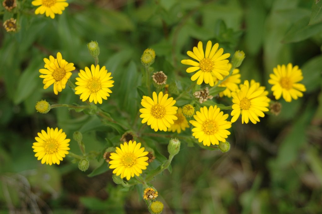
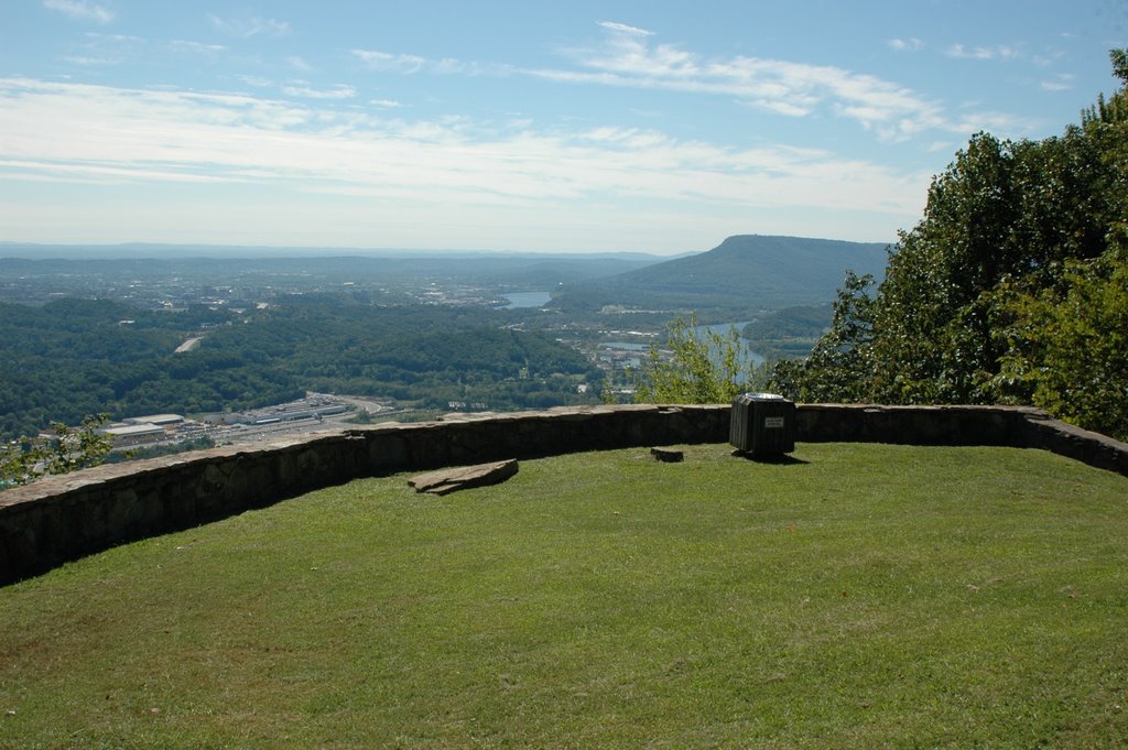
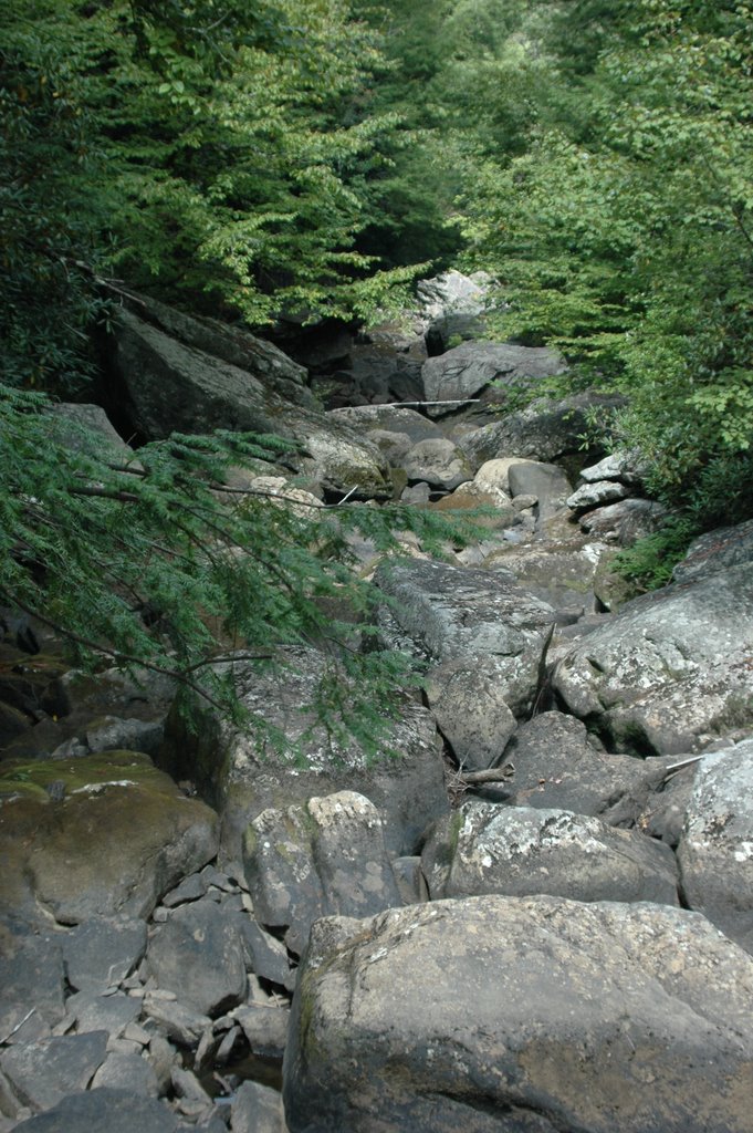
"When you get the chance, slow down when you take a hike." When I see a friend's advice in print it's really kind of funny. Because like most people, I feel like I'm always in high gear. And when I do get a chance to take a walk in the woods, I find myself heading out on the trail like I have to cover the whole thing before the clock runs out. Then I realize there's no rush, and I see things I would have missed. The small stuff. Like the picture above of some pine seedlings sprouting up from the middle of a rotting log. There's no rush here in the wilderness. While we say time flys, in nature it slowly marches on. Think of how long this log has been decomposing to the point where it's a fertile plot for these new trees to take root. Will they be covered in leaves this Fall and die out by Spring? Or will the right amount of moisture and sunlight hit this patch of forest floor, so one day a tall pine shades the way for a future hiker?

Our weather this weekend will be perfect for pondering such small things while enjoying a hike. Abundant sunshine today will help move readings back into the upper 60s to low 70s this afternoon. Chilly tomorrow morning. In Chattanooga we'll drop into the low to mid 40s, but there could be some patchy frost away from the city Saturday morning. This morning some spots were in the upper 30s, and tomorrow morning there could be a few mid 30s. We'll get back into the mid 70s Saturday afternoon. Another front sweeps through late Saturday night, and we could see a few light showers or sprinkles with this but that's about it. Then look for a big warm-up next week with highs back into the mid 80s by Tuesday and Wednesday.

Today: Mostly sunny and cool. High: 69

Tonight: Fair and chilly. Low: 44

Saturday: Partly cloudy and pleasant. High: 76

Saturday night: A few light showers possible. Low: 54

Sunday: Partly cloudy and mild. High: 79

Monday: Mostly sunny. High: 83

Tuesday: Sunny. High: 85

Thursday, September 28, 2006

Ups And Downs Of Autumn

Another gorgeous day across the valley yesterday with a high in Chattanooga of 82. Two more fronts the next five days, one today and another on Sunday. Today's front is triggering some scattered showers this morning, and will open the door to cooler temps this afternoon and tonight. I think after a showery first half of the day, this afternoon becomes breezy with some sunshine through the clouds. Then quiet and generally cool Friday and Saturday. Late Saturday night and Sunday morning we could see a few sprinkles or light showers, but most areas only see a trace of rain during that time frame. And most of Sunday looks fine. Next week look for temperatures to swing back to above normal levels. In fact the air conditioning may come back on as we see numbers in the low to mid 80s.

Today: Showery early, then breezy and cooler this afternoon with a few breaks in the clouds. NW 10-15 mph and gusty. High: 72

Tonight: Fair skies and chilly. Low: 49

Friday: Mostly sunny and cool. High: 69

Saturday: Mostly sunny and pleasant. High: 73

Saturday night: A few sprinkles possible late. Low: 54

Sunday: Partly cloudy and pleasant. High: 78

Monday: Mostly sunny and warmer. High: 83

Wednesday, September 27, 2006

Fronts Sweep Through Quickly, Then Disappear

Even though the weather a couple of weeks ago was dry, a recent walk in the woods revealed some of nature's smaller, yet most important life forms....fungi. It seems there was just enough moisture for a variety of mushrooms and toadstools to poke up through the ground and provide a feast for the eyes. It didn't occur to me when I took this picture, but now that it has been posted, the tops of these mushrooms look kind of like sesame seed buns. And the two little guys in back look like pawns that have escaped from a nearby chess board.
A couple of fronts will sweep through the area in the next 5 days. One tomorrow and another on Sunday. The first front should stir up scattered showers and a few storms from mid morning to early afternoon, then drop temperatures Friday and Saturday. Another front should zip through on Sunday and could trigger a few sprinkles when it passes by. But overall Sunday should be dry.

Today: Mostly sunny and a bit warmer. Southwest winds 10 to 15 mph and gusty with highs near 80.

Tonight: Clouds increase with a slight chance for a shower by daybreak. Low: 57

Thursday: Scattered showers and a few storms, then breezy and cooler. Winds turning to Northwest 10 to 15 mph and gusty. High: 72

Friday: Partly cloudy and cooler. High: 69 Lows dropping into the 30s by Saturday morning in parts of the Tennessee Valley. 44 in Chattanooga.

Saturday: Mostly sunny and pleasant. High: 70

Sunday: Partly cloudy with a slight chance for a light shower or a few sprinkles. High: 76

Tuesday, September 26, 2006

Sunshine And Sunflowers

Thanks this morning to Kathy Davis for sending this picture of September sunflowers. It's a beauty, and I'm glad she's sharing it with everyone.
Weather-wise things look pretty nice for the next few days. We'll see a lot of sunshine today and tomorrow with big swings in temperatures from the morning hours into the afternoons. Our next front comes whipping through here on Thursday. Right now the air is pretty dry and the speed of this front won't allow much moisture return. So I think most areas get less than 1/4" of rain on Thursday. What will grab your attention is the cooler air behind this front Friday and Saturday. Another front may breeze through here on Sunday with a few mainly light showers.

Today: Sunny and nice. High: 77

Tonight: Clear and chilly. Low: 52

Wednesday: Mostly sunny, pleasant. High: 80

Thursday: Scattered showers a few thunderstorms early. High: 71

Friday: Mostly sunny, cool and breezy. High: 68

Saturday: Sunny and cool. Morning lows around 44 in Chattanooga, but outlying areas should drop into the upper 30s. High: 71

The Department of Homeland Security announced yesterday that $5 million dollars has been made available to put NOAA weather radios in all 97,000 public schools in the U.S.. Tennessee and North Carolina are among six states that already mandate the weather radios are in place in schools. But they will still get the most up to date models. Delivery is supposed to take place in October. That's great news, and perhaps long overdue.

Monday, September 25, 2006

Underwater UFO Mystery Surfaces

I'm going to let a picture of the famous "Spaceship House" from here on Signal Mountain suffice for an introduction to this post. You see I've always enjoyed a good science fiction book, television show, or movie. I grew up watching "Star Trek", and was bananas over "Star Wars". And I can't count the times I have watched all or part of "Sphere", which combines diving and the discovery of a UFO wayyyyyyyyyyyy down deep. So today imagine my surprise and interest in a legitimate UFO mystery that has been discovered underwater.
A dive team has located the wreckage of an Air Force F-89 that went down in Lake Superior in 1953. Like all good mysteries this one began when a radar operator reported a UFO and the F-89 on the radar screen merging into one image, then disappearing.
Today's sonar allows divers to look for wrecks and find them with amazing resolution even hundreds of feet deep. If you have ever seen "Deep Sea Detectives" you know what I'm talking about. So the images have been released of this plane wreckage and the UFO today, and you have to check them out at http://www.divester.com . Make sure you follow the links to see all of the pictures and the historical account of what was being reported in November of 1953.
What's awesome is this mystery will surely be solved with time. There are very sophisticated remotely operated vehicles or ROVs that can explore such deep sites. And this story has enough intrigue to make an awesome episode for "Deep Sea Detectives" or some other show.
There's probably some very simple answer to what the round object is near the aircraft. But on the other hand...........it brings to mind a line from the movie "Contact". Jodie Foster's character looks up at the night sky and says, "If we are the only ones, it seems like an awful waste of space."

Drying Out After Hefty Rainfall This Weekend

Officially Chattanooga recorded 2.42" of rain from Friday through Sunday, but most of our Channel 3 Storm Alert Skywatchers had 3" to 5". I had 4" at Casa Benson atop Signal Mountain, and let me tell you coming home from work Saturday night the water was rushing down the "W" road and actually bouncing off the walls of the "W" around 9:00 pm. It looked like a ride at a water park. But it was much worse to our north and northwest. Much of Roane, Knox, and Loudon counties in Tennessee were under water with reports of standing water in several locations 4 to 5 feet deep. Flooding was even worse in much of Kentucky where parts of the Bluegrass State saw 5" to 10" of rain. And Doppler radar estimates put rainfall in Southern Illinois at over 11".
For us much drier air settles in for the next few days, and for anyone who works outside this will be a pleasant week overall. But some rain will enter the picture late Thursday into Friday with another front that will pound temperatures into the 60s for highs Friday afternoon.

Today: Partly cloudy and pleasant. North wind 5 to 10 mph. High: 76

Tonight: Clear and chilly. Calm wind. Low: 51

Tuesday: Sunny and Nice. Light North. High: 77

Wednesday: Mostly Sunny and Pleasant. High: 78

Thursday: Clouds increase with some showers and a few storms late. High: 74

Friday: Morning showers, then partly cloudy cool and breezy during the afternoon. High: 68

Friday, September 22, 2006

Springlike Storm May Produce Severe Storms Here

Here's another snapshot from Savage Gulf of some beautiful flowers growing in one of the stream beds. When you pick up one of the trail maps, these flowers are featured inside but not identified. I tried to do an internet search for Tennessee wildflowers, but most were Spring bloomers. So I'm not sure what these are, but the closest I could find was the Crimson Bee Balm / Oswego Tea. And I don't think that's it. So if anyone knows for sure let me know by e-mail: tbenson@wrcbtv.com .
The weather is looking more spring-like than fall-like this weekend. A potent storm system is moving into the upper Midwest today and could produce a large outbreak of severe weather from eastern Oklahoma through Arkansas, Northern Mississippi, Western Tennessee, Southern Illinois and the eastern half of Missouri. We probably won't have to worry about any severe storms until Sunday when the front sweeps through. But we will have to deal with showery periods and a few storms today and Saturday.

Today: Mostly cloudy with scattered showers and a few storms. South winds 10 to 15 mph. High: 78

Friday Night Football: Warm and breezy with a 30% chance for a shower at gametime. Kickoff Temp: 74 10 pm: 70

Overnight: Mostly cloudy 20% for a few showers. Low: 68

Saturday: Mostly cloudy with scattered showers and a few storms. Windy. Southwest Winds 10 to 20 mph and gusty. High: 85

Sunday: Showers and storms likely. Some could be strong to severe. High: 77

Monday: Mostly sunny, cool and breezy. High: 74

Tuesday: Sunny and pleasant. High: 77

Normally we have two severe weather seasons, one in the Spring and one in the late Fall. But normally that doesn't happen until late October to mid November. The forecast models show a couple of strong systems that could keep us busy with thunderstorms from time to time over the next couple of weeks. So we may have an early secondary severe weather season.

Thursday, September 21, 2006

Chilly Start, Another See 7 States Afternoon

  • If it weren't for Winter coming next, I'd say this is my favorite time of year. As it stands I still choose Spring #1, but Autumn in the Tennessee Valley can't be beat. These last couple of afternoons have been spectacular. So I drove over to the brow of Signal Mountain to snap a couple of quick pics. Here's one of them. After such a hazy, hot summer it was nice looking over the Tennessee River to the south and all the way to the Blue Ridge Mountains to the east.
Brrrrrrrrr this morning. As of 6 am some of the chillier readings:
  • Bledsoe State Forest 39
  • Blairsville 40
  • Blue Ridge 43
  • Ellijay 43
  • Sale Creek Mtn. 43
  • Cohutta 44
  • Prentice Cooper S.F. 45
  • WRCB-TV 3 49

Today: Mostly sunny and pleasant. Southeast winds 5 - 10. High: 77

Tonight: Fair and cool. South wind 5 mph. Low: 57

Friday: Partly cloudy and breezy, with a 20% chance for a light shower late. High: 79

Saturday: Mostly cloudy with a 40% chance for showers and storms. High: 82

Sunday: Scattered showers and a few storms. High: 78

Monday: Mostly sunny and pleasant. High: 74

On this shift I'm loving the darkness coming early as I usually hit the sack around 7:30 pm. But I noticed the dwindling daylight while mowing the yard. I had a light sweatshirt on which felt good in the shady areas. There wasn't enough daylight left to finish. (At least that's my story and I'm stickin' to it.) So today it's out with the bagger for the first time. Already a lot of leaves down in my yard. I hope the color ends up being as vibrant as last year's show. Already there are touches of bright reds showing up, and with lows in the upper 30s and low 40s like we had this morning, the curtain is rising on the Fall Foliage Show '06. Let's hope it lasts longer than last year's brief but beautiful display.

Wednesday, September 20, 2006

Dry Conditions Shown By What's Missing.


Todd Yakoubian our former weekend meteorologist was in town last week, and we took a quick trip up to Savage Gulf to spend a very pleasant afternoon hiking. I visited the park back in April, and I was telling Todd how nice the waterfalls were up there. Unfortunately, being nearly 10 inches below average rainfall has some drastic effects on streams on the plateau. In fact we initially took the wrong trail, hiking right past what was a roaring falls back in April. So I'm posting two sets of pictures this morning so you can see the difference between April '06 and September '06. There is still plenty to see at Savage Gulf, so I still think it's worth the trip....especially with this kind of weather. But it's going to take some big time rainfall to get the water rushing down the mountain again.
Morning lows in the higher elevations were down into the 40s this morning. And even Dayton and Murphy dropped into the upper 40s shortly before sunrise today. And the cooler air is still moving into the area, so by morning we should see lows in the upper 40s in the city. Outlying areas may drop into the mid 40s briefly. That's a bit nippy after such a lonnnnnnnnnng hot summer. Our average low tomorrow morning is 60. The record low is 44 set in 1956. The last time Chattanooga was officially in the 40s was May 19th when the airport fell to 46. That's 124 days ago! (And if the GFS model is right, there could be a REAL COLD shot coming up around the first of October. First lows in the 30s? But that could end up being a figment of the models imagination.)
Enjoy this weather while it lasts.

Today: Sunny, cool and breezy. North wind 10 to 15 mph and gusty. High: 73

Tonight: Clear and chilly. Low: 49

Thursday: Mostly sunny and pleasant. High: 78

Friday: Increasing clouds. High: 79 Slight chance for a shower Friday night. Low: 66

Saturday: Clouds and some sun. 30% chance for a shower. High: 83

Sunday: Mostly cloudy with a 50% chance for showers and storms. High: 82

By the way check out your local PBS station tonight and next Wednesday for a special on our National Marine Sanctuaries. It's called "America's Underwater Treasures" and it will feature all of 14 sites including the Flower Garden Banks National Marine Sanctuary which is supposed to be featured tonight. You should get a good idea how close the Tennessee Aquarium has come to re-creating this natural wonder.

Tuesday, September 19, 2006

Rain In Spain From Gordon, Our Forecast A Breeze


Every once in awhile you get a tropical system to hang onto enough steam to remain a named storm when it approaches Europe. And it looks like Gordon will spread rain on the northern plains of Spain. (And much of Portugal.) Helene will eventually head northeast as well, so it remains to be seen if there will be an Iberian double whammy.
Some decent rainfall amounts from yesterday and overnight. Here at Channel 3 nearly 3/4" of rain......still showery when I left Casa Benson this morning so that tally remains to be seen. (Note to Santa: Thom needs a wireless rain gauge.)
Our front opens the door for some rather chilly air to move in during the day. As I type breaks in the overcast already moving overhead, so the rest of the day looks great. A bit on the breezy side later this afternoon and tomorrow. And another front should slide into the area beginning on Friday.
So with two fronts this week, and considering the time of year I am cautiously closing the door on any more official 90 degree days this year. So far we have had 59 days at or above 90 this year, 13 more than the average 46. Historically we don't hit 90 after October 9th, although it reached 89 on October 21st, 1963. So we can still have some very warm days in September and October, it's just that it's harder to top out at 90 or hotter now.

Today: Mostly sunny afternoon, breezy and cooler. Northwest winds increase to 10 to 20 mph and gusty. High: near 80

Tonight: Clear skies, chilly. Low: 53

Wednesday: Sunny, cool and breezy. North 10 to 15 mph. High: 73

Thursday: Mostly sunny and pleasant. High: 77

Friday: Clouds increase with scattered showers. High: 79

Saturday: Mostly cloudy with scattered showers and occasional storms. High: 81

Monday, September 18, 2006

Cool Tropical Shot, Shot Of Cool For Us.


Check out the Atlantic satellite picture with hurricanes Gordon and Helene just about vertically stacked along 49W. Both systems still churning away, and turning away from the U.S.. Also notice the little system spinning up just east of North Carolina's outer banks.
We're focused on a front that will bring us rain and a few thunderstorms from late this afternoon through early tonight. Ahead of this we'll see some sunshine through the clouds early this morning. As the rain and storms arrive, most areas should see 1/2" to 3/4" of rain by early Tuesday morning. Tuesday afternoon will turn cooler and breezy as skies become partly cloudy. Some real Autumn chill Wednesday morning and Thursday morning. A lot of outlying areas will be in the 40s!
By the way, the question those temperatures will evoke is; "When does Fall officially begin?" But the answer is a bit of a trick question this year. In Chattanooga, it's Saturday. But in Jasper, TN it's Friday. What????? That's right because this year Fall officially begins at 12:03 am EDT Saturday. So in the central time zone, that's 11:03 pm CDT Friday.
Here's the scoop on the next few days:

Today: After some morning sun, clouds thicken this afternoon with showers and a few storms moving in. High: 82

Tonight: Showers and a few storms, especially early tonight. Low: 65

Tuesday: Early morning showers especially southeast of Chattanooga. Then some clearing, breezy and cooler. High: 76

Wednesday: Chilly morning with lows in Chattanooga around 53, then sunny and pleasant Wednesday afternoon. High: 73

Thursday: Wake up temperatures in the 40s for most areas. In the city near 50. Mostly sunny Thursday afternoon with highs around 76.

Friday: Partly cloudy with a chance for showers and storms as we head toward Friday night. High: 78

By the way, we hit 89 in Chattanooga Sunday afternoon and with two front rushing through here in the next 7 days it makes me think an official 90 may not happen again in 2006. That's not rock solid with above normal temperatures possible by the end of the month. But by that time our average high is 78. Historically we have not had a 90 reading in the city after Oct. 9th. Although 89 was achieved on Oct. 21st, 1963.

Friday, September 15, 2006

Tropics Still Busy Out To Sea. We See Perfection.


Gordon still a strong category 2 storm this morning, forecast to keep away from the U.S. and gradually weaken. Helene is still a Tropical Storm this morning. She is forecast to gradually grow, but still recurve before becoming a U.S. issue. So that's the good news....the better news is how nice this weekend will be across the area. Here's the scoop:

Today: Lots of sunshine. High: 84

Tonight: Friday night football fans will find kickoff temps around 77, and 10 pm temps around 69. Overnight lows should drop to around 56 in Chattanooga.

Saturday: Mostly sunny and warm. High: 86

Sunday: Mostly sunny and warm. High: 87

Monday: Clouds increase with scattered storms by evening. High: 83

Tuesday: Scattered showers and a few storms early. Cooler afternoon. High: 74

traveling to an SEC game this weekend?

Vols: 8pm Kickoff temp 77 in Knoxville.

Dogs: 1 pm Kickoff temp 84 in Athens.

Tide: 6 pm Kickoff temp 81 in Tuscaloosa

Thursday, September 14, 2006

Gordon First Major, Helene To Become A Hurricane


Whew! Look at Gordon's eye this morning. That is a strong hurricane. Keep in mind the sustained winds of 120 mph are only estimated. No recon flights have made it out that far. But the sigh of relief is this is a fish hurricane, staying east of Bermuda. And Helene will likely become a fish hurricane as well.
The other news nugget is NOAA stated yesterday a weak El Nino is in progress in the Pacific right now, and that may become a moderate El Nino later on. If that becomes the case a wet winter should shape up from central and southern California through the Gulf states and Florida. And warmer than normal weather will be found in the northern plains and upper Midwest. Near normal conditions here in the Tennessee Valley.

Today: Mostly sunny and pleasant. High: 81

Tonight: Clear and cool. Low: 58

Friday: Mostly sunny and nice. High: 84

Saturday: Mostly sunny and warm. High: 87

Sunday: Mostly sunny and warm. High: 86

Monday: Partly cloudy with some storms late in the day into Monday night. High: 82

We may see cooler highs in the mid 70s Tuesday and Wednesday of next week.

Wednesday, September 13, 2006

Gordon Grows, TD #8 Will Become "Helene"


Nice looking satellite shot of hurricane "Gordon" early this morning. Still looks like Gordo will be a fish hurricane. T.D. #8 is a large system but not very strong just yet. It should go on to become Tropical Storm "Helene" later today and from there on to hurricane status....the 4th of this year. Notice how the models want to turn this storm west with time, so "Helene" will have to be watched.
For us a front is across Middle Tennessee this morning and heading our way so we still have a shot for some showers early today. Out west the sky is clearing from Memphis westward, so we should see some breaks later this afternoon. In the last 24 hours we have recorded about 3/4" of rain here at Channel 3. It was still raining at my house at "O"-dark-thirty, so I'm not sure how much we picked up. But the puddles were as big as I've seen them in the neighborhood in quite some time. Very nice weather heading our way just in time for the weekend. So get ready to enjoy!

Today: A few light showers early, some breaks in the clouds this afternoon. High: 79.

Tonight: Partly cloudy with patchy fog late. Low: 59.

Thursday: Partly cloudy and pleasant. High: 81.

Friday: Sunny and warm. High: 84

Saturday: Sunny and warm. High: 85

Sunday: Mostly sunny and warm. High: 85

Tuesday, September 12, 2006

Test Post - Dudley Says Howdy!

I'm testing a different digital camera this afternoon, that has about double the resolution of my current camera. What I really wanted to find out was whether the size of the file would take longer to post, and how it would look to blog readers when clicked on for full-sized viewing. So I'm going to send them and check it out. Duds was the perfect subject for this test, he was available and loves to mug for the camera........it usually means a biscuit.

Flo On The Go...Gordon Grows...Rain Helps Us Mow


Hurricane Florence is moving up toward the North Atlantic brushing past the Canadian maritimes, while Gordon is strengthening southeast of Bermuda. Gordon will likely become the 3rd hurricane of 2006. And another system off the African coast could become Helene in the next day or so.
Looks like we finally get a good soaking across the area today through early tomorrow. Most locations should see 1" of rain, with some spots ending up with 1.5". The last time we officially recorded 1" of rain in Chattanooga was on August 20th......22 days ago! That ought to get newly seeded lawns growing.

Today: Showers and a few storms move in. High: 80

Tonight: Rainy periods and a few storms. Low: 68

Wednesday: Rain early, then some sun. High: 75

Thursday: Mostly sunny. High: 81

Friday: Sunny. High: 83

Saturday: Mostly Sunny. High: 85

Monday, September 11, 2006

Fresh Fish - Was That What I Thought?


"Gordon" was named as the season's 7th tropical storm. But this will be a fish storm, with possible fringe effects on Bermuda. (Gordon's fish sticks anyone?)
There is also a pretty big system coming off the coast of Africa which could become "Helene" in the next few days.
A little shower popped up over the house this afternoon. Sunshine all around, and 1/10" in the rain gauge. The driveway was bone dry underneath the trees though. Still looks like we're on track to get 1" to 2" of rain across the area between now and Wednesday afternoon. Bring it on.

Much Needed Rainfall Ahead


Florence was upgraded to a hurricane on Sunday, and as of the 5 am advisory the storm still has 80 mph sustained winds. But the eyewall has been falling apart a bit during the overnight hours. Overall the models have done a good job with this system. Since Wednesday they have been forecasting a hurricane strength storm passing very close to Bermuda, and this morning it's passing about 80 miles to the southwest of the island.
T.D. #7 is likely to become "Gordon" later today, following a similar path to Florence. Northward to near Bermuda and out over the Atlantic. But this system probably won't become a hurricane.
We had to turn our air conditioning back on yesterday. At Lovell Field the temperature hit 89 yesterday afternoon, and it was 83 at the house. It was very steamy again, and this steam will stay with us through Tuesday night as another front pushes through. And this front promises to bring some much needed rainfall to the region with many areas getting 3/4" to 1" from Tuesday night through early Wednesday.

Today: Partly cloudy with a 20% chance for a pop-up shower or storm this afternoon. High: 87

Tonight: Mostly cloudy with a 20% chance for an isolated shower. Low: 68

Tuesday: Sun and clouds mixed early with rain and storm chances increasing through the afternoon. High: 80

Tuesday night: Showers and storms likely. Low: 66

Wednesday: Showers and storms likely early. High: 75

Thursdsay: Mostly sunny and comfortable. High: 81

Friday: Mostly sunny and warm. High: 85