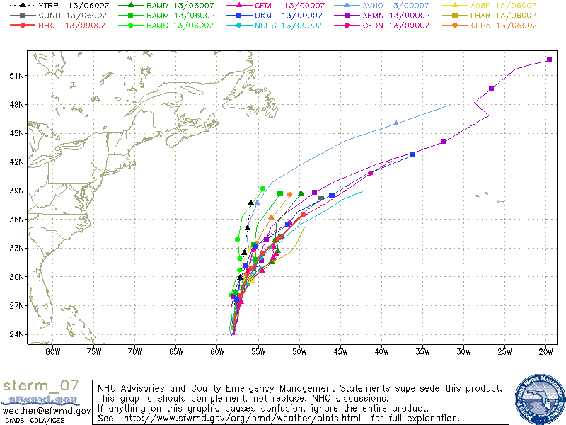
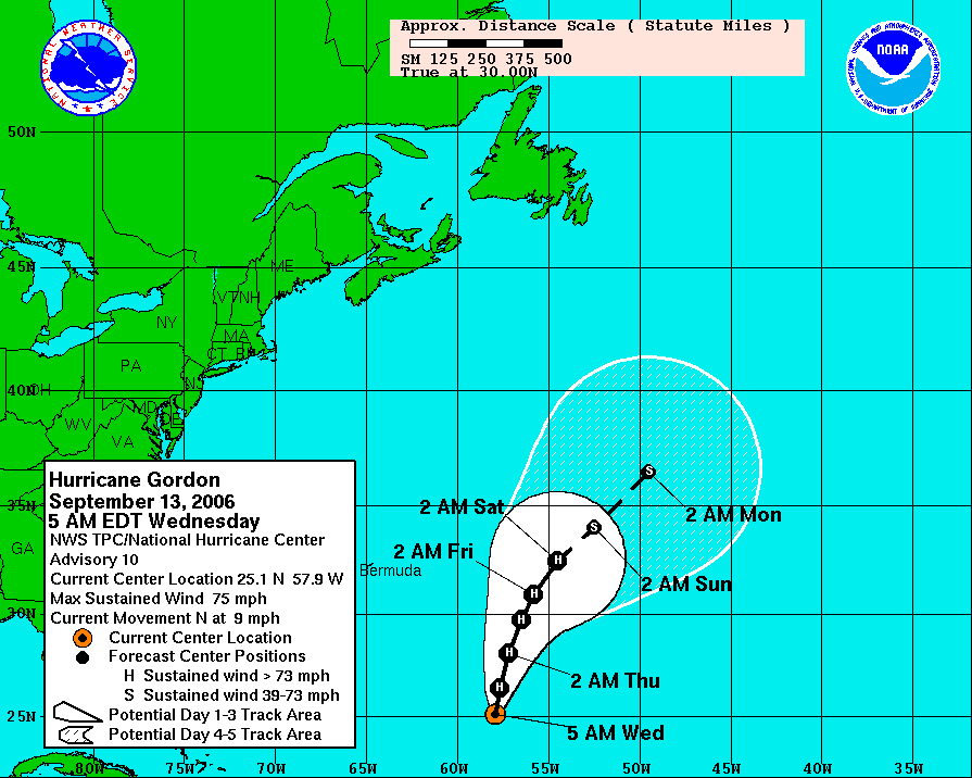
Gordon Grows, TD #8 Will Become "Helene"


 Nice looking satellite shot of hurricane "Gordon" early this morning. Still looks like Gordo will be a fish hurricane. T.D. #8 is a large system but not very strong just yet. It should go on to become Tropical Storm "Helene" later today and from there on to hurricane status....the 4th of this year. Notice how the models want to turn this storm west with time, so "Helene" will have to be watched.
For us a front is across Middle Tennessee this morning and heading our way so we still have a shot for some showers early today. Out west the sky is clearing from Memphis westward, so we should see some breaks later this afternoon. In the last 24 hours we have recorded about 3/4" of rain here at Channel 3. It was still raining at my house at "O"-dark-thirty, so I'm not sure how much we picked up. But the puddles were as big as I've seen them in the neighborhood in quite some time. Very nice weather heading our way just in time for the weekend. So get ready to enjoy!
Today: A few light showers early, some breaks in the clouds this afternoon. High: 79.
Tonight: Partly cloudy with patchy fog late. Low: 59.
Thursday: Partly cloudy and pleasant. High: 81.
Friday: Sunny and warm. High: 84
Saturday: Sunny and warm. High: 85
Sunday: Mostly sunny and warm. High: 85
posted by UnderH2Owxguy at 8:41 AM
![]()

1 Comments:
This weather certainly is wonderful! I noticed tonight that the GFS is thinking perhaps 40's for lows and 60's for highs late next week?? Are you seeing this also?
Post a Comment
<< Home