Wednesday, March 15, 2006

Smooth Sailing Now, Cruising Towards Colder

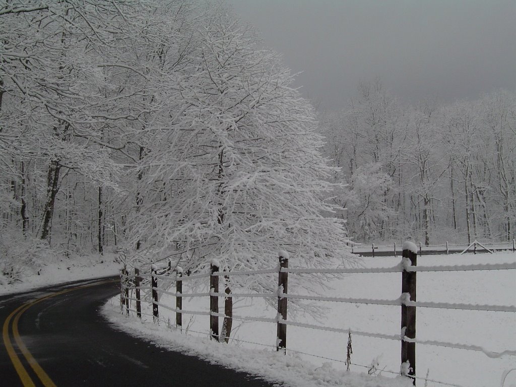
Here's a shot you won't be able to take for awhile. The view matches what you could see today on the Tennessee River. Blue skies overhead. Light winds. Bradford pear trees in the distance in bloom. But unless you are a construction worker, you're not going to take this picture from the closed Market Street Bridge.
Actually I wish I would have had one of my deer pictures to post today. This morning I was able to walk around the house without the lights on when I first woke up at 1:30 am. The full moon was actually Tuesday night, but you could have read by the moonlight last night. And the whole yard was easily seen. When I left the house there were 3 deer strolling down the road only about 3 blocks from the driveway. Apparently they were enjoying the great night vision too. And they didn't seem to be in any hurry. It occurred to me that this was a bit ironic since yesterday I was lamenting the fact that development in the neighborhood might drive them away.
Looks like smooth sailing weather wise for the rest of the week and into the start of the weekend. Big swings in highs and lows the next couple of days with March sunshine and dry air. Up into the low to mid 60s this afternoon. Down to 39 tomorrow morning. Back to the mid to upper 60s Thursday afternoon with partly cloudy skies. Thursday night a front will swing through and while we may see some sprinkles or very light showers, I doubt that anyone ends up with more than 1/10". Mostly sunny and cool Friday with highs in the lower 60s. Then partly cloudy and cool on Saturday with highs into the mid 50s. It still looks like rain moves into the area Sunday and Monday with chilly temperatures. Highs Sunday may only be in the upper 40s! A little bit warmer on Monday, but still showery.
You want crazy? The overall look to the models suggests were cruising towards colder than average weather for the rest of the month. And one of the models today paints a swath of snow moving through here Friday night the 24th of March into Saturday morning the 25th. It's probably unlikely that ACTUALLY happens. But it tells you with 5 days left until Spring begins, Old Man Winters chill isn't going away quietly.

Tuesday, March 14, 2006

Picture Perfect March Weather


This picture was taken last March just down the street in an empty lot. Every year the jonquils fill this place with the colorful message that Spring is almost here. People have been making a pilgrimage to this spot to take pictures with their children, or like these artists, capture the scene on canvas. I'm going to try to get back there with my camera in the next day or so because I'm afraid this may be the last chance for a photo op. There's a larger field behind this lot, and lately there's been quite a bit of activity there. They have been cutting brush and trees, and moving a little dirt. And even around the edges of the daffodil field, the brush and trees are being cut. It is probably only a matter of time. The real estate market has been picking up steam the last few years and is pretty warm if not red hot in this area. So honestly it's hard to believe no one has built on this property before. But a part of me, (and probably others) will miss this little plot of wildness in the midst of civilization. I like the flowers in the Spring, and the rest of the year I like the thought that the deer that sometimes pass through my yard are enjoying this tiny oasis. And when it's gone I'll sound like the duffer who's older than dirt, "I remember when there was nothing there but a bunch of yellow flowers and the occasional white-tail."
The wild string of weather across the United States is finally over. The storm's circulation is now up over Eastern Canada and the trailing cold front is about to move off the Southeast U.S. coast. Sunday's rash of tornadoes in the Midwest may have set a record. Once again we managed to escape a narrow brush with severe weather reports near Crossville, and over parts of middle Tennessee. And a couple of tornado reports southwest of us in east-central Mississippi and west-central Alabama.
Lots of sunshine today, but north winds will keep us chilly this afternoon. Afternoon reading will stay in the upper 50s to around 60. Down to 33 by daybreak Wednesday morning in Chattanooga. But outlying areas will likely see sub-freezing temps for a couple of hours before sunrise Wednesday. Then back to 63 with sunny skies. A slight chance for a sprinkle or light shower Thursday with highs around 62. Then mostly sunny Friday with highs in the upper 50s. Partly cloudy with highs again in the upper 50s Saturday. A quick peek down the road leads me to believe we could see a showery and cool pattern for Sunday through Tuesday.
So we may not see 80s for some time to come, but when you look at the averages, this is picture perfect March weather the next couple of days.

Monday, March 13, 2006

Storms, Monkey Grass, and Cooler Temps


This picture is a still captured from the Channel 3 Lookouts Cam from last August of a storm sliding west to east, just south of downtown Chattanooga. This image was just about sunset, and while the exposure seems a little heavy I still like the view.

WOW! Whatta weekend we just had! Saturday's high tied the record of 81, and Sunday's 81 was 2 degrees shy of tying the mark for the 12th of March. That is remarkably warm! We should have highs this time of year in the lower 60s. To borrow (and put a weather twist) on a Tom Jones line....."It's not unusual to have highs in the 70s", but it is rather rare to get into the 80s this early in the year. A scan of the weather records from the last 10 years reveals we have only reached the 80s one other time before the 11th of March.

Here's a look at the warmest highs 1-1 through 3-11 from 1996 to 2006:

  • 81 3-11-2006
  • 71 1-4-2005
  • 76 3-4-2004
  • 74 2-22-2003
  • 77 1-30-2002
  • 76 2-9-2001
  • 82* 3-7-2000
  • 75 1-27-1999
  • 72 2-26-1998
  • 79 3-1-1997
  • 77 2-26-1996

Since last Monday the Storm Prediction Center has had 1369 preliminary storm reports across the United States, with more to come today. Some possibly in our area. A line of storms now entering NW Tennessee will sweep eastward and arrive here this afternoon. Large hail and strong, straight line winds appear to be the main threats. Highs today should reach well into the 70s before the storms get here. The front triggering this latest round of storms has some rather chilly air behind it so we may only be in the upper 50s with some wind tomorrow afternoon. A cold start to the day on Wednesday. Lows will drop to near freezing Wednesday morning with highs popping back into the low 60s with sunshine. Then a slight chance for a shower or storm Thursday. Dry on Friday. Highs both days in the mid to upper 50s.

I took advantage of the weather yesterday getting my Monkey Grass trimmed back before it started to sprout up. Most years I end up waiting too long, and have to hand trim around the new growth which is a real pain. But now it's done and I feel like I'm a little bit more prepared for Spring. 7 days until Spring officially arrives, but it may not feel like it again for awhile. The long range models have a cooler look to them. And the Climate Prediction Center has much of the nation in below average temperatures through the 26th.

Friday, March 10, 2006

Yesterday Ruled "D2" - Another Round Of Storms Monday?


Another "Photo Friday" on Channel 3 Eyewitness News Today this morning. So a HUGE thanks to William Newberry of Chattanooga for sending this pretty sunset he shot from Missionary Ridge on Valentine's Day. What a sight!

What a windy day yesterday. Here are a few of the pre-frontal peak gusts:

  • Chattanooga 36 MPH
  • LaFayette, GA 37 MPH
  • Calhoun, GA 42 MPH
  • Lookout Mtn. 44 MPH
  • Murphy, NC 46 MPH

From yesterday's post I think that's firmly in the "D2" category, although I didn't get to officially register that with the Dud-monster.

We were lucky that last night's storms simmered down as they hit the relatively dry air in the Tennessee Valley. There were over 300 severe weather reports yesterday alone stretching from NE Texas right up to our backdoor. The closest severe weather report was in Jackson County, AL where a tree fell onto a house. But this should be a reminder that severe weather season is upon us, and the next time we may not be as fortunate. We would like to see NOAA weather radios as common as smoke detectors in area homes. And we still have a way for you to get one that comes pre-programmed for the county or counties you would like to be warned for. Here's the link: http://www.wrcbtv.com/news/weather/weather_radio.cfm

By the way, we have been asked if these work anywhere in the U.S.. They do. And if you are purchasing one for a family member in another state, all you need to know is what county they live in. So it will be set up and come ready to operate right out of the box.

Weekend weather: A returning warm front will bring back the chance for scattered showers and a few thunderstorms Saturday. Hit and miss storms will be possible on Sunday. Highs both days into the low to mid 70s. Then mid 70s again for Monday ahead of a fairly strong front. So Monday night into Tuesday could be another round of severe weather as a line of storms marches our way. There will be a drop in temperatures behind this front though. Look for highs around 60 on Tuesday, and maybe down into the mid 30s for lows by Wednesday morning.

Thursday, March 09, 2006

Windy Today - But will it be "D1" or "D2"?

Today's picture was taken in Sequatchie County on Walden's Ridge. It's one of those roads I have passed by a number of times and I always wondered where it went. But most of the time life's to busy to allow for any exploration. But this mission was to seek out the unseen, and check out the snowy scenes. And I didn't dare to cut this trip short. My co-pilot Dudley Dog was having too much fun hanging his head out the window and letting his ears flap in the wind.
Is there possibly a tie in from that to today's weather? Yes.
(The set-up....) Years ago Alan Moeller, from the NWS office in Fort Worth would come to Abilene, TX to head up a severe weather seminar given primarily for HAM radio storm spotters. His presentation was awesome. Al would really come to life when talking severe weather, and most of the slides in his show were shots he had taken. He's a great photographer and had some fantastic shots of not only severe storms and tornadoes, but also of wildflowers and the sky. He was big on the contrast of warm and cool colors whenever he could get them in the same frame. One of the best parts of the program was his "D" scale. It was Al's tongue in cheek version of the Fujita scale. He had shots of a basset hound encountering various wind speeds from "D1" where the ears were hardly flapping, to "D5" which was dog gone.
(And now the connection....) If I get a chance to jog with Duds today he might be somewhere around "D2" with his ears and lips flapping in the wind. Look for south winds to crank up across the area with valley sustained winds 20 to 25 mph with gusts to nearly 40. Mountains may see sustained south winds 25 to 35 mph with gusts to 45+. Most of today should be dry as severe storms rake the Mid-Mississippi valley and continue east towards us. Tonight these storms should lose some of their punch, but we still could have a squall line with damaging winds. It's all out of here by Friday morning, with mostly sunny skies Friday afternoon. Saturday still a chance for some scattered showers and thunderstorms. Only a 20% chance for Sunday. Then most of Monday will be dry followed by some more rain and storms Monday night into early Tuesday. Look for cooler conditions next week. Stay tuned to Channel 3 Eyewitness News throughout today and tonight as Paul Barys brings you the latest on this threatening weather situation.

Wednesday, March 08, 2006

Strong Storms Mooooooooove East

Today's picture looks like it could come from the Midwest, but was actually taken on Countyline Road on Signal Mountain. A fresh snow like this will cling to the slimmest of lines and wires if there isn't too much wind and make for some nice pictures.
This image reminds me of Winters past where I grew up in Illinois. We were sandwiched right between "America's Dairyland" to the North and the endless cornfields that begin in Northern Illinois and stretch out west until I-80 nearly bumps into the Rockies. After you've been away for a while, it seems like a sea of green. I think we were lucky to have farmers and farms in our family. It gave us kids experiences others miss out on. Like being around the animals, crops, and seasonal cycles that drive daily life. A thunderstorm in the city is one, detached experience. A thunderstorm on the farm is felt in a more connected manner. Rain that rushes down the driveway and into flooded gutters runs down the drain and away. But flooded fields can spell disaster. Small hail and brief wind gusts are curiosities in town. In the country, they can flatten wheat or shred corn or soybean fields. My brothers, sister and I also laugh about the family gathering on a farm in Eastern Nebraska when tornadoes were swirling in the area and we were all herded into the basement. (Secretly I wanted to sneak back up a take a look. Too many viewings of "The Wizard of Oz" I guess.)
From the plains to the Midwest strong to severe storms will be triggered by a storm complex that will create breezy conditions here today, and windy conditions tomorrow. After a rather pleasant day in the upper 60s today, we should hit the low 70s tomorrow. But hang onto yer hats pardner. South winds will start to howl across the area tomorrow afternoon at least 15 to 25 mph, but mountains will be buffeted by gusts over 40 mph! Rain and storms will likely form a squall line in Western Tennessee by tomorrow afternoon and evening. This line will move towards us tomorrow night. Quite a bit of the punch will be gone by then, but a few strong to severe storms could still have strong winds with them. So we'll be watching the VIPIR very closely. The rest of Friday will be dry and warm. Then scattered storms will be possible both Saturday and Sunday. Weekend readings will still be in the lower 70s.

Tuesday, March 07, 2006

Spring About To Break Loose


I still have some snowy shots left from Feb. 11th. So while we are inbetween Winter and Spring color returning I'll post as many as I have. Besides, snow is so fleeting around here it's nice to look back at how the area was decorated. This is the historic Conner Toll House atop Signal Mountain.

We are off to another windy morning, with north winds running between 10 and 20 mph with gusts over 20. These will begin to settle down later this afternoon as high pressure moves on top of us. The fire danger remains high, and once again Red Flag Warnings have been posted across most of Georgia. We have been drier than average since December, and the relatively small fires that have been dotting the area are evidence of that. But around here there's plenty of time to turn this into a sloppy situation.

In the Western U.S. however it's a different story. Look at Phoenix, AZ for example. From the NWS Phoenix: "The record dry spell continues at Phoenix Sky Harbor. The end of today will be the 139th consecutive day with no rain....not even a trace. Record keeping in Phoenix began 6 August 1895." Reports from parts of Arizona have some residents literally watering cactus to keep them alive. And real drought conditions exist from Texas and Oklahoma into parts of Arkansas and Missouri. This will be interesting to watch heading into Summer if this Spring doesn't wet the Plains States down some. They'll have several rounds of storminess the next couple of weeks though.

Here at home look for dry and increasingly warm conditions through Thursday. Thursday we should see south winds really starting to howl, bringing up Gulf moisture to fuel some storms Thursday night into the early hours of Friday morning. Much of Friday looks dry, but this weekend could be unsettled with one round of storms possible on Saturday and another possible on Sunday. Spring may be about to break loose across the area bringing some welcome rainfall.

I sure would hate to start watering the cactus in the parking lot here at Channel 3!

Monday, March 06, 2006

March Getting Ready To Turn Lion-Like

I took this picture on Feb. 11th of the snow on the Japanese maple in the front yard. I went with the low shot upward into the branches to show the same view I posted on the blog back on November 30th. For me this is going to be fun showing the four seasons with my favorite little tree.
Well we had a great weekend in Chattanooga didn't we?
Today we should see the winds increasing just a bit as we head into the afternoon. But no other problems weatherwise. Highs today and tomorrow should end up around 60. Then upper 60s on Wednesday with southwest winds beginning to pick up. Hang onto your hats Thursday as the winds will really be whipping ahead of a storm system that should provide a couple of days worth of strong to severe storms in the plains and Midwest. We'll have the chance for some meaningful rainfall Thursday night and into early Friday morning. And we may even see some strong to severe storms. At least lower 70s Thursday and Friday. And if the computer numbers are right for Saturday we could approach 80 on Saturday!
All the jonquils are up and many are already blooming in the yard. And it won't be long at this rate for the leaves to unfurl on the little maple. So it may be time for the Spring picture to be taken.

Friday, March 03, 2006

So Long Winter?

This picture was taken on Feb 11th just down the street from Casa Benson atop Signal Mountain. This is an awesome snowman that was about 7 feet tall. I'm not sure who lives there, but last year they built a pretty neat snow family complete with the family dog. I'll use this as the leaping point for today's post because this guy is either waving "Hello" or "Goodbye". And at the risk of writing Old Man Winters obituary prematurely, I think he's waving "TAA TAA".
We have a huge trough off the west coast of the United States spinning storminess onshore out there. With a ridge buckling northward over our heads the next few days, we'll see rather bland weather heading right through the weekend. One piece of a storm moves past us to the north Sunday night and into Monday with a slight chance for some sprinkles or light showers then. But not the kind of soaking rain we need to douse the brush fire threat. After a cool weekend, we'll see highs climbing back into the 60s next week, and in fact we could be into the upper 60s by the end of the week. The longer range models have rounds of thunderstorms firing up in the plains states down the road. Those would be moving east towards us from time to time. If our western trough keeps progressing east, this would make a lot of sense. And we are getting into the meat of severe weather season the next few months. So even though it's not as warm as Wednesday and Thursday this weekend, let's enjoy the tranquil weather while it's here. Have a great weekend!

Thursday, March 02, 2006

Time To Talk Weather

Been a bit busy this week, so my blogging and jogging has been put on hold a bit. My thanks this morning to Jennifer Taylor from Shenandoah Baptist Academy in Cleveland, TN for sending this picture from yesterday's visit. It was a big group with nearly the whole school in attendance.
On Monday I was driving up to Allen Elementary in Soddy - Daisy when the plume of smoke on Walden's Ridge caught my eye. It was late morning and that fire was covering a small area on the side of the mountain. Well here it is Thursday morning and we still have active fires burning on the side of Signal Mountain just above Falling Water. We are now over 3 1/4" below average in rainfall since January 1st. And the prospects for meaningful rain looks grim between now and next Wednesday. Normally March is our wettest month of the year with average rainfall of over 6 inches. So this thing will likely turn around, at least to some degree. But today winds are already breezy and will become quite gusty this afternoon as we climb to around 70 by noon today. Once the front goes through our temps should level off and slowly fall later today. Right now the weekend looks dry and seasonably cool. Chilly mornings Saturday and Sunday in the upper 20s to around 30. Daytime highs into the mid and upper 50s. The pattern may start to shift to a wetter and stormier period after next Wednesday.