Friday, December 29, 2006

2006 Ends On A Warm Note.

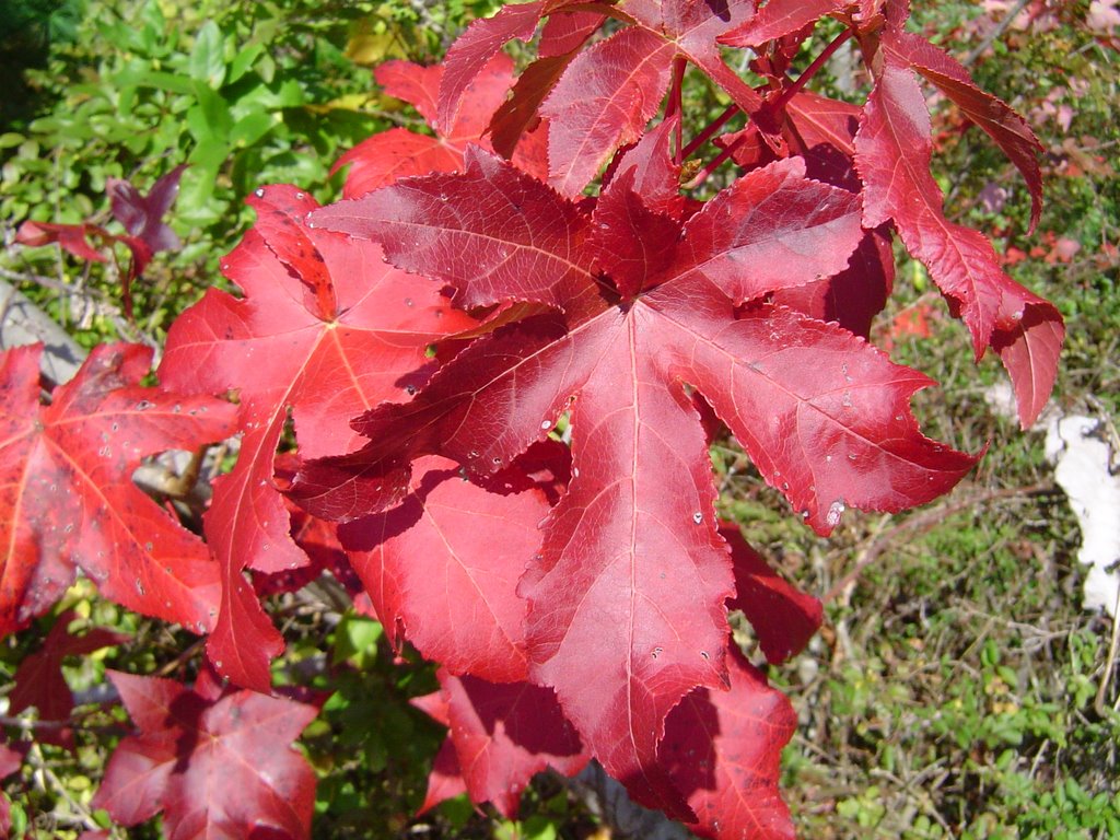
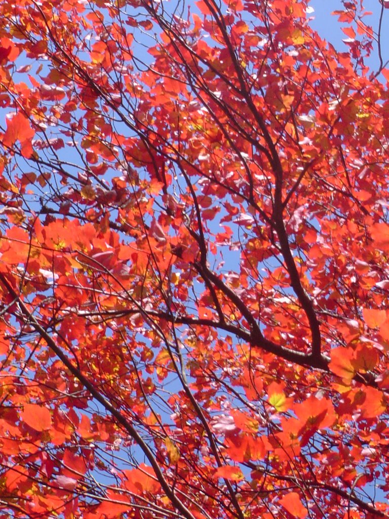
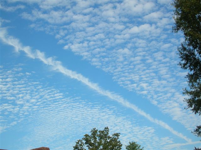
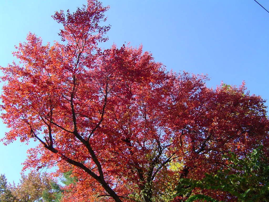
Average highs this time of year are only in the upper 40s, and today we're looking at topping out in the lower 60s. If I look back on the weather of 2006 here at home I'm glad to say there were not any major problems this year. Sure we had our usual bouts of thunderstorms from time to time, but overall we were fortunate weather-wise this year. And believe it or not I'd say our top weather story was awesome Fall Foliage we had this year, and the conditions to enjoy it all. Just yesterday I was speaking to someone from the Atlanta area who spent some time in New England this past Autumn. She said the color was much more spectacular here this year, and lasted much longer.
We'll wrap up the old year with warmer than normal temperatures and wet weather. No big drops in temperatures for the New Year though. In fact if you're looking for Winter fun and games nothing is imminent.......but stay tuned around the 11th of January. The models have been hinting (in a big way) that something may stir Snowbird out of his hibernation. That's way out there, but fun to keep an eye on.

Today: Partly cloudy and pleasant. South 5-10. High: 62

Tonight: Partly cloudy and chilly. Light SE Low: 42

Saturday: Clouds thicken, warm. SE 5-10 High: 62

Saturday Night: Rain moves in. Low: 51

Sunday: Rainy periods with a few storms. High: 64

Sunday Night: Rain diminishes. Low: 47

New Year's Day: Clouds Decrease High: 59

Monday Night: Fair, chilly. Low: 34

Tuesday: Mostly Sunny. High: 51 Low: 32

Thursday, December 28, 2006

Nice Wrap Up To 2006

Thanks this morning to Max Holland of Hixson for sending this picture of a sunrise at Parksville Lake. I love that area, but it seems like there are always little things that prevent me from getting over that way more often and enjoying the outdoors. I'm not big on resolutions, but that's mine for the New Year....get out and enjoy nature a lot more this year than in the past. This would be a great time to start. The weather is going to be ten to fifteen degrees warmer than average right through Sunday. With a sluggish storm system bringing us rain and storms Saturday night and into Sunday. But right now New Year's Day looks pleasant.

Today: Mostly sunny & pleasant. South 5-10. High: 58

Tonight: Fair skies, chilly. Low: 33

Friday: Partly cloudy, mild. SE 5-10. High: 61 Low: 43

Saturday: Clouds increase, mild. High: 63

Saturday night: Rain & Storms. Low: 51

Sunday: Showers Early. High: 60

New Year's Eve: Partly cloudy. Low: 41

New Year's Day: Partly Cloudy. High: 56

Wednesday, December 27, 2006

Another Jump Up In Temperatures, Then Stormy.

Thanks this morning to Shamane Barkes of Coalmont, TN for sending this picture of a few flakes that flew and blew around parts of Grundy, County yesterday morning. That'll do it for any frozen precipitation for awhile.
There's another big storm crashing into the coast of California, Oregon, and Washington this morning. Already it's been responsible for some wind gusts south of Reno, NV clocked at over 100 mph. This system will likely hammer Denver again with some hefty snowfall. Severe storms will also move out into the plains states Friday afternoon and evening. These probably lose most of their punch by the time they move our way, but we'll see how this shapes up over the next couple of days. Right now it looks like most of the area could pick up 1 1/2" to 2" of rain late Saturday into early Sunday.

Today: Becoming mostly sunny. Light North wind. High: 51

Tonight: Fair and cold. Calm wind. Low: 30

Thursday: Mostly sunny, pleasant. South 5-10. High: 58 Low: 38

Friday: Partly cloudy, warm. High: 61 Low: 48

Saturday: Rain and Storms move in. High: 62 Low: 48

Sunday: Mostly cloudy, 20% chance for a shower. High: 50
Low: 36

New Year's Day: M. Cloudy, 20% chance for a shower. High: 48 Low: 32

Thursday, December 21, 2006

A Good Soaking Still Coming, Chilly Christmas Day.

I thought these vibrant red oak leaves looked like a poinsettia. So consider this a small way to say Merry Christmas a little early to family and friends. This December has been busier than many I can remember, so I'm looking forward to a few restful days ahead. I hope you get a chance to slow down a bit and enjoy the holiday weekend.

Today: Showery periods, mild. South 5-10. High: 58

Tonight: Rainy & cool. South 5. Low: 51

Friday: Rainy periods, a few rumbles of thunder possible. South 5-10. High: 60

Friday night: Showery, cool. Low: 47

Saturday: Early AM shower, then clouds decrease. High: 61

Saturday night: Partly cloudy, chilly. Low: 36

Sunday: Partly cloudy. High: 56

Sunday night: Showers late. Low: 38

Christmas Day: Rainy and chilly. High: 45

Monday night: Valley showers, mountain snow showers possible. Low: 37

Wednesday, December 20, 2006

Goodbye Warmth, Hello Winter?

Winter officially begins tomorrow evening at 7:22pm EST, but it's still not going to feel very Winter-like just yet. After the last nine days at 64 or warmer, we should top out in the low 60s this afternoon. Rain arrives tonight and stays with us all the way through Saturday morning. A second system may develop in the Gulf of Mexico over the weekend bringing another round of rain Sunday evening into Sunday night and into Christmas Day. Things get complicated Monday night and into Tuesday, but right now it looks like at least the mountains around here could see some kind of winter mix. Obviously a lot can happen between now and then, but I thought it's good to let folks know there is some potential beginning to show up. We have plenty of time to evaluate and update this potential between now and then.

Today: Clouds thicken, mild. SE wind 5-10. High: 61

Tonight: Showers move in, cool. Low: 49

Thursday: Rainy & cool. South 5-10. High: 57

Thursday Night: Rainy & cool. Low: 51

Friday: Rainy periods. High: 60 Low: 49

Saturday: AM showers. High: 58 Low: 41

Sunday: Showers late. High: 54 Low: 39

Christmas Day: Showery and chilly. High: 45

Christmas Night: Showers, Mountain Snow Showers Possible. Low: 36

Tuesday, December 19, 2006

Fall Or Summer With Only Days Until Winter.

I visited Daisy Elementary yesterday and had a great time with the students there. They were all ready for the holidays and hoping for something cold and white for Christmas. (That won't be the case.) I was asked to read a holiday story about a father and son hiking through the woods to cut down a Christmas tree. Along the way they saw a fox, some deer, an owl and a beaver lodge. They really chose the right book for the right guy. Over the past several years I have had an opportunity to spend a little time in the woods on Christmas Day. Two years ago there was a thick blanket of snow on the ground for this holiday hike. If you have had the pleasure of being in a forest after it snows a foot or more you know how wonderful that time can be. Everything is quiet, the snow muffles most of the sound you normally hear amidst the trees. And you can see every critter and every movement they make. And have made. It's fun following their tracks, and wondering how their routines are changed by the snow. As a youngster I spent as much time as I could hiking all over the place all four seasons. But the best hikes were winter ones, wandering through the snowpack until my toes went numb. Thanks to the teachers at Daisy Elementary for choosing one book that brought back so many pleasant memories. I'm now looking forward to Christmas even more and spending a little quiet time outside enjoying a walk in the woods. Snow or not.
Yesterday we hit a record high of 73 degrees. Temperatures should be stepping down as we head toward the weekend. And rainfall will move into the area tomorrow night through early Saturday possibly delivering 1.5" to 2" of much needed rainfall.

Today: Partly cloudy, mild. North 5-10. High: 64

Tonight: Partly cloudy, cool. North 5. Low: 42

Wednesday: Partly cloudy, mild. NE 5-10. High: 60

Wednesday night: Clouds increase, showers late. Low: 45

Thursday: Rainy periods. High: 57

Friday: Rainy periods. High: 59

Saturday: Showers end early. High: 56

Christmas Eve: M. Cloudy with scattered showers. High: 56

Christmas Day: Mostly cloudy, chilly. High: 47

Monday, December 18, 2006

Minor Earthquake Early This Morning.


A few calls this morning from Dayton Mountain, Tellico Plains, Athens, and Turtletown reporting the early morning earthquake that "Sounded like a big truck" and "Lasted for about 30 to 40 seconds". In many cases a quake isn't audible unless it's magnitude is over 4, but I suppose underlying rock layers could make the difference in this case. Anyway here are the details:

3.3 (Minor)
Date-Time
Monday, December 18, 2006 at 08:34:27 (UTC)= Coordinated Universal Time
Monday, December 18, 2006 at 3:34:27 AM = local time at epicenter
Location
35.360°N, 84.350°W
Depth
17.4 km (10.8 miles)
Region
EASTERN TENNESSEE
Distances
5 km (3 miles) W (261°) from Tellico Plains, TN
14 km (9 miles) ESE (121°) from Englewood, TN
17 km (10 miles) ENE (78°) from Etowah, TN
52 km (32 miles) ENE (66°) from Cleveland, TN
77 km (48 miles) SSW (209°) from Knoxville, TN
178 km (111 miles) N (2°) from Atlanta, GA

The forecast gets cooler after another very warm day today. And by Thursday and Friday we should see some soaking rainfall.

Today: Mostly Sunny and Warm. Light south wind. High: 70

Tonight: Fair skies with patchy fog late. Calm wind. Low: 43

Tuesday: Partly cloudy and mild. SW wind 5 to 10 mph. High: 66 Low: 37

Wednesday: Partly cloudy. High: 59 Low: 40

Thursday: Rainy and cool. High: 56 Low: 43

Friday: Rainy and cool. High: 53 Low: 43

Friday, December 15, 2006

Enjoy This While It Lasts, Flip Ahead

Another stellar day yesterday with highs once again in the mid and upper 60s. This weekend and into early next week highs will edge up into the upper 60s to around 70. That will put us within 4 or 5 degrees of record territory today through Monday. Check it out:
  • Today's forecast high: 67 record: 72 in 1971
  • Saturday's forecast high: 70 record: 74 in 1971
  • Sunday's forecast high: 70 record: 75 in 1924
  • Monday's forecast high: 68 record: 72 in 1924
  • Average highs: 52 today, falling to 51 by Monday

Next weekend we may find ourselves 20 degrees colder with highs next Saturday and Sunday only around 50.

Today: Mostly sunny and warm. West wind 5 - 10 mph. High: 67


Tonight: Fair and chilly. Low: 39


Saturday: Mostly sunny and warm. South 5 - 10 mph. High: 70 Low: 41


Sunday: Mostly sunny, warm again. High: 70 Low: 44


Monday: Partly cloudy High: 68 Low: 46


Tuesday: Partly cloudy High: 64 Low: 44


Thursday, December 14, 2006

Sunroof Is Wide Open With Frank

Quick post this morning with just enough time to say, "Let's have another one, just like the other one." Yesterday was fantastic. I drove around with the windows down and the sunroof open, Frank Sinatra's "I Believe" blaring on the cd player. I really don't have to have cold to put me in the mood for Christmas. I believe I could take weather like this all Winter long.

Today: A.M. Fog, then Mostly Sunny. SW wind 5-10 mph. High: 68

Tonight: Partly cloudy & cool. Low: 43

Friday: Partly cloudy & warm. High: 66 Low: 36

Saturday: Mostly sunny. High: 69 Low: 42

Sunday: Mostly sunny. High: 68 Low: 45

Monday: Partly cloudy. High: 65 Low: 47

Wednesday, December 13, 2006

Some More Beautiful Sky Shots & Weather


Thanks again to David Wills for these gorgeous evening sky shots. I'm not sure if David carries his camera all the time, but I'm guessing he has it nearby quite often as he comes up with shots like these frequently. Thanks for letting me share them with everyone.
Zonal flow across the country will keep things warmer than average here through the weekend. And rainfall will be hard to find in the eastern United States through Monday. This morning the models are hinting at colder air coming down our way as early as the 22nd, but the past few days that hasn't shown up until the 26th. But as always, Mother Nature likes a balance and when temps are out of whack one way they tend to get evened out by a flip to the opposite. So another blast of cold may appear around Christmas or shortly thereafter. So we'll enjoy basking in the warmth while we can o.k.?

Today: Fog burns off, partly cloudy and pleasant this afternoon. High: 66

Tonight: Fair skies, patchy fog late. Low: 38

Thursday: Mostly sunny & warm. SW 5 - 10. High: 68

Friday: Mostly sunny & warm. High: 68

Saturday: Mostly sunny & warm. High: 67

Sunday: Partly cloudy & warm. High: 67

Tuesday, December 12, 2006

Awesome Sky Shots, Temps Will Seem Sky High


Thanks this morning to my friend David Wills for sharing these sky shots with me. This will be a two part post as David sent some others that everyone should see. Hopefully I'll have them posted tomorrow morning.
Yesterday was spectacular. We hit 64 degrees officially in Chattanooga and it really felt like Spring. The cold air is shut off for awhile now as the main branch of the jetstream should hug the Canadian border for the next week or so. The only signs of chilly air dropping this far south is around the 26th. Until then, take a breather and enjoy the warmth.
Today: Clouds increase and showers move in this afternoon. South wind 5-10 mph. High: 60

Tonight: Showery and cool. Low: 43

Wednesday: Clouds decrease, mild. High: 62

Thursday: Mostly sunny, warm. High: 66

Friday: Mostly sunny, warm. High: 67

Saturday: Mostly sunny, warm. High: 67

Monday, December 11, 2006

Coldest Air Behind Us For Awhile.

Thanks this morning to Debbie Nix for sending this great picture of Chattanooga as seen from Lookout Mountain on a cold December night. Fortunately for us, those cold nights are a thing of the past for awhile. The jetstream will be swinging northward and away from us, and that pattern will not allow any more arctic air to come our way any time soon. In fact if the Climate Prediction Center is right, we could have above normal temperatures here right up until Christmas Day. We'll watch and see.
In the short term a Pacific system moves west to east towards us bringing a round of rain to the area mainly from late Tuesday through early Wednesday morning. Most areas should end up with 1/2" to 3/4" of rainfall during that time.
Today: Partly cloudy and pleasant. South wind 5 mph. High: 61

Tonight: Mostly cloudy, 20% chance for a few sprinkles. Low: 41

Tuesday: Mostly cloudy, a slight chance for a shower. High: 59

Tuesday night: Rainy with a rumble of thunder possible. Low: 43

Wednesday: Early morning shower, then clouds decrease. High: 60

Thursday: Partly cloudy, mild. High: 59

Friday: Mostly sunny, pleasant. High: 61

Friday, December 08, 2006

Coldest Morning This Early In At Least A Decade!

A picture is worth a thousand words, or in this case just one. COLD! Thanks this morning to Hal Perry who lives up on Signal Mountain for taking this picture around 6:50 am this morning. His thermometer read 5 this morning with 10 mph winds, so Hal's windchill was down around -10! You think Hal's thermometer is wrong? I don't think so. Check out a few of these lows from around the area:
  • Sale Creek Mountain 8
  • Bledsoe State Forest 8
  • Dayton Mountain 8
  • Lookout Mountain 9
  • Prentice Cooper S.F. 10
  • LaFayette, GA 14
  • Chatsworth 17
  • WRCB-TV3 17

Tomorrow will be nearly as cold for the valley locations, but mountain spots should be a tad warmer tomorrow morning. Warmer weather heads our way for the second half of the weekend and into much of next week.

Today: Breezy early, then sunny and cold. NW 5-10 mph and gusty. High: 40


Tonight: Clear & Cold! Low: 17 in Chattanooga, outlying areas will be colder.


Saturday: Sunny & Cool. SW 5. High: 50


Sunday morning: 22


Sunday Afternoon: Mostly sunny. High: 56


Monday: Partly cloudy. High: 59


Tuesday: Clouds increase, 30% chance for showers. High: 57

Tuesday, December 05, 2006

Mountains Warmer Than Valleys Today.

I am thankful for Paul Turney for sharing this spectacular sunrise picture taken in South Pittsburg on November 14th. Paul, this should be enlarged and framed. It is a wonderful view. And I really appreciate it.
Our weather will be relatively tranquil the next several days. A small bump up in temperatures the next couple of days. Then a sharp drop Thursday and Friday with the next clipper system. Look for windy and cold conditions Thursday, and breezy and cool conditions on Friday.

Today: Sunny & Cool. Northwest wind 5 mph. High: 51

Tonight: Fair Skies, Cold. Low: 26

Wednesday: Mostly sunny, pleasant. SW wind 5-10 mph. High: 58

Thursday: Partly cloudy, cold & windy. High: 44

Friday: Mostly sunny, breezy. High: 43

Saturday: Mostly sunny, a bit warmer. High: 55

Monday, December 04, 2006

You think it's cold here........

I got this e-mail from Mark this morning, "Good morning, anyone up for a hike at Mt Mitchell this morning? -42F Wind Chill."
Mark also included this cool link to the automated weather station atop Mt. Mitchell. It's worth a look: http://ils.unc.edu/parkproject/webcam/weather.html
I believe I'll wait until Spring when the wildflowers are in bloom before I take that hike though.

Cold But Dry Weather Ahead.

We had a nice weekend across the area. I'd call it great, but our temperatures were a bit on the cool side. Not enough to hold back the crowds for the Holiday Nightlight Parade in Downtown Chattanooga Saturday night. And afterwards the Big Ridge Elementary 4th and 5th graders did a great job singing holiday songs in front of the Aquarium.
Now another front has come through and the winds will be a bit brisk through the morning, but they should settle down this afternoon. Southwest winds and slightly warmer readings return for Wednesday. But guess what? Another front reverses the wind flow and back down go the temperatures Thursday and Friday. So the ups and downs will continue into this weekend.

Today: Sunny, but cool & breezy. North 10 to 15 mph and gusty. High: 44

Tonight: Clear skies, cold. Light North. Low: 23

Tuesday: Sunny & Cool. Light SW. High: 50

Wednesday: Mostly Sunny. High: 55

Thursday: Partly cloudy, cool & breezy. High: 46

Friday: Mostly sunny, windy & chilly. High: 43

Be sure to join Channel 3 this Wednesday at the First Tennessee pavilion in Chattanooga, and the NW Georgia Trade Center in Dalton for "Share Your Christmas". We'll be accepting your donations of food and cash to help the Chattanooga Area Food Bank.

Friday, December 01, 2006

Wow Whatta Storm! Gusts Cause Damage Here.

Thanks this morning to Regina Akins of Ringgold, GA for sending me this picture. It was taken by her sister Charlotte who lives in Wewoka, Oklahoma. And as you can see, the scene was snowy there last evening. Wet snow has been falling heavily across the Midwest overnight causing a lot of travel problems especially at Chicago's O'hare airport.
Wind was the big story here this morning, bringing down trees and power lines across the area. Here are a few of the peak wind gusts recorded by some automated weather stations:
  • Lookout Mountain 65 mph
  • Indian Grave, Blount County, TN 50 mph
  • Coker Creek, TN 46 mph
  • Prentice Cooper WMA 47 mph
  • Cohutta, GA & Ft. Payne, AL 45 mph
  • Murphy, NC 38 mph
  • WRCB-TV3 38 mph

A huge temperature range is helping to create these strong winds. Before sunrise when we were tying a record high of 71 it was 31 in Memphis. We had several hours of 71 at Chattanooga's Lovell Field, so we might have broken that record. Yesterday's 74 also broke the record for Thursday.

Need to catch your breath? We'll do that with a quiet and cool weekend.

Jed, LaTrice and I hope to see everyone Downtown Chattanooga Saturday night for The Holiday Starlight Parade which begins at 6pm. It should be a nice and fairly mild evening with a temperature around 52 when the parade begins. And we should only fall into the low 40s when the music wraps up in front of The Tennessee Aquarium later in the evening. Hats off to the Downtown Partnership for putting together another great family event that should be packed with people. See you then!

Today: Mostly cloudy, windy and colder. WNW wind 15 to 25 mph and gusty. The official high was recorded before sunrise....a record tying 71. But temperatures will fall into the 40s by this afternoon.


Tonight: Clearing and cold. North 5 - 10 Low: 30


Saturday: Mostly sunny, cool. North 5 - 10 High: 54


Sunday: Partly cloudy, cool. High: 56


Monday: Mostly sunny but chilly. High: 45


Tuesday: Mostly sunny. High: 52