Wednesday, November 30, 2005

Wild November Closes Mild.

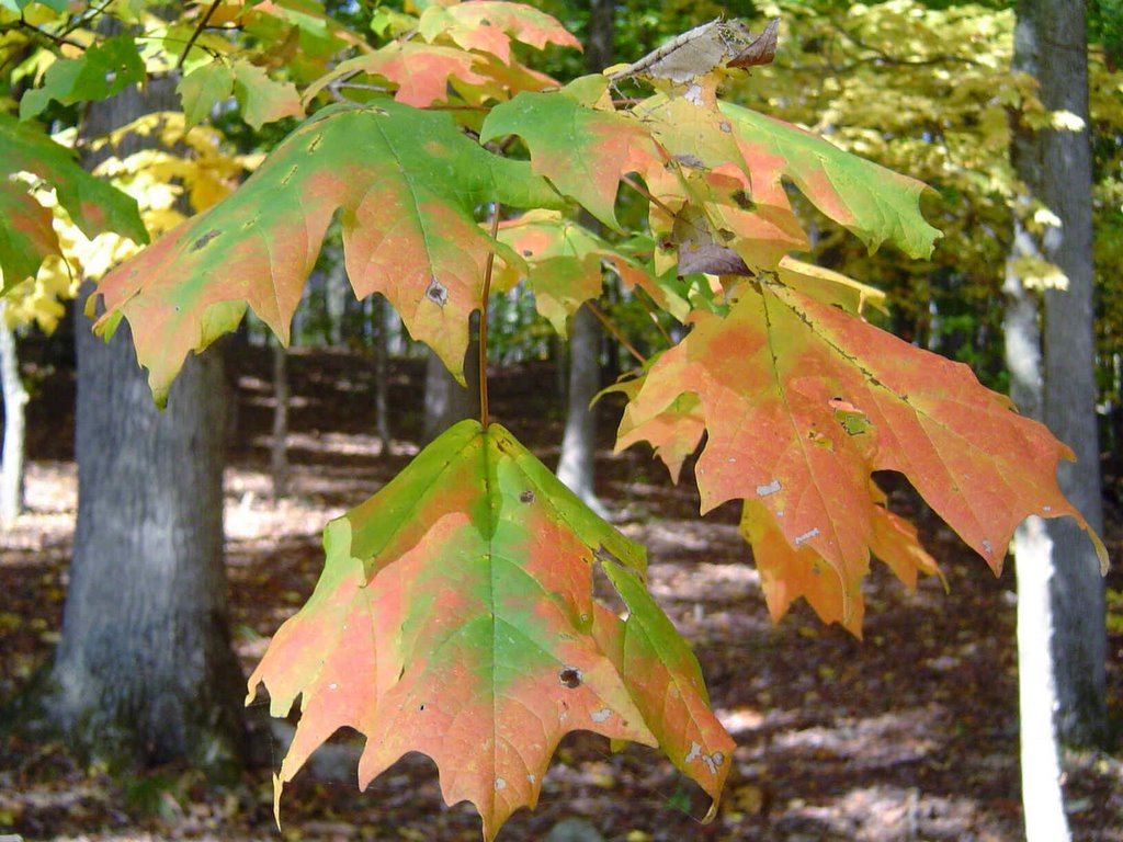
Another shot of the now bare Japanese maple in the front yard. Yesterday as I passed by it I was struck by the thought that it will be another 5 months before I see leaves on it. But if that time passes as quickly as this month has gone, it will seem like next week when April arrives.
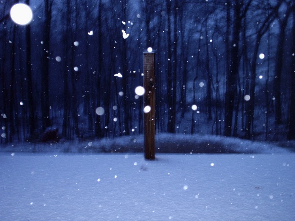
What a wild November we have lived through. The month started out very warm and dry with 4 record highs in a row, November 6th through the 9th. Remember the 84 we hit on the 8th? That tied the all time high for November, and was the latest we'd ever been that warm. Contrast that with last Monday evening when the mountains west of town were getting dumped on with accumulating snow. (Probably the earliest that much snow has fallen in some of those locations in memory.) And we had a couple of bouts with limited severe storms. But even so the airport only got 3.57" of rain this month, 1.31" below normal.
So what's ahead?
Two systems go by in the next 5 days. Before system #1 we'll see sunny skies, light winds and highs in the low 50s. The "mild close" to November. As system #1 approaches tomorrow, west to southwest winds pick up. With mostly sunny skies highs Thursday will climb into the mid to upper 50s. Then the front goes through, northwest winds pick up and even with mostly sunny skies Friday, highs struggle to get back into the upper 40s.
System #2 picks up some steam and some Gulf moisture by then. That begins spreading showers into the Tennessee Valley as early as Saturday afternoon. Right now it looks showery from Saturday through Sunday night. Most of the moisture is gone by Monday morning, but there still could be enough for mountain flurries or snow showers then. And colder air looks like it will plunge southward Tuesday and Wednesday.
Will December open mild and close wild?

Tuesday, November 29, 2005

(Fraidy) Cats and Dogs (Snow Hounds)

Here's Dudley enjoying the kind of weather he likes best. Sunny and cool. Those are the days when he could, and often does, spend the entire day outside. He'll shift from patch of sunlight to patch of sunlight soaking up as much warmth as he can. Second to those days are the times when he heads outside and suddenly realizes there's snow on the ground. This snow hound will tear around the yard slippin' and slidin' and dipping his snout in the snow. And you should see how he chases a snowball or tackles a snowman. On the other hand, thunderstorms drive him bonkers lately. And last night he was a wreck. There was nothing I could do to control his shaking and panting like a freight train. I don't know why he's been such a fraidy cat lately.
Fortunately the storms were not severe for most of the area. Just two reports of minor wind damage in Jackson County, Al. Most of the area saw 1.5" to 2" of rainfall, with some locally heavier amounts. The airport officially picked up .68", while here at Channel 3, 1" fell. It was a nice round of rain.
Fairly busy looking weather maps the next week or so. Right now it looks like two systems dig into the plains and zip northeast towards the lakes. The first one probably doesn't stir up our weather too much. There could be a sprinkle or even mountain flurry late Wednesday night or very early Thursday morning north of Chattanooga. But trace amounts of moisture at best. The second system could be another dilly. Right now it looks like rainfall would hold off long enough for Chattanooga's Downtown parade to finish dry. But overnight Saturday night some showers could appear. Then rain and thunderstorms get Dudley shaking like a leaf again. But the real question is, does he get to chase snowballs sometime Monday? Could be. This system may be like the one a week ago where the air is sharply colder behind the storm itself to blanket at least the higher elevations with measurable snow. And the air may stay cold enough and just moist enough to squeeze out occasional snow flurries or snow showers into Tuesday. Of course a lot can happen between now and then, but as active as the pattern has been, it may keep both fraidy cats and snow hounds happy.

Monday, November 28, 2005

Turbulent Weather Bumps Through

Thanks this morning to Paula Shell for sending this beautiful picture of the Fall foliage in Tellico Plains. Her mother's home is in the picture which Paula says is over 100 years old. It's a great picture and I'm glad she was willing to share it with everyone.
The big storm in the middle of the country is a monster, effecting everyone from the Canadian border to the Gulf of Mexico. Snow is flying in the Dakotas with the threat of more severe weather east of the Mississippi River. Yesterday the Storm Prediction Center logged 27 tornado reports, 60 severe wind events, and another 67 reports of hail 3/4" or larger. An incredible 154 severe weather reports!
We have already seen some pockets of heavy rainfall move through the area this morning, and more is on the way. And there is still some potential to see some strong to severe storms today into tonight. Average rainfall amounts look like between 1" to 2" in the next 24 hours with some locally heavier amounts.
We still need rainfall. As of this morning these are the numbers compared to average:
  • Since Nov. 1st - 1.75" below average.
  • Since Sept. 1st - 6.55" below average.
  • Since Jan. 1st - 7.63" below average.

Most of this past Saturday was spent on leaf patrol for what looks like the final time in 2005. Up on the roof as well to get the gutters cleaned one more time. So I'm ready for the rain.

Friday, November 25, 2005

Photo Opportunities


Photo Friday on Channel 3 Eyewitness News Today this morning. And once again we have a couple of great shots to share with you. The top picture was sent in by Mark Barnhardt of Dalton, GA. It was taken about 30 minutes north of Cherokee, NC on the Blue Ridge Parkway. The bottom picture was snapped at this year's Chattanooga Airshow by Ricky Mundy. Make sure you click on both to see them full-sized. They are both awesome. Thanks Mark and Ricky for sending them.
It was a picture perfect Thanksgiving Day. We loaded up the car and headed up to Cloudland Canyon for a turkey day stroll. Quite a few others had the same idea, hiking and snapping a few pictures.
This weekend a couple of other photo ops are on the menu. Look for a big crowd and some nice shots of the events at the Grand Illumination tonight. The lighted boat parade will pass by Ross's Landing around 7 pm this evening, followed by music and the fireworks around 9 pm. Nature lovers should have a photo op once again at the Hiawassee Wildlife Refuge in Meigs County near Birchwood. The ultra-light led whooping cranes could take off from Cumberland County today. Yesterday the winds were just to strong to make it over the Cumberland Plateau, so they spent Thanksgiving Day resting. To follow their progress log onto: http://www.operationmigration.org/Field_Journal.html
If they make it, tomorrow would be fine weather for snapping some pictures of these beautiful birds.
Then our Kodak moments end weather wise. A showery picture developing for Sunday. Scattered storms on Monday as temps warm into the upper 60s. Some showers or storms may be in the picture on Tuesday as well.
Have a great weekend!

Thursday, November 24, 2005

A Weather Feast

Happy Thanksgiving! Above is a picture of the Conner Tollhouse on Signal Mountain taken in early November on a warm afternoon. This month has been a real weather feast with everything from record highs to cold snaps, severe weather, and the recent mountain snows. And it looks like a cornucopia of weather ahead. I think there are some challenging forecast days as we move into the rest of the holiday season.
Hang onto your hats today as west winds will increase during the day and shift to the northwest this afternoon. After upper 50s to near 60, look for a plunge into the 20s for the early shoppers in the morning. Then a nice but chilly Friday with highs in the mid 40s. Saturday looks partly cloudy and mild with highs in the mid 50s. Then rainy on Sunday, with the possibility of storms Monday and Tuesday. We'll be eyeing the forecast models closely for early next week to monitor severe weather potential.
After some turkey and all the fixin's, I'm looking forward to a little football today. Probably only a little football though. I'm usually resting my eyes by naptime....uh, halftime.

Wednesday, November 23, 2005

Travel Troubles Limited


Three more viewer submitted pictures from Monday's snowfall. Thanks to Christy Argo of Coalmont, TN for the top picture. Thanks to Mollie Holland for her picture from Fredonia Mountain near Dunlap, TN in the middle. And thanks also this morning to Karen Potts for her picture on the bottom from Valley Head, AL.
We're thankful this morning that regional travel problems will be small. This afternoon and tonight there will be some sprinkles or flurries from I-40 northward, possibly with light accumulations from Knoxville northeastward.
But that's small potatoes compared to the wind and snow from Chicago through Detroit today. This clipper system heads towards the Big Apple for Thanksgiving Day which may give the balloons at the big parade problems. I look for some snow to fly and whipping winds. Might be interesting to tune in to.
Here at home Thanksgiving looks quiet, with partly cloudy skies with highs into the mid 50s. Then northwest winds crank up Thursday night pushing lows down to between 20 and 25 degrees for the early bird shoppers.
A very sunny Friday afternoon ahead, but it will be breezy and cold with highs only around 45. That's great news for the Grand Illumination Friday evening at Ross's Landing. It will stay dry through Saturday and most of Sunday. But Sunday night we could see a few scattered light showers. Right now Monday and Tuesday look rainy at times.

Tuesday, November 22, 2005

Snow Stickin' And Chops Are Lickin'


Woof! Woof! The snow hounds are howling this morning after last evening's surprise accumulations in the mountains northwest of the city. We received several pictures from the folks who saw snow. Thanks this morning for the top picture from Michael Curtis of Spencer, TN. And following with today's theme, a real snow hound named appropriately, "Stormy". He's the best friend of Steve and Carol Trickler from Coalmont, TN who sent the second shot in. I love it!
Last night I ended up with a skim of slush on the windshield atop Signal Mountain. But other locations in the area ended up with 1" to 3" of snow. My snow hound Dudley was disappointed. He loves to play in snowy weather. You should see him chase a snowball or attack a snowman. And I think he may get his chances this Winter. Imagine the possibilites of yesterday's weather-maker stirring things up in 4 weeks or so from today. WOOF! WOOF!
Major accidents due to the rain soaked roads yesterday, and one major interstate tie up this morning. Hopefully those are not repeated tomorrow as we should stay dry in the southeast for the big travel day.
There are a couple of ups and downs in the next week or so. First chilly northwest winds behind yesterday's big rain/snow maker. Then dry and warmer Wednesday and Thanksgiving Day. It looks like temps will dip for shoppers on Friday. Then start to rebound again into the upcoming weekend.
We should stay dry through the weekend, then another southern system soaks the area Tuesday. But scattered showers may start popping up on Monday.
This time around you can keep them hounds on a short leash. No snow with this one.
But every dog has his day, and Dudley may get his next Friday night Dec. 2nd through Saturday Dec. 3rd. And possibly Sunday Dec. 5th into Monday Dec. 6th. That is if the GFS is correct. And if it is, "Smithers, release the hounds!"

Monday, November 21, 2005

Lick Them Chops.

This tree was along Taft Highway on Signal Mountain. Absolutely on fire with color one day, then absolutely bare less than a week later.
Time seems to be flying by lately, it's hard to believe Thanksgiving Day is Thursday. But ready or not, here it is. I've been licking my chops thinking about some green bean casserole, turkey, and fresh baked pumpkin pie.
Weather-wise Thanksgiving Day looks tranquil with highs in the mid 50s.
But right now a good soaking is heading our way today through tonight. I think most areas will see 1/2" to 1 1/2" with some locally heavier amounts. And we need it. As of this morning these are the rainfall amounts compared to normal.
  • Since November 1st Chattanooga is 2.11" drier than average
  • Since September 1st Chattanooga is 6.61" drier than average
  • Since January 1st Chattanooga is 8.09" drier than average

Snow hounds look at a system like this in November and lick their chops wishing it was late December, January, or February. With this strong a low hugging the Gulf coast and some cold air lurking around, in another month or so this could be quite a dumping of snow. Well, put in your orders now. Only 30 days until Winter officially begins.

Friday, November 18, 2005

BRRRRRRR! Coldest Morning Since Last March.

Photo Friday this morning on Channel 3 Eyewitness News Today, and thanks to Janis Johnson for sending this beautiful shot in. Her picture was taken right near Central High School. I tried posting a couple other pictures that were submitted from Graysville Mountain but for whatever reason this computer didn't want to transfer them here. But anyway thanks everyone for sending them in.
BRRRRRRRRRR! is the headline this morning. Teens and twenties across the area. As I type this it's 29 here at Channel 3, but as cold as 19 in Dayton. Everywhere I went yesterday folks were asking when it's going to warm up again.
Two ways to look at this cold snap. First, you could say, "Well it's mid November and we should be this cold." But when you examine our records for 2005, these temperatures are kind of rare territory.
Including this morning, Chattanooga has recorded official lows:
  • In the 30s - 52 times
  • In the 20s - 17 times
  • In the Teens - 3 times

Chattanooga averages 68 lows at or below 32 degrees, BUT:

  • In 2005, so far only 29 mornings have been that cold
  • And we've only had ONE daytime high below freezing. That was the 31 degree high recorded on January 23rd.

And compared to the record highs we had just over a week ago, this cold feels especially harsh. Yesterday's wind had some teeth too. So lighter winds will make 50 this afternoon feel quite a bit better. And we should head into the upper 50s Saturday afternoon.

Cooler than average temps stick with us through Thanksgiving the way things look right now. The only argument the models are having this morning is where a coastal low develops this weekend. Right now I'm leaning with the idea it's far enough southeast of here that all we see is an increase in clouds. And we probably stay dry through Thanksgiving.

Have a great weekend!


Thursday, November 17, 2005

Feeling Like A Frozen Turkey A Week Out.

Waking up 30 to 40 degrees colder this morning across the area. Most places were still in the low to mid 60s before dawn yesterday....today there are some spots in the low 20s. And with North winds at 10 to 15 mph that feels like 10 or 11 degrees. WOW!
This will be the coldest morning in Chattanooga that we've seen this season. The coldest we've officially been so far is 31 on October 30th. Prior to this morning the coldest we've been this month was 32 on November 11th. And the coolest low we had in September was on the 30th, and that was a balmy 51.
As skies remain clear tonight, and our winds drop off I expect numbers to tumble into the mid 20s in Chattanooga for tomorrow morning. Outlying areas will be 3 to 5 degrees colder than the 25 I think we'll officially hit in the city.
The last time we were in the 20s:
  • March 9th, 2005 28 degrees
  • March 3rd 2005 27 degrees
  • March 2nd 2005 23 degrees

As I look at the models for next week, I see the potential for some mountain snow flurries or snow showers late Tuesday night into very early Wednesday morning. I don't see this as a travel problem for anyone driving on Wednesday. But it wouldn't surprise me if mountains around the area got a light dusting. I remember being on Cagle Mountain a year or so ago on the Friday after Thanksgiving and there was a skim of snow on the leaves up there that afternoon.

Right now Thanksgiving Day here looks pretty good. I'm looking for generous helpings of sunshine trimmed with southwest breezes that will make for a palatable afternoon high around 56.

Wednesday, November 16, 2005

Two Potential Bullets Dodged

According to the Storm Prediction Center, 35 tornadoes touched down in 5 states yesterday.
  1. 11 in Tennessee
  2. 10 in Indiana
  3. 7 in Kentucky
  4. 5 in Missouri
  5. 2 in Illinois

So we dodged the severe weather bullet with most of the storms fury unleashed in Western and Middle Tennessee. Tornadoes touched down as close as Franklin, and Columbia.

It will be interesting to see 3 day rain totals come in from the Channel 3 Storm Alert Skywatchers this afternoon. I'm guessing based on what fell at my house, that most locations will have 1" to 3" totals since Monday. And that helps us dodge the wildfire bullet that appeared to get more ominous with each passing dry day until this front came along.

And what a front it is. Yesterday's high was 76. That's one degree shy of the record 77 set for the date in 1933. Officially the airport was 70 at midnight, so that will be the high in the books for today. But blustery conditions will keep us in the 40s for the rest of today. And some cold starts are ahead of us. 29 with wind Thursday morning. 26 Friday morning. 28 Saturday morning.

Gradual warming by the weekend, but only into the upper 50s to around 60 by Sunday afternoon.

Tuesday, November 15, 2005

Scattered, Smothered, And Covered.

Yesterday as I was driving in the rain I was thinking what a contrast that was compared to a week ago. The steady moderate rain seemed almost alien to me. It's been a long time since I'd seen 1 1/2" of rain at the house, and that's what I ended up with. Just a bit more than 1/4" fell in the official bucket at Lovell Field.
  • The last time we officially recorded 3/4" in Chattanooga Oct. 6th & 7th (.73")
  • 1" Sept. 15th & 16th (1.01")
  • 2" Aug. 15th - 17th (2.14")

This will be an amazing Fall storm system the next few days. Look for our area to see scattered strong to severe thunderstorms, with the northern plains and upper Midwest smothered in snow. Inbetween it looks like Southern Illinois, and Indiana through western Kentucky and Tennessee, and parts of Mississippi and Arkansas get covered with severe weather today.

Hopefully everyone will be paying attention to watches and warnings today to our west. And tonight through tomorrow morning here in the Tennessee Valley. Paul Barys, Brian Travers, and I will be watching the Channel 3 Storm Alert VIPIR and Live Doppler Network very closely for you the next 24 hours. Stay tuned!

Monday, November 14, 2005

Severe Weather Threat, Temps Tumble

I took this picture after the November 10th, 2002 tornado outbreak in Bledsoe County, TN. Even though the Bledsoe County tornado was rated F1, the damage was fairly impressive at this location and two other spots where the tornado skipped through the county. But the scenes from Cumberland County were absolutely heart breaking.
As outlined in Friday's post November can be a very active severe weather month for us. And right now it appears the threat for strong to severe storms is increasing for Tuesday night through early Wednesday. So we will watch this next front very closely the next couple of days. A healthy drop in temperatures will occur with some stiff north winds Wednesday behind this boundary. So for the next 2 1/2 days keep the umbrella handy, something that we haven't had to say much recently. In fact,as of this morning:
  • November rainfall is 1.99" below normal
  • Rainfall since Sept. 1st is 6.89" below normal
  • Rainfall since Jan. 1st is 7.97" below normal

The old saying is make hay while you can, and a lot of people took advantage of the weather this weekend to clean up leaves. Every where I drove on Saturday I saw baggers on mowers, riding mowers with the bagger trailers, and the distant whine of leaf blowers could be heard everywhere. My yard was whipped into shape one more time. That should do it for the majority of the leaves. And I climbed up on the roof to clear out the gutters with the help of ye olde leaf blower. Aluminum ladders make a distinctive rattling sound when they are being carried. As I was wrapping up my gutter patrol, I heard the familiar rattling sound. The neighbor two doors down was on his way up, with ye olde leaf blower in hand. Ahhhhhhhh, the sweet sounds of Autumn.

Friday, November 11, 2005

Why isn't beauty self-cleaning?


Photo Friday on Channel 3 Eyewitness News Today and these two pictures are both along the Ocoee River and Parksville Lake.
Thanks to Carl Presley of Calhoun, TN for sending the top picture in. It's taken from Chilhowie Mountain above Parksville Lake. Thanks also to Chuck Gwatney of Mineral Bluff, GA for sending the other picture in. It was taken at the Parksville Dam right there on U.S. 64. They are both gorgeous shots. It's nice to see these vistas from around the area. I haven't had the time to get out and about this Fall and it's really a shame considering how awesome the color has been. And I like the broad views seen here. Most of my shots have been closer and I seem to have forgotten the forest for the trees. (Be sure to click on them to see them full sized.)
When the weather is as tranquil as it's been lately, it's easy to forget the weather can get nasty this time of year.
Since 1950 here's some of the tornadoes that have hit the area:
  • Nov. 7th, 1996 - Franklin County, TN F2
  • Nov. 10th, 2002 - Cumberland County, TN F1, F0, F3
  • Nov. 10th, 2002 - Bledsoe County, TN F1
  • Nov. 10th, 2002 - VanBuren County, TN F2
  • Nov. 15th, 1989 - Bradley County, TN F1
  • Nov. 15th, 1989 - Jackson County, AL F1
  • Nov. 18th, 1957 - Chattoga County, GA F2
  • Nov. 18th, 1957 - DeKalb County, AL F1
  • Nov. 18th, 1957 - Murray County, GA F1
  • Nov. 22nd, 1992 - DeKalb County, AL F1, F2, F2, F0, F2
  • Nov. 22nd, 1992 - Dade County, GA F1
  • Nov. 22nd, 1992 - Catoosa County, GA F1
  • Nov. 22nd, 1992 - Walker County, GA F1

Strong to severe storms will be possible in the Midwest Saturday and early Sunday with the front that's headed our way. But right now I think we'll be dry through Sunday afternoon. Sunday evening showers and storms move in and should be with us through early Monday. Another system spreads some showers into the area on Tuesday.

So this weekend many of us will be raking, mulching, and up on the roof cleaning out the gutters. Fall color is always nice while it lasts.......I just wish it was self cleaning.

Thursday, November 10, 2005

Leaf-Alanche!

Perspective is everything. For some, things are always looking up. (I like to think I'm a glass half-full kinda guy.)When I'm playing photographer I try to get positive results on the negatives (or digital memory card) by looking up and down. This shot is the Japanese Maple in front of our house. It's only about 4 feet tall, but by lying on the sidewalk and looking up I was able to capture the sunlit leaves against the blue November sky.
Tuesday the trees out front had almost all their leaves. Yesterday afternoon when I drove home it was like colored snowfall as the leaves were floating downward in chaotic spirals. The southwest winds that pumped our high to a record breaking 81 also caused a "Leaf-Alanche". The trees out front are now virtually bare. This morning when Johnny Parks our Channel 3 Skywatcher from Ringgold, Georgia called, he said, "It looks like the roads here have been repaved with leaves." Johnny had 2/10" of rain at his house. Slightly more than 1/10 here at Channel 3 and at Chattanooga's airport.
Red Flag Warnings have been posted today for North Georgia and Alabama meaning it's too dry and windy for any outdoor burning. And unless this season turns around soon, these fire danger forecasts are likely to become the norm anytime it's windy this Autumn.
There will be another system heading our way for late Sunday into Monday that should provide more significant rainfall to the area. And we really need it. Right now our rain gauge is more half-empty than half-full.

Wednesday, November 09, 2005

Record Breaking Broken Record To Be Broken Tomorrow

This picture was taken Thursday in the front yard. This maple tree usually is red to some degree every year, but this year it was spectacular. But last evening it was already bare. I'll have my work cut out for me with breezy conditions today and tomorrow. I expect to have a veritable avalanche of leaves.
Three records set in the same year have been erased the past three days. Yesterday's 84 is the warmest it's ever been so late in November and ties the all-time record for the month of November which was the 84 set on Nov. 2nd 1961. How 'bout another one? Yessireee Bob. 79 today should be surpassed pretty easily today with partly cloudy skies and southwest winds ahead of our front. That's the record breaking, broken record breaker. This morning it was 63 degrees at Channel 3 at 7 am. It will be tough to get much above that tomorrow afternoon.
It will be a short dip with the possibility of patchy frost Friday morning and Saturday morning, but daytime highs will gradually climb heading into the weekend. Not to record levels, but still above average with highs around 70 Saturday and Sunday. Late Sunday we'll have another shot at some showers, but again rainfall may be somewhat limited. That's bad news for our parched pattern, good news for those who don't like leaf glop.

Tuesday, November 08, 2005

Color Fades. Leaves and records falling.

This past Thursday one tree in my yard was a brilliant red. As of yesterday afternoon that particular maple had lost almost all it's leaves. It's been a short burst of amazing color this year, and it's had many people commenting on how beautiful it's really been. We only get so many Autumns in our lives, so it's a real treat when we get to enjoy one like this. (I have some more pictures taken around the area the last few days I hope to get to disc today so I can start posting them in the morning.)
Two down. Two to go. That's record highs in Chattanooga. 80 degrees will go into the books as the new record highs for Sunday and Monday. We'll be close to tying the record of 80 today, and may break the record of 79 tomorrow. I think we'll end up right at 80 both days. The further into November we go the more difficult it is to top out that high with low sun angle and loss of daylight. By the way the warmest we have ever recorded in Chattanooga was 84 degrees in 1961. The date: November 2nd. There is some significant cooling for Thursday through Friday, but highs will remain above average.
Now for rain prospects and the computer models are still pretty stingy. This makes sense with more of a southwest windflow ahead of this front rather than a south or southeast fetch off the Gulf of Mexico. And remember, "The Trend Is Your Friend". So this front goes through with only light rainfall amounts. Most locations only seeing trace amounts the way things look this morning.
I know we need rain. But as long as there are leaves in my yard and in my rain gutters, I'd like to see it stay dry until I can get it all cleaned up. (There's nothing worse than leaf glop.)

Monday, November 07, 2005

Where'd Fall Go?

This morning a variation of the popular character "Where's Waldo?"....Where'd Fall Go? Yesterday the mercury hit 80 at Chattanooga's Lovell Field. The old record was 78 set back in 2003. If you think back to early November 1999 you'll recall the warm start to the month that year. And for the next three days those are the record marks we'll be close to.
  • Nov. 7th 1999 - 79
  • Nov. 8th 1999 - 80
  • Nov. 9th 1999 - 79

I took advantage of the warmth on Saturday defrosting the deep freeze in the garage. It was amazing how fast that goes on a warm day. Since it was so Spring-like, Spring cleaning of the garage was in order as well. The rest of the afternoon was spent on round one of leaf removal. Round two was undertaken yesterday in shorts and a t-shirt. Last Thursday the color was bursting at my house. By this weekend the leaves were falling in droves. And judging by some of the pictures we're getting in at Channel 3, it is an impressive display across the area.

So where did Fall go? The jetstream is the key and it's zipping across the country from west to east almost in a straight line. There is some REALLY cold air in parts of Canada and Alaska, but it's not showing any signs of dropping southward anytime soon. A front will drop in on us Wednesday night and Thursday, but once again limited cooling. So I don't see our daytime highs dropping below the 60s late this week.

Friday, November 04, 2005

Persimmon Tales And What's Ahead


Wow is all I can say about the colors across the Tennessee Valley right now. I drove up to Cleveland, TN yesterday to visit Yates Primary School and the drive up I-75 was awesome. The reds and oranges are really popping right now. And occasionally you see purples mixed in. Like in the top photo which was shot by Channel 3's web administrator Suzie Bowling. She says after a long wait, finally there's some color in her back yard! The other photo I took during a walk in the woods. I'm hoping to get out for a hike this weekend while the colors are at their peak.
One of the things I look for this time of year in the woods is a persimmon tree. If you're quiet enough and wait awhile you'll find that's a whitetail hotspot. Deer absolutely love the sweet flavor of persimmons.
I had never tasted one until yesterday. I have always heard they were tasty, and a piece of persimmon pie is a slice of heaven. But watch out for the ones that aren't completely ripe......they are very sour. There are two of the biggest persimmon trees near Channel 3's transmitter. Bob Keeler was working up there yesterday and he talked me into tasting one. They taste like peaches crossed with some other kind of fruit.
Earlier in the day I was talking with Roy Brown who's one of the first people I met when we moved here. Roy said he cut into a persimmon and found a fork. If you're not up on your folklore, fork-shaped persimmon kernels indicate a mild winter. Spoon shaped means lots of snow. Knife shaped means icy cutting winds for the next several months. I told him we have a dilemma. Either his persimmon is right or my hornets are. (See the August 16th post for more on that.)
It's another weekend full of outdoor activities, and the weather will be very nice. But also very warm and mostly dry. Mid 70s today and Saturday with fair to partly cloudy skies. Saturday night and early Sunday we'll see some scattered showers and maybe a few storms. But rainfall will be less than 1/4" in most spots. And there's no cold air behind this front. Numbers stay in the 70s through Wednesday of next week. So enjoy the weekend. If it was Spring or Summer I'd say take some time to stop and smell the roses. But it's Autumn, so take some time to stop and enjoy the colors.

Thursday, November 03, 2005

Fall Colors And Temps Peaking This Weekend

I'm no tree expert but in my humble opinion our dry weather combined with chilly nights and warm sunny afternoons is making for a spectacular color show. It seems like there are more reds this year and they're more vibrant. I spent some time snapping some shots and enjoying the warm reds, oranges, and yellows against the bright blue November sky. I'd have to say this weekend will be the peak for Fall foliage in the Tennessee Valley. And with the warm weather it might be a perfect time to take some time out and enjoy the show. If you want some information and suggested scenic routes check out the information on WRCBTV.COM at this link:
http://www.wrcbtv.com/news/news.cfm?DID=15297

So what's the skinny on this next front? This morning's charts are suggesting it swings through here early Sunday with some scattered showers and a few storms. But right now the prospects for more than 1/4" of rain don't look too good. This system may zip across the Great Lakes without pulling down much cold air. If that's the case, maybe another week of above average temps ahead. At some point I would expect the other shoe to drop. So I'll keep eyeing the long range charts to see when that's going to happen. A brief cold shot may come down around the 15th, but not last. (I'm not complaining about the warm temps mind you. It's just that I'd rather not carve turkey on the picnic table and have Thanksgiving dinner on the deck. That would be wrong.)

Wednesday, November 02, 2005

Mild To Wild?

My brother-in-law lives in Southern California and says when it rains out there, people are drawn to the windows and will stop and stare out for long periods of time. He says it's as if they are amazed water falls from the sky.
To a lesser degree I was drawn to the window yesterday afternoon as a shower popped up at home. "Hmmm, am I turning into a Southern Californian?" I thought.
Honestly it's been that long for us. Chattanooga's Lovell Field recorded a whopping .01". The first measurable rainfall there since the .35" on Oct. 7th. And the way the radar looked yesterday afternoon, most places were like my house where it was still dry under the trees.
The picture I posted is a reflection of the Autumn color in a puddle. But it was taken in the Shawnee National Forest in Southern Illinois, not in the bone dry Southern California of the southeast - Chattanooga.
I still think this weekend will feature a big upswing in temperatures followed by a drop next week. Yesterday's post outlined the possibilities for near record highs and I still think that's where we end up. Strong to severe storms may erupt late Sunday into Monday if this system turns out to be a slow enough mover to get some Gulf moisture streaming up here. This time of year big warm-ups are usually followed by big drops. But there is still disagreement among the models about what happens next week. I still think a sharp, but short lived cold snap is possible. But we'll see. The latest Climate Prediction Center forecast still calls for warmer and drier conditions for us through November 15th.
So it will be pretty neat to watch and see if we switch quickly from mild to wild.

Tuesday, November 01, 2005

Spotty Showers Today, Then Big Time Warming. Other Shoe Drops?


I'm really enjoying this stretch of Fall weather we've been having. Yesterday in Chattanooga the high was 72 which I think is the ideal temperature. Most of the Channel 3 Storm Alert Skywatchers were in the upper 60s to low 70s. We wrapped up October on a warm and dry note, which summarizes the month as a whole. October 2005 in Chattanooga averaged out over 2 degrees above normal. Rainfall ended up 2.5" below average.
As we turn the page on the calendar, November average temps slowly fall from 66/43 on the 1st, to 56/36 on the 30th. November extremes are 84 degrees recorded Nov. 2nd, 1961 to 4 degrees above zero on Nov. 25th, 1950.
Here's where things get interesting.
Late this week as southwest winds pick up our highs will be boosted into the upper 70s. Below are the record highs for this week into the weekend.
  • Today Nov. 1st - 83 in 1950
  • Wednesday Nov. 2nd - 84 in 1961
  • Thursday Nov. 3rd - 82 in 1974
  • Friday Nov. 4th - 81 in 1909
  • Saturday Nov. 5th - 80 in 1948
  • Sunday Nov. 6th - 78 in 2003

So I doubt the records are in jeopardy through Friday, but we could be close on Saturday and Sunday. Right now it appears a front may get closer Saturday night or Sunday bringing us another chance for rain and maybe storms. But if that occurs slower, Sunday's record could fall. So we'll see.

The Climate Prediction Center still says expect above normal temps with average to below average rainfall through mid-November.

This time of year I always look for the other shoe to drop. And in geek-speak, the European model has a BIGGGGG Plunge in temps headed our way Monday. IF this model is correct, we would probably see some strong to severe storms breaking out late in the weekend with temps diving into the upper 20s to lower 30s by Tuesday morning.

So enjoy the weather now, and strap in this weekend for what may be a wild weather ride.