Tuesday, January 31, 2006

Augustine Link. Warmth Dented?


A continuation of yesterday's Alaska theme as Doug Geren sent me a link to a cool website that keeps track of Alaska's volcanoes. And the Augustine volcano has been very active lately. Check it out here: http://www.avo.alaska.edu/activity/Augustine.php

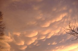
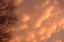
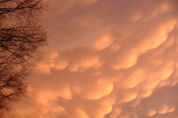
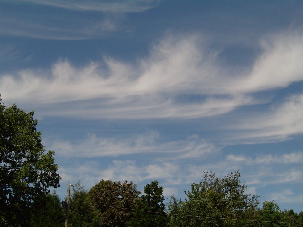
By the way, the pictures from yesterday and today were taken in Southern Illinois back in September. A very comfortably cool day with some beautiful cirrus overhead.

I had some very small hail mixed in with the rain and thunder at my house yesterday. It was a quick shot though. At first the rain was pretty heavy, but it ended quickly. I only recorded 1/10" which is o.k., considering how wet the yard is right now.

Two dry days today and Wednesday. Then a new storm system will bring rain to the area Thursday afternoon and evening. Amounts look rather light right now, with the heaviest amounts sliding through central sections of Alabama and Georgia. We should end up dry from Thursday night through Friday afternoon. But Friday night and into Saturday another round of rain and storms move in. Some storms may be strong early Saturday. As this storm pulls away from the area, colder air will move in. So the mountains around here may see some flurries or snow showers late Saturday afternoon and into Saturday night. Amounts look light though. So don't look for any snowmen popping up.

It still looks like February could get much colder for the eastern 1/2 of the U.S. after the 5th or 6th. So it will be interesting to see to what degree January's warmth can be trimmed back or reversed. Another gas bill just came in yesterday, so I'm hoping we'll remember this winter for it's warmth and not February chill. (I'm also hoping the gas company estimated this month.)

Monday, January 30, 2006

O Brother How Cold Art Thou?

My brother Phil loves the movie "O Brother Where Art Thou?". I'll have to admit the first time I saw it I didn't quite get it. But it's one of those movies that makes me chuckle more every time I see it. The tie in is with our second oldest brother JP. He used to live in Fairbanks, Alaska. Now he's in Dublin, Ireland. I used to give him a call now and then and ask, "How cold is it today?"
So today his e-mail says temps in Ireland have been running between 45 and 60, ABOVE. And he's glad he hasn't seen one vehicle with a power cord hanging out of the grill. He said I should check out the temps in interior Alaska. So far this month the warmest afternoon high has been 6 degrees above zero. The coldest low has been -51! Every morning this month has been below zero to start the day. And there are places in interior Alaska that have been even colder this month. Check out what long time Alaskans have to say about this cold: http://hosted.ap.org/dynamic/stories/A/AK_INTERIOR_FREEZE_AKOL-?SITE=AKFAI&SECTION=HOME
This would be the time I would call JP and say, "Man whatta weekend we just had. The end of January and Friday it was sunny and 55, Saturday was sunny and 62, and yesterday we hit 67. By the way how cold is it there?"
By the way our coldest official reading so far this month was 27 on the 7th of January. So we really don't have anything to complain about.
Some scattered showers should move through today with highs into the upper 50s to low 60s. Then mostly sunny, cool and breezy conditions for Tuesday. More clouds and some scattered showers Wednesday night and early Thursday. A break for Thursday afternoon through early Friday before another system brings a chance of showers back into the area late Friday.
The question now is, does this next system open the door for a taste of cooler air this next weekend? Right now it looks like we get significantly chillier. But nothing terribly cold. The Climate Prediction Center still has below normal temps coming for much of the U.S. for the period of Feb. 6th through the 12th. But even that may only produce daytime highs in the 40s. But that's quite a swing for us when we've been so warm.
If we get any colder than that, maybe I'll get a phone call from one of my siblings with the taunt, "O Brother How Cold Art Thou?"

Thursday, January 26, 2006

Awesome Pictures From Niota!


Wes Foster gets top honors today for his awesome weather shots. Wes took these back in December as storms were moving through the Niota area. I have always loved pictures featuring mammatus clouds. I have one on the wall near my computer that a friend of mine took in Southern Indiana years ago. And somewhere at home I have at least 2 boxes of other mammatus displays I never got around to getting in frames. I pull them out once in awhile and say wow. Just because I think they are the most stunning cloud formations in the world. (Standing lenticulars are a close second.) A very good site with more awesome pictures and descriptions is available at:http://ww2010.atmos.uiuc.edu/(Gh)/guides/mtr/cld/cldtyp/oth/mm.rxml

Yesterday's post featured a look at daytime highs for January. Today take a look at the comparison between December and January. December's average monthly temperature was 3.4 degrees below normal. January 2006 may end up as one of the warmest on record.

Here's a side by side comparison of daytime highs:

December January

  • 60s: 2 Days 10 Days
  • 50s: 10Days 12 Days
  • 40s: 19Days 1 Day
  • 30s: 0 Days 2 Days

To me the most striking numbers are the days in January in the 60s compared to December. And the number of days in December when the highs stayed in the 40s compared to January. These seem even more impressive when you consider that 23 days in December were recorded as either clear or partly cloudy. In other words even with sunshine or partial sunshine the mercury struggled to get up to the 40s and 50s, where we had MORNING LOWS 8 times this month.

I think we'll end up seeing highs above average for the rest of the month which probably seems like no big surprise. With sunshine today we'll make it up to 53. 56 Friday afternoon with mostly sunny skies. Clouds will increase quickly Saturday with highs in the upper 50s. Rain moves in Saturday night and Sunday. Right now it looks like most areas will average around 1 inch of rain.

The models seem to be wavering as to what happens in February. But right now it would appear that the excessive warmth of January will at least be trimmed back if not reversed in a big way. It will be interesting to wait and see.

Wednesday, January 25, 2006

Little Sprouts May Need Some Little TLC


Special thanks this morning to Arlos Dempsey of Signal Mountain for a nice sunrise shot.

This morning's sunrise was pretty nice too. Just crystal clear skies. Right around 7:00 am the Channel 3 Lookouts Cam was a sight to see. The sun was just beginning to climb towards the horizon at that hour. Early birds will have the same sight again tomorrow morning. Although with clear skies and calm winds it will be pretty cold in the morning. Which leads into a note of caution for gardeners out there.

The last week or so I've been able to jog around in shorts with Dudley dog. (Although on top there's a t-shirt, sweatshirt, and windbreaker.) But what I've noticed along the route is a lot of sprouts popping through the soil in areas where the jonquils, and other Spring flowers are usually seen in March and April. So gardeners may want to spend today spreading and mounding some mulch as we should see morning lows in the 20s Thursday and Friday mornings.

Wet weather should hold off until Saturday night and Sunday across the area. And this may end up being a dandy of a low spinning up in the middle of the U.S..

Longer range models are still hinting at cold coming back our way sometime after Groundhog's Day. That would certainly even things out wouldn't it.

Most of December's highs were below average. And here's a the number of days so far with highs in the:

  • 30s: 2 days
  • 40s: 1 day
  • 50s: 11 days
  • 60s: 10 days

Tuesday, January 24, 2006

Nice to have a sunrise again.


Many thanks to Jim Gray of Culberson, NC for sending in this excellent shot of a sunrise over Brasstown Bald. We only get so many in a lifetime, and they're not always this beautiful. When I see something like this it makes me wonder how many I've missed by sleeping late.

My best sunrise? Probably one seen in the early morning chill while canoe camping in Quetico Provincial Park, Canada.

We had camped near a waterfall on the Maligne River. The day before we had an excellent day of paddle trolling for walleye in the swift water. Just about every trip upstream would yield a sizeable and fiesty fish. About the time you'd get him in the canoe it was time to start paddling for all you were worth, or over the falls you'd go. That night after a satisfying meal of freshly caught and filleted walleye, a few of us were up watching the last of the coals from the fire starting to fade. I looked up but instead of millions of stars I saw a dazzling display of the Northern Lights. The colors were vivid, and seemed to be gently swirling across the night sky. We woke everyone up so everyone could enjoy this spectacular show.

So the next morning as the first birds were beginning to sing their pre-dawn songs, I got up early to see if the light show was still going on. It wasn't. But the skim of fog just skating above the water was illuminated by the rose hues of another day in the North Woods. This wasn't the prettiest I've seen. In fact Jim's sunrise is a lot more picturesque. But I'll always remember the feeling of that morning's chill, the scent of pine needles, and the morning sky framed by tall trees and ancient granite.

Make sure you click on Jim's picture to see it full sized.

Nice to have a sunrise here this morning again after all the dreary weather since last Friday night. We should see a lot of sun the next couple of mornings. But you'll know it's January again the next few mornings. A clipper system moves out of (Quetico) Canada and into the Great Lakes today and tonight, pushing a front through the Tennessee Valley. This one goes through without any precipitation, but it will usher in some colder air. But only slightly colder. After lows in the 20s Thursday and Friday mornings, highs will climb back to near 60 by Friday afternoon. There's another chance of rain heading our way late Saturday. And if the models are right this morning, we'll have a very wet Sunday again.

Wednesday, January 18, 2006

Will Winter Ever Come?

Thanks this morning to Alan Barnes for being quick with the camera late last night. He snapped this picture in Lakeview, GA of the snow showers that left a brief dusting on the car top. Alan said, "Finally some snow you can touch." Tangible snow has been hard to come by this month, although portions of Middle Tennessee measured some last night. The National Weather Service Office in Nashville reported 1/2" to 2" there. Putnam County, TN apparently was the big winner with 2" to 3" at Monterey.
Yesterday was a 24 hour rainfall record at Chattanooga's Lovell Field with 1.27" in the bucket. Many of our Channel 3 Storm Alert Skywatchers had impressive amounts ranging from 1 1/2" to 3" of rain. Quite a soaker!
Today we'll see a lot of sunshine, but colder air and west winds 10 to 20 mph and gusty will make it feel pretty chilly all day long. In fact this may be only the third day this month with a daytime high below average.
  1. Jan. 6th High:39
  2. Jan. 14th High:38
  3. Today High:47

Today also marks a transition of sorts. This is the first day the climatalogical highs edge upward one degree. Today's average high is 49. So on paper we're turning the corner toward Spring, although we haven't seen much Winter at all this month.

So what's ahead??

Look for sunshine and highs near 60 Thursday. Mostly sunny skies and highs into the low to mid 60s on Friday. The next system looks like rain from start to finish on Saturday. That storm won't soak the area like the last one, but many areas could see 1/2" to 1". A wetter system scoots through Monday into Tuesday. But that one will likely be all rain as well.

Farther down the road a bigger dip in temps may happen around the 30th or 31st, but that's quite a ways out right now. But to me it wouldn't be all that surprising to see some kind of weather correction at the end of the month or near the first part of February. We'll see.

Tuesday, January 17, 2006

Wild January Ride Continues


Thanks this morning to Hunter Madewell of Dayton Mountain for the top picture today. This nice shot was taken early Saturday morning in Bledsoe, County. The middle and bottom pictures were sent to WRCB-TV3 by the Rhodes Family in Morganton, GA. Thanks to them for showing the light coating of snow they received this past weekend. I think the shot in the middle kind of illustrates what we have been seeing so far this January. An almost spring-like plant with a touch of winter on it.

Heavy rainfall at times today, with many locations picking up 1 1/2" of rain pretty easily. Some spots may end up with some downpours that push their totals to between 2" and 3". We'll find out from our skywatchers later. This will reverse a 5 month trend of below normal rainfall stretching back to our last ABOVE normal month....July.

Here are the months and deficits from 2005

  1. December -.96"
  2. November -1.31"
  3. October -2.51"
  4. September -2.39"
  5. August -1.41"

Most of the rain will be out of here by tonight, but there's still a chance to see some mountain flurries or snow showers late tonight and in the very early morning hours of Wednesday. Winds today will whip across the area out of the southwest, and come around to the west and northwest tonight and Wednesday. Southwest winds and sunshine will boost temperatures back into the upper 50s to around 60 Thursday afternoon. And we should end up in the low 60s again on Friday. Another round of soaking rain and storms for Saturday.

This wild January ride continues.

Monday, January 16, 2006

Encore Performance Ahead???


Last week all four seasons, wrapping up Friday night and early Saturday as some snow showers and snow flurries for the mountains in the area. So a big thank you to everyone who sent pictures in to Channel 3 over the weekend. The first picture on top is from Bob Woodstock of Ivy Log, Georgia. Looks like Bob has a beautiful place to call home. And the second shot is from T.J. Cloer who took this picture on a short drive this weekend. T.J. says that's Grassy Mountain just east of Crandall, Georgia in the background. Thanks T.J.! And remember, you can click on these pictures to get the full effect. They are both very nice shots.
Well this has certainly been a wild ride lately. Rapid fire systems look to cross the country every three to five days. A pattern that may last until the end of the month.
Let's start with the short term. Today will be mostly cloudy with a few light showers popping up mainly this afternoon and evening. But the significant rainfall holds off until tomorrow. And that's when the rain and even thunderstorms get heavy. Right now it doesn't look like we'll see any severe weather but rainfall amounts from today through Wednesday will be between 1.5" and 3". And then late Tuesday night and into Wednesday morning it looks like we'll be cold enough to see another round of snow showers and snow flurries across the area. But like the activity that created the beautiful scenes above, this will only add up to minor amounts in the mountains. Then we'll bounce back up to the mid and upper 50s with mostly sunny skies on Thursday. Late Friday night another system generates some more rain and thunderstorms. That round of rain is likely to last into early Saturday. But there shouldn't be any winter shenanigans behind this system.
In fact the flow may stay west to east across the nation much of the following week. Keeping truly cold air up in Canada. There may be a pressing southward of that cold air towards the end of the month, but right now there doesn't appear to be any sustained cold for us for the next two weeks.
After such a chilly December, this may be the longest January thaw we've had in a long time.

Friday, January 06, 2006

Wild Dip Dusts The Tops.


Many thanks this morning to David Broome for being the quick draw with the digital camera and e-mail. David shot these pictures at his home on Signal Mountain before 6 am this morning, reporting about one inch of snow, mainly on above ground objects. From David's description, he lives about 4 miles from Casa Benson. This is wild stuff. I was literally jogging with Dudley-Dog on Wednesday atop Signal in shorts and a sweatshirt. Wednesday it reached 62 at my house. This morning, snow. And by Sunday we'll be back to the upper 50s to low 60s across the area.
The big jetstream dip that's making it cold for the first time this year will lift out this weekend. Southwest surface winds pick up, and voila! Back to Spring-like temps.
The jetstream looks to fly west to east across the nation next week so we'll keep temperatures 10 to 15 degrees above our average of 48.
So the old weather saying that is adopted by every corner of the country hold true here, "If you don't like the weather now, wait a minute and it will change."