Friday, June 23, 2006

Tepid Temps To Tone Down

The day lilies across the area have been beautiful lately in spite of the dry weather. It was "Photo Friday" on Channel 3 Eyewitness News Today, and this picture was one of the nice shots shown this morning. Thanks to Matt Hansen for sending it. Great job! There's one home on my daily wog (walk/jog) that has several varieties out front. And they really look nice right now.
Wow was it hot part deux..........yesterday we hit 98 officially, the first time we've been that hot since August 2nd, 2002. And only two degrees short of the record 100 in 1988. (Again the specter of a 100 degree day or hotter in Chattanooga this summer looms large. Something that hasn't happened here since September 6th, 1999. That year we hit 100 or 101 six times.)
The way to stop an official 100 degree day is to keep the ground wet. Last year the tropics really helped us out. June was a wet month with 7.05" of rain. .74" came up from Tropical Storm Arlene. During July of last year we recorded 6.05". But almost all of that came from Hurricane Cindy: 2.50", and Hurricane Dennis: 2.46".
Again, I'd hate to see anyone on the Gulf Coast get slammed with a storm, but a slow moving tropical storm could help us out a bunch. But there's nothing imminent on the horizon. But a tropical wave east of the Bahamas will approach Florida over the next few days. And at least one of the models brings some moisture as far northwest as Chattanooga late in the weekend into early next week. The caution is, this model has also been wetter with our weather lately as well. So I'm not putting much stock in that solution. So I'll label it "a wave of interest" and keep a casual eye on it.
A weak front is sagging into Tennessee this morning, with showers and thunderstorms draped along it from Nashville to Memphis. We should see another steamy day today with scattered storms developing. Hit and miss storms Saturday and Sunday, with rain chances tapering off Monday and Tuesday. Highs this afternoon should hit 93, then in the upper 80s to near 90 Saturday through Tuesday.
Have a great weekend!

Thursday, June 22, 2006

Cool Kids Having Fun While The Heat Is On


Thanks this morning to everyone at the Chickamauga Public Library for inviting me to come speak to the cool kids at their summer reading program. When Darla Chambliss first contacted me about coming, I said yes because I really enjoy visiting Chickamauga. What a great town. And I was surprised to see a packed house when I arrived. It was nice to see everyone, although afterwards I was told they had an Astro Jump inflatable playground set up out back. So I'm thinking the crowd was there for other reasons. At any rate the kids asked good questions and seemed to enjoy learning a little about the ocean of air we live in.
Wow was it hot for the first day of summer yesterday! That was the hottest it's been since July 26th, last year. If it would have gone to 98, it would have been the hottest since August 2nd, 2002. That's a testament to how dry the ground is right now. Only a trace of rain was recorded at Chattanooga's Lovell Field. So right now we are 2.71" below normal for June, 9.07" below since the beginning of the year.
Big time boomers knocked out power to about 5,000 Cleveland Utilities customers on Wednesday. A lot of big trees knocked over from the gusty downburst winds. This is something that we have to deal with frequently during the summer months. And it will be a possibility through the first part of next week.
Right now I think average rainfall amounts across the area from today through Monday could end up around 1". But this will come in daily rounds of scattered storms. So locally heavier amounts will occur, and some locations could get short-changed. But the overall pattern favors at least a little bit for everyone.
Today - Partly cloudy with hit and miss afternoon storms. Highs near 95.
Friday through Monday - Scattered mainly afternoon and evening storms. Highs Friday in the lower 90s. Highs Saturday through Monday - Mid to upper 80s.
That's it for today...........I'm off to find some popsicles.

Tuesday, June 20, 2006

Age old silly question - "Hot enough for you?"

I love lightning pictures and this is a nice one. Thanks today to Jim and Glenda Knapp of Soddy Daisy for sending this shot of a storm over Cleveland, TN last night. It's appropriate for Lightning Safety Awareness Week this week. I wish we had more lightning pictures coming in, because we are really baking the area dry. Chattanooga's Lovell Field hit 94 this afternoon. 95 in Fort Payne.....and I'm not sure what's up with Rome, GA but the hourly ob at 3 pm was 99, and at 4 pm it hit 101. (I have been noticing Rome's tendency for rather high afternoon readings lately. But even if you shave 5 degrees off that it's still scorching if you're working outside.)
A few storms drifting out of Kentucky will move into parts of Tennessee, but I think they will have a hard time making it this far south. And with the exception of the Blue Ridge Mountains, we should stay dry Wednesday and Thursday. By the way, summer officially arrives tomorrow morning at 8:26 am. This weekend a front sags closer to the region helping us with scattered showers and storms during the afternoon and evening hours.
Here we go:
Wednesday - Hazy sunshine highs around 95.
Thursday - Partly cloudy with highs around 94.
Friday through Sunday - Partly cloudy with a 30% to 40% chance for an afternoon storm. Highs from 89 to 92.

Monday, June 19, 2006

A Few Lucky Spots, Midweek Hot Streak


Every time I dive in the Tennessee River I'm amused by the large mouth bass. How do they know this bubble blowing oversized fish isn't there to gobble the nearest fish? In fact they seem to look forward to these intruders from dry land. They will cruise as close as they can, cautiously eyeing you. They seem to be waiting for you to scare some little critter out of hiding and into their hungry mouths. But if you reach to touch them, they'll back away. (Bottom pictures.) I believe I saw similar behavior while snorkeling in Cozumel. In the shallow water near shore there are literally tens of thousands of small minnows. And every once in awhile a juvenile barracuda. The barracuda will stay fairly close to you, but they seem to use the snorkler as a diversion. As soon as the minnows dart away from you.....ZIP....SNAP! And the barracuda has a snack. (Top pictures.)
Back on land today we had a few lucky folks who picked up some locally heavy downpours from isolated afternoon storms. When Jim Garner our skywatcher from Jasper, TN called this afternoon he said, "Thom can you hear it?" I sure could. Jim was one of the lucky ones getting a good downpour.
I wish I had better news, but right now I'm only expecting isolated storms Tuesday afternoon. But the coverage will be sparse. Then the temps soar into the mid 90s Wednesday and Thursday with hazy sunshine and only a 10% chance for something popping up. But by this weekend, we should see a few more hit and miss storms popping up. Highs Friday through Sunday will be in the upper 80s to lower 90s.
For some of our Skywatchers today marks the 23rd day without measurable rain.
Everyone says it, "We need rain."

Sunday, June 18, 2006

Riverbend '06 Rain-free....Showers Ahead.


Years from now most folks will be talking about the music at Riverbend, but I'll always remember this year's festival as the rain-free event. Usually at least one night gets a brief downpour, if not an all out gully washer. But this year remarkably it was not only dry, but the air was dry enough that you didn't feel soggy just from standing around. So now that another year is in the books at Ross's Landing, let's bring on the rain.
Today northwest Tennessee has been getting quite a soaking. And while I don't think we see that kind of rain, we'll get some beginning overnight tonight. Showery weather and a few thunderstorms off and on for Monday. So temperatures will be tough to forecast so I'm going to split the middle and shoot for a high near 84 Monday afternoon. But some places probably will end up around 87, and a few spots could be only around 80. Then our rain chances dwindle to a slight chance for a few afternoon storms on Tuesday. Highs Tuesday afternoon around 90. Summer officially begins Wednesday, and man are we ever going to feel it. Highs will likely be 93 to 96 Wednesday and Thursday with very humid conditions. Friday and into next weekend should feature another dip in the jetstream over the eastern third of the nation. So our weather may not be AS hot as the middle of the week. But we should still top out slightly above 90 with some scattered storms around. We need the rain, so hopefully we'll get back on track this week some.

Friday, June 16, 2006

Sunfish And Scattered Showers

Another shot from down under in The Tennessee River. A pretty friendly bluegill and if you click on the picture and see it full-sized, you'll notice there's two sunfish in the picture. This guy was a little better than hand-sized, and I have a fairly large hand. As long as I'm showing fish, and about to talk heat, I'm reminded of Durwood Graham a former skywatcher when I was out in Texas. This Texas rancher called me one time to tell me it was so hot fishing one afternoon even the fish were sweating. In West Texas that's what they call H-O-Tee-Tee hot. We haven't been quite that bad lately. In fact if you were up and out early enough, you know the morning hours have been downright nice. Danny Stewart our Channel 3 Skywatcher from Coalmont, TN had 50 this morning. But it shot up to 90 this afternoon at his house! You only get that kind of range when the air and ground is dry. And we have been extremely dry this year. How dry???
It was so dry the grasshoppers were on the power lines sucking the juice out of them. (Another West Texas one-liner.) This is the driest first half of June in the past 10 years:
  • 2005 4.00"
  • 2004 1.12"
  • 2003 3.45"
  • 2002 1.85"
  • 2001 3.64"
  • 2000 1.05"
  • 1999 1.44"
  • 1998 4.90"
  • 1997 3.33"
  • 1996 2.17"
  • Average rainfall June 1st through 15th: 1.95"

This streak may go back even further, but that's as deep into the records as I could dive without a mandatory climatological decompression stop.

But hear ye, hear ye. Wetter times may be ahead.

I still think most of us stay dry this weekend, but an isolated storm still can't be ruled out. Especially over the Cumberland Plateau to our west and the Blue Ridge Mountains to the east.

Saturday and Father's Day - Hazy sunshine with highs near 90 and a 20% chance for an isolated afternoon storm.

Monday - Partly cloudy, hot and humid with highs near 88. But we should see scattered storms developing. Chance of rain is 40%.

Tuesday - 30% chance for some scattered afternoon and evening storms. Highs near 90.

Wednesday - Chances for showers drop off to around 20% with highs back up around 93.

Happy Father's Day to all! I hope you get a chance to tell Dad what he's meant to you.

Thursday, June 15, 2006

Relief Ahead, Or Is It A Mirage?


I'm told there are two shipwrecks in the Tennessee River near downtown Chattanooga. Look closely at the pictures above. These shots are taken of "The Chattanooga", a paddle-wheeler that went down in about 20 feet of water. You need to click on the pictures to see them full-sized. The sides and the decking are still pretty much in tact, but the paddle wheel is long gone and all that's left are a few sprockets or flywheels from the mighty machinery that once powered this boat. After spending most of our bottom time cruising along the sides and right on the deck, I can see how shipwreck diving could become addictive. While I was underwater hovering above the deck, gently pulling myself along by the fingertips, I tried to imagine what this boat once looked like. The captain was probably proud of her, and might have felt a great deal of anguish when the Tennessee River claimed her. Now I'm curious about this piece of history that sits hidden away in one of the most visible locations in our area. Literally a million or more people pass right by this site and never even know it's there. If anyone knows a bit about the history of "The Chattanooga" or how she sank, I'd love to hear about it.
Now back to our bone-dry conditions.
  • So far this June we've had only .15" of rain.
  • The driest June on record: 1944 .29" of rain.
  • Average rainfall for the first 15 days of June: 1.95"
  • Last year June 1st - 15th: 4.00" of rain fell.
  • Average rainfall for the entire month: 3.99"

I don't see any rainfall Friday, and you'd have to be very lucky over the weekend to get wet. Although one model has quite a soaking for middle TN, and the Cumberland Plateau. (But I'm wondering if it's picking up on the beer convergence at Bonneroo.) I'd like to leave the weekend forecast dry, but terrain induced showers could pop with daytime heat.

Friday - Partly cloudy and steamy with highs near 91. Code Orange Ozone Action Day is in effect for Friday.

Saturday and Sunday - Partly cloudy and steamy with a 20% chance for an isolated storm. Highs both days 90 to 92.

Monday and Tuesday - 30% chance for some hit and miss afternoon storms. Highs staying up near 90.

Wednesday, June 14, 2006

Visibility Above and Below

Here's my dive buddy Ricky Boyd on last Sunday's trip down under. Visibility really wasn't this bad, but there were enough particles suspended in the water that the single flash on my camera was really spreading out. In fact Ricky might have a hard time recognizing himself in this shot. You will recognize some of the fishy friends we saw that I'll try and post in the days to come.
While it was a bit murky in the water Sunday, it was also pretty murky in the sky as well. And if you remember what that looked and felt like Sunday afternoon........guess what? It's coming back.
Today was a real treat really. Dewpoints dropped into the mid 50s and with a north breeze, 88 really wasn't that bad. And with less moisture, the visibility was pretty good. The trade off is that as the steam-bath returns, so does the chance for afternoon storms which we really need.
Thursday - Mostly sunny and hot with highs in the upper 80s to low 90s.
Thursday Night - Clear and sticky with lows around 64.
Friday - Hazy sunshine with highs in the low 90s.
Saturday - Partly cloudy with highs in the low 90s with just a 20% chance for an isolated storm.
Sunday - Partly cloudy with highs in the upper 80s to low 90s. 20% chance for an isolated storm.
Monday - 30% for an afternoon storm. Highs still in the upper 80s to low 90s.
The way the models look this afternoon, I doubt many of us east of the Cumberland Plateau see much Saturday or Sunday. But I just don't think ALL storm chances can be ruled out. But Monday and Tuesday we are in the running across the entire area. As of today we are -1.67" for the month, and -8.03" year to date.
I have decided that I'm going to let my lawn go until it rains again. Or if I absolutely HAVE to mow before then, I'm going to raise it up on the highest setting and see if the yard can stay green that way.

Tuesday, June 13, 2006

Rockin' & Rollin' On (And In) The River


A couple more pics from Sunday's dive with the Riverbend venue in the background. I enjoyed the "fish eye" view from the water's surface, and I hope some of you like these snapshots as well.
All eyes are on "Alberto" this morning, which remains a tropical storm. While there's some coastal flooding, heavy rains, and sustained winds around 65 mph, this has not been a big storm by any means. But there's been a tidal wave of coverage of this year's first named storm. Yesterday afternoon while channel surfing, I was swept away by the crest of the wave. Everywhere I turned it was all "Alberto", all the time. I think TV-Land was even running classic Alberto VO5 commercials.
We are seeing the northern cloud shield from "Alberto" over our heads. And early this morning there are even a couple of small showers moving past Calhoun, GA and inbetween Resaca and Dalton, GA. There may be some spotty showers south of a LaFayette to Ellijay line today, but for the most part "Alberto" will be a missed rainfall opportunity for us. That's good news for Friends Of The Festival and the rest of Riverbend 2006, but the prospects for rain are looking grim this month. And if we keep going down this rather dusty road, we could wrap up the month of June as much as 3.50" or slightly more below normal. To date we are already -1.54".
Long term that could lay the foundation for some real heat to hit. We have not had a 100 degree day in Chattanooga since 1999. Usually we have moist enough ground and high enough humidity from hitting the century mark. But July, August, and September of 1999 were all 2 to 3 inches drier than average and BOOM! 6 days at or above 100.
  • 9/6/99 100
  • 9/5/99 101
  • 8/19/99 101
  • 8/18/99 101
  • 8/13/99 101
  • 8/12/99 100

And from July 18th through Sept. 12th, some 61 days were well into the 90s with only 4 days in the 80s!!!!

So while I wouldn't want anyone to suffer another strike from a tropical storm or hurricane, a nice depression moving up from the central Gulf coast could pull our bacon out of the fire this summer.

Today - Breezy with high and mid clouds overhead. A spotty shower or two south. Highs near 86.

Tonight - Clear and a bit sticky with lows near 64.

Wednesday - Mostly sunny and warmer with highs near 88.

Thursday - Sunny with highs near 89.

Friday - Sunny with highs near 91.

Saturday - Sunny with highs near 92.

Monday, June 12, 2006

Hot At Riverbend, Nice And Cool Below


Pretty hot stuff over the weekend. In fact officially Chattanooga topped out at 93 on Saturday, and 94 Sunday. Sunday's high was the hottest so far this summer season. And those have been the only official 90s this month. But plenty more to come, especially if we stay this dry. In fact, if we don't see some soaking rains soon we could see our first 100 degree readings in several years this summer.
So with the steamy heat at Riverbend, members of the C.U.D.A. club spent some time underwater where the water temperature was a pleasant 77. Our bottom time was around 1 hour and 15 minutes. And while there was plenty to see, it was pretty murky with a lot of suspended particles and around 6 foot visibility. I'll post a few pictures that turned out from underwater in the days to come.
A slight chance for a shower or storm today, especially early. But I think anything that pops up will be isolated. Look for highs this afternoon around 89 with a northwest breeze helping things out for The Bessie Smith Strut this evening.
Muggy lows tonight around 66.
Then sunny to mostly sunny skies Tuesday through Friday with highs each day 87 to 91.
Tropical Storm Alberto is going to help parched areas of Florida with much needed rainfall. But this storm will stay to far south and southeast of us to help our dry conditions out. Last year it was the tropics that pulled our bacon from the fire. We had several systems give us enough rainfall to stay green and well below 100 all summer long. You really hate to be dependent on tropical storms for your summer rainfall for several reasons. So hopefully we start seeing more scattered afternoon storms late in the next weekend and into early next week. Otherwise this may turn out to be a nasty hot summer here.

Friday, June 09, 2006

Dewpoints The Difference

Thanks this morning to my friend David Wills for this beautiful picture. David takes some great weather shots. And now he needs to take a camera with him while he's diving.
The mantra this morning is: "Air temps not that different. But dewpoint temps will soar, and you'll really feel the difference."
Yesterday's high was 88 and by Sunday we could hit 93. So over the next three days we're only talking about a 5 degree difference. But the dewpoints will jump almost 20 degrees during the same time frame.
  • Thursday @ 6pm dewpoint 46 degrees - NICE!
  • Today @ 6pm dewpoint 56 degrees - Still comfortable.
  • Saturday @ 6pm dewpoint 65 degrees - Steamy.
  • Sunday @ 6 pm dewpoint 67 degrees - Borderline oppressive.

The old adage it's not the heat, it's the humidity is surely true in this range. But I question people's experience when I hear folks saying, "I'd take 110 in Texas over 95 here any day." Sure a steamy 95 in Chattanooga is a bear, but anyone who's been in a dry 110+ "dry" heat, knows how literally breath-taking that is.

Today: Mostly sunny and hot. (But low humidity for one last day.) North winds 5 to 10 mph. Highs around 90.

Tonight:Fair skies and sticky with lows around 65.

Saturday: Mostly sunny and steamy with only a 20% chance for an isolated afternoon storm. Highs around 92.

Sunday:Partly cloudy and steamy with only a 20% chance for an isolated afternoon storm. Highs around 93.

Steamy with a slight chance for and afternoon storm Monday and Tuesday with highs both days near 90.

Big question for the weekend: Will something tropical pop up near the Yucatan peninsula and move up into the Gulf? Most of the models develop a low down there. But forecast strength and movement is all over the place. This may not turn out to be much, but if I had vacation plans for the beaches of Florida I'd take a look at this over the weekend to find out if this system forms.

Have a great weekend and enjoy Riverbend 2006!

Thursday, June 08, 2006

World Ocean Day Today


After last year's hurricanes, many people will be paying attention to the Atlantic Ocean and Gulf Of Mexico like never before. So today on World Ocean Day we are encouraged to learn a bit more about the role of the world's oceans and why they are important. Many of you already know our oceans:
  • generate most of the oxygen we breathe
  • regulate our climate and control our weather patterns on a large scale
  • provide a huge food source
  • and are a storage locker for new drug discoveries

And lately technology is helping marine scientists make new discoveries virtually every day. Right now researchers are searching deep water reefs for new pharmaceuticals in the Straits of Florida between Miami and Bimini. Apparently even though no new species may be found, some known sponges, and other organisms have different properties at depth that may hold promise for a drug breakthrough.

And I read another interesting note concerning bottlenose dolphins and how they communicate. Some researchers now believe these dolphins may have names for themselves and recognize other dolphin names. In fact when two are communicating, they may even talk about a third dolphin by name!

I've always wanted to dive where dolphins or whales could be heard. And hopefully I'll be underwater to hear them first hand some day. Until then I can enjoy their sounds, and so can you with your computer here: http://www.dosits.org

We are told that there is a need for more scientists to study our atmosphere and oceans. With science headlines being made nearly daily in meteorology, astronomy, and oceanography what an exciting time to show students how cool these fields are. And we're lucky to have The Tennessee Aquarium, and The Challenger Center, world class facilities in our own backyard to inspire young minds to become future scientists.

By the way I took the pictures above while scuba diving in Cozumel in April of 2005.

From our Blue Water back to our Blue Skies:

Today: Mostly Sunny, warm and breezy with highs near 87. Look for northwest winds 10 to 20 mph and gusty today. But that ushers in some dry air again, so at least it won't be steamy.

Tonight: Fair skies and comfortable. Lows in the city around 61, outlying areas in the 50s.

Friday: Riverbend 2006 kicks off with Mostly sunny skies and warm with highs near 90.

Saturday and Sunday: Steamy with partly cloudy skies and highs near 90. I don't think we can completely rule out an isolated storm, but most of the area should miss out on significant rainfall.

Monday: The Bessie Smith Strut may have to dodge a stray shower as hit and miss storms pop with daytime heat. Highs Monday will be in the upper 80s to around 90.

Wednesday, June 07, 2006

Northwest Flow Bears Watching

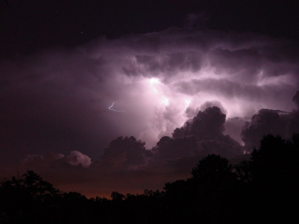
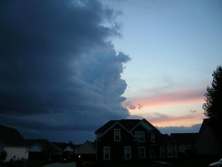
Thanks this morning to Gordon and Angela Geralds for this awesome storm picture. This was taken on May 13th during the outbreak of hail storms that hit the area. Those storms were riding the upper level wind flow from northwest to southeast across the area. We have that kind of flow above the ground again today, but we're not expecting anything like what we saw back in May. But the Storm Prediction Center has outlined a slight risk for severe storms from Middle Tennessee through Kentucky up into Indiana and Ohio. To me it looks like most of the storminess will be along and north of the Ohio River, but we'll keep an eye on points northwest for storms that could move in here.
Today: Mostly sunny skies early, then partly cloudy late with a few storms late this afternoon into early tonight. Highs today around 85.
Overnight: Storms fade out. Some patchy fog is possible with lows around 63.
Thursday: Mostly sunny and breezy. Northwest winds pick up 10 to 20 mph and gusty. Highs Thursday afternoon around86.
Friday: Partly cloudy and warm with highs near 87.
Saturday and Sunday look steamy with highs near 90. And a small threat for an isolated storm or two popping up with the afternoon heat both days.
Overall, I think things look o.k. for the start of Riverbend 2006.
By the way, a good question from a viewer who asked this question, "I was wondering if we [our area] are entering the time of year when tornadoes are becoming less and less frequent? In other words, at the end of May didn't we reach our peak tornado season for our forecast area?"
The answer is yes, and no.
Tennessee does tend to have one spike in tornado activity during the Spring months, but there is also a secondary severe weather season that hits in November around here. And the fact of the matter is, in the Southeast United States the tornado threat is spread out through the entire year. It's possible to have a tornado in ANY month here. Which tends to be part of the preparedness problem here.
In the Plains states like Texas and Oklahoma, there is only one giant spike in tornado activity from late March to early June, with early May being the peak. People know that and are really tuned into the weather in that time frame. They are ready to act.
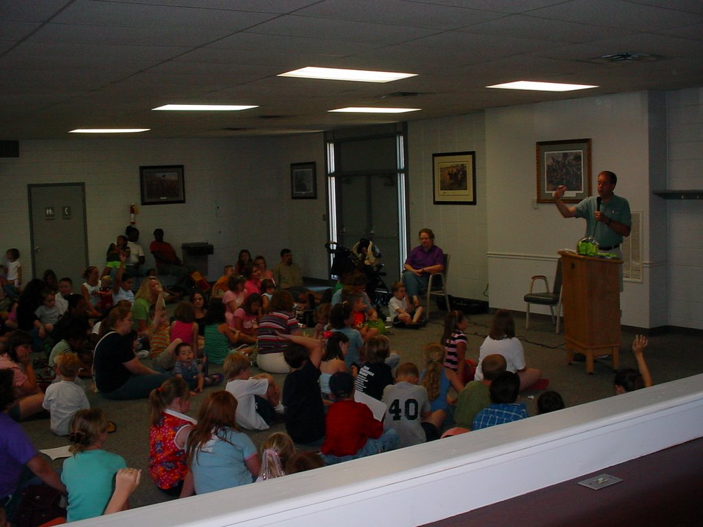
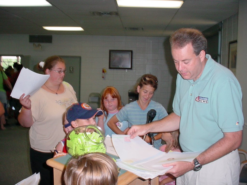
Here it's a different story. People pay attention in the Spring, but may not be as tuned in to severe weather thinking during other times of the year. We need people to pay attention just a little bit to the weather every day. So on those days when there's a threat for severe storms they are already on alert. That's why Channel 3 Eyewitness News still has the Storm Alert Weather Radio offer on our website. Click here for details: http://www.wrcbtv.com/news/weather/weather_radio.cfm
35 people died in Tennessee this year in tornadoes. More than twice the number of all the other states combined. There were devastating outbreaks earlier in the season, but clearly more needs to be done. And a great starting place would be making weather radios in homes as common as smoke detectors.
And as long as I'm on the subject, I need to rant. I think another important step needs to be taken. We need to get back to the days when weather radios were used for weather information ONLY!!!! I am referring to the use of NOAA weather radios as a vehicle to deliver "Amber Alert" messages.
Before I go any further, let me state that I believe the Amber Alerts are a terrific way to save children, and get them back with their parents as soon as possible. There's no doubt that the system works, has saved lives, and should have been developed years ago.
But sending a tone alert for a missing child in the middle of the night on a device that people have using to get severe thunderstorm and tornado warnings on is JUST PLAIN WRONG!
Because when people are trained to shut off or unplug that radio because it's an Amber Alert waking them up instead of a weather warning, you have just destroyed a system that took years to develop, worked, and has saved A LOT of lives. And I know people are shutting them off.
When the Amber Alerts first started toning on NOAA weather radios, I contacted the NWS in Morristown, TN to ask if there was anyone who would listen to debate on this issue. I was referred to the president of the Tennessee Association of Broadcasters who basically said this was the best vehicle to get information to all radio and television stations instantly. He had heard the arguments, but they felt like there was no other option available.
Let me say again...........Amber Alert - great program.
But like the fatal fire where a smoke detector is in the home with a missing or dead battery, I think the day is coming where a home or public building is the site of a death or deaths where a NOAA weather radio is present but shut off or unplugged.

Tuesday, June 06, 2006

Good Grass Growin' And Mowin' Weather

With the cool mornings, relatively wet ground and sunny afternoons the grass has been really jumping out of the ground lately. And so have the weeds. I should have plucked these guys above out of the ground, but they ended up getting their picture snapped instead. (This way I can say I'm not pulling the weeds in the flower bed because I'm not sure which are the flowers and which are the weeds.)
Will this be the last of the comfortable days in the Tennessee Valley this summer? Unfortunately I think so. But that may not be all bad as a change in the pattern will bring back moisture to keep things green with more rainfall chances ahead.
Today: Mostly sunny and very nice with low humidity and highs around 84. Look for light north winds at 5 to 10 mph.
Tonight: Still comfortable, but a tad warmer at 60 tomorrow morning.
Wednesday: A weak front gets close before washing out giving us some scattered storms late in the day into Wednesday evening. Highs Wednesday around 83.
Thursday: There may be enough of this dying front to keep an isolated storm chance in the forecast for the afternoon, but I don't see many areas getting wet Thursday afternoon. Look for highs around 85.
Friday through Sunday: The first weekend of Riverbend looks steamy, but not bad. Highs in the upper 80s to near 90 with partly cloudy skies.
If the computer models are right this morning, umbrellas may be the fashion statement at Riverbend from next Wednesday on. Not all day soakers, but scattered storms may be numerous each afternoon and evening from Wednesday of next week through the following weekend.
That'll keep the grass growin' and everyone mowin'.

Monday, June 05, 2006

Not Exactly Summer Weather Lately


Just back from a nice break and it was nice to come back to an e-mail from Michael McDonald. Michael lives in Ringgold, and was our Junior Forecaster awhile back while Paul Barys was on vacation. Michael had a great time while he was here at Channel 3, and who knows........you might see Michael again on t.v.. He wants to be a meteorologist some day. He checks out the radar every day on his computer at home. Good luck Michael! And thanks for the pictures.
So far, so good weather-wise. Heat has been building out west from Texas and Oklahoma westward. And here we sit with VERY COMFORTABLE humidity and slightly below average temperatures. As we know these conditions won't last long, so we need to enjoy it while it lasts.
Today: Mostly sunny and becoming breezy this afternoon with highs into the lower 80s.
Tonight: Clear and cool. I think Chattanooga ends up around 56 by tomorrow morning. But outlying areas could dip into the low 50s, and an isolated report or two of upper 40s would not surprise me.
Tuesday: Mostly sunny and pleasant. Low humidity and highs around 84.
Wednesday: Another front approaches the area, but this one may not have the push the last couple of fronts have had. I still think we have some scattered storms move in Wednesday afternoon into Wednesday night with highs into the lower 80s.
Thursday and Friday: Partly cloudy with a slight chance for an afternoon storm and highs in the mid 80s. But right now the start of Riverbend 2006 looks pretty good.
Some real questions down range. If you look at the pattern evolving on some of the models, a pretty strong front moves through the middle of next week with some very nice, cool air again moving in Wednesday the 14th through Saturday the 17th. But the Climate Prediction Center is forecasting a pretty big heat wave moving into the eastern 2/3rd's of the nation June 12th through the 18th. The center of above normal temperatures is parked over Southern Illinois and Kentucky and we would really be feeling Summer in all it's glory. So it will be fun to see what actually happens. Stay tuned!