Saturday, April 29, 2006

Trashy Thoughts. Cloudy Weather Kinda Nice.


A few more pictures from last Saturday's CUDA club Earth Day clean-up. Some shots of some of the junk brought up. And one unusual item that made everyone chuckle. Today I found these related little tidbits online thanks to Ocean Watch:
  • It takes an apple core 2 months to decompose.
  • It takes 50 years for a stryrofoam cup to decompose.
  • It takes 200 years for an aluminum can to decompose.
  • It takes a plastic bottle 450 years to decompose.
  • It takes monofilament line 600 years to decompose.

So it's safe to say there were thousands of years worth of garbage pulled out of the Chickamauga Dam area in just a couple of hours.

What a great day today. I know, most people would like to see sunshine on a Saturday. Me too most Saturdays. But today was spent working around the house. Hedges are all trimmed, clippings raked up and hauled away. Low hanging branches cut out of the way. And most importantly, the gutters are now clean. This job is best done on a cloudy day when the roof isn't 600 degrees. So I was appreciating the cloud cover and 62 degree air while scooping piles of maple tree seeds out of the absolutely full gutters. For whatever reason, this has been one of the best years for "helicopters" I can remember.

Now when it rains tomorrow, the water will go down the pipe rather than over the top like it did last week.

Friday, April 28, 2006

"Tanks!" CUDA Club. Low Pressure Triple Header.


Once more "Tanks!" to the Chattanooga Underwater Divers Association for their work cleaning up the Chickamauga Dam Swimming area this past Saturday. The group was out there in the same area in October. And it's a shame to think that bags full of trash can keep coming up from the bottom, and from along the shoreline. (This junk piled up during the colder months, imagine what it's going to look like by October when River Rescue comes up again.) Somebody brought that stuff with them, why couldn't they have taken it home with them?
This is a complex weather pattern we're in for the upcoming weekend. Looking at the satellite images you can easily see three separate storms swirling over or near the U.S.. First one is off the North Carolina outer banks, second one is located over the Dakotas, and system number three is now spinning it's heels over southern Arizona and New Mexico. And inbetween is the region of high pressure keeping our skies crystal clear this morning.
So what happens next?
The low off the Carolina coast moves sluggishly backing up all the weather traffic to the west, so the weekend is not looking that bad overall.

Today: Sunny and pleasant with highs near 78 in the city.

Tonight: Partly Cloudy and cool with lows near 51.

Saturday: Some sun early, clouds increase during the afternoon. Highs around 73. Southeast winds 10 to 15 mph.

Saturday night and Sunday: We'll see mostly cloudy skies with scattered showers. Lows Sunday morning will be around 54. Highs Sunday afternoon around 64.

For a look at the rainfall potential check out the "Weather Feature" graphic here: http://www.wrcbtv.com/news/weather/index.cfm

Monday and Tuesday we'll still have a chance for some scattered storms.

Thursday, April 27, 2006

Divers Make A Difference.


Hats off to members of the Chattanooga Underwater Divers Association for their work on Earth Day. CUDA volunteers worked below the waves and along the shoreline at the swimming area near the Highway 153 dam. This particular spot was chosen to maximize the benefit of the clean-up. With warmer weather just around the corner, people will be flocking to this popular spot. And even though most won't know it, the CUDA club took the time to make sure their first trip into the water won't start with a trashy view or a cut foot from broken glass. More on this effort in the next couple of posts.
Cooler air is diving into the area today helping to plunge readings a little below our average highs this afternoon. Lots of sunshine with highs around 72 today, this will be an opportunity for you to open up the windows and let the breeze flow through the house. But if you do that be aware that you may scramble for a blanket in the morning. Here in the city lows will drop to around 46, but many spots will dip down to between 40 and 45. April sunshine will boost readings back into the upper 70s Friday afternoon.
This last system gave us another round of rain that has helped push April into the rainfall surplus category. And with only a couple of days left in the month this will be the first month of 2006 with above average rainfall. Here's a look at 2006 rainfall compared to average:
  • Jan. -.21"
  • Feb. -2.8"
  • Mar. -4.25"
  • Apr. +2.0"
  • So we are now -5.00" Below Avg. Since Jan. 1st

This last system was also more sluggish than the models forecast, and they seem to be leaning towards the next system moving slower as well. That's good news for the start of the weekend. Right now I look for increasing clouds Saturday morning with showers arriving Saturday evening. Rainy periods with embedded thunderstorms will stick around Saturday night through Sunday. And while there may not be heavy rain on Monday, I think there's potential for clouds and occasional light showers rotating through the area during the day on Monday.

Wednesday, April 26, 2006

Raining Cats And Dog.

Just had a pretty stout thunderstorm at the house. So far .9" rainfall today, with some pea-sized hail mixed in. The picture is a bit blurry, but you get the idea....standing water in the back yard. That's Dudley on patrol. He heard it was raining cats. "So where'd they go?"

Nice Weather Wedged Inbetween Wetness

It was interesting to see showers and thunderstorms in greater concentrations yesterday move north through Kentucky, and south closer to the Gulf coast past us. A few showers popped up inbetween across the area.
Today here comes a fairly solid mass of rain and some embedded thunder right down the middle across the Tennessee Valley. Looks like this will last into early afternoon and then move out. Average rainfall amounts will probably end up between 1/4" to 1/2" today, with some locally heavier amounts across NE Alabama, and North Georgia. Looks like I won't get the lawn cut today. (Evil laugher as lawn changes to yawn = naptime. Ha ha. Nothing like a nap when there's a gentle rain outside.)
Thursday and Friday look great with mostly sunny skies and very comfortable weather. (Perfect weather for the hammock. Lawn can wait.)
That nice weather is wedged inbetween today's rain and what's to come this weekend. Looks like rain and thunderstorms will start moving in Saturday morning and could last until Sunday morning. But Sunday afternoon does not appear to be a bargain. Mostly cloudy skies and some spotty showers may still spin overhead with this system throughout the afternoon hours.
(So if I don't get to it Friday, lawn won't get done until Monday. Which fits in with my procrastination schedule perfectly.)
Did anyone read the Perspective section from this past Sunday's Chattanooga Times Free Press?
Interesting commentary from Nicholas Kristof on global warming and methane hydrates which lie on and below the world's sea floor. I saw a great special on methane hydrates on the Discovery Science Channel awhile back. They were showing how oil companies are trying to safely extract this fuel source. Deep remotely operated vehicles are being used in this exploration. Fascinating stuff.
Kristof's article was zeroing in on the thawing of frozen methane hydrates causing a sudden release of methane that would cause a climate bang, and you guessed it, cable re-runs of "American Idol" would be pre-empted by the total destruction of everything we know. Of course the culprits are in Kristof's mind, President Bush and all of us driving around willy-nilly putting out greenhouse gases.
As evidence Kristof offers this: "One reason for concern about a methane hydrate apocalypse is that something like it may have happened several times in the past. For example, 251 million years ago, there was a catastrophe known as the Permian extinction that came close to wiping out life on earth."
"Nobody is sure what caused the Permian extiction, but one theory is that it was methane burps."
"And as long as I'm fear mongering, there was also a better understood warming 55 million years ago, known as the Paleocene-Eocene Thermal Maximum, or PETM. That was a period when temperatures shot up by 10 degrees Fahrenheit in the tropics and by about 15 degrees in polar areas, and many scientists think it was caused by the melting of methane hydrates."
Kristof goes on to say the following:"But our political system doesn't seem able to grapple with scientific issues like climate. Our only hope for firm action would be a major U.S.-led global initiative to curb carbon, and the Bush administration has already dropped the ball on that."
Got that. Ahem, excuse me. According to you Mr. Kristof, the planet got catastrophically hotter 251 million years ago, and at least one other time 55 million years ago. I wonder how many "W" stickers were on the back of carbon belching Ford Expeditions back then?
Look, I love clean air and water. I choose to drive smaller fuel economical vehicles than bigger models that were less fuel efficient and actually cost less. I spent earth day helping pick up trash on the banks of the Tennessee River. The bottom line is this, let's do what we can to conserve resources and keep our air and water clean. But please don't fall off a cliff following the other lemmings when someone says we're all going to fry under the summer sun in January because we don't car pool or don't vote the right or wrong way. This earth has been hot before and cold before. Very hot and very cold. And it all happened without a bunch of crazy legistlation.
End of rant. Thanks for reading, I feel cooler already.

Tuesday, April 25, 2006

Another Warm One, Storms, And A Downward Trend

One last picture to share with everyone from Savage Gulf State Park. It didn't occur to me at the time I took this snapshot, but now I realize how spectacular this view will be in October. Click on the picture to see the full view. By the way, with gas prices what they are these days these local spots ought to be real attractive to anyone wanting a quality hiking experience without the time, traffic, and expense of traveling up to Gatlinburg. (I still enjoy that area too, but honestly some of the hikes around here are just as nice without the crowds.)
Pretty nice weather around the area the last couple of days, but things are getting ready to change. In the pre-dawn hours we have some showers moving past us to the north. Cumberland County, especially south of Crossville has had some rumbles of thunder and some locally heavy rain this morning. Most of us will enjoy partly cloudy skies for the first half of today with highs climbing into the lower 80s this afternoon. Showers and storms will move in later today through tonight. And while we could see some strong to severe storms this doesn't appear to be a huge outbreak for us. Still we'll be watching the Live Storm Alert Doppler Radar and the VIPIR very closely for you. We'll still have some rain and storms around the area tomorrow morning, possibly lasting until mid to late morning here in Chattanooga. Then cooler conditions tomorrow afternoon with highs in the upper 60s. Very nice weather Thursday and Friday with mostly sunny skies, breezy northwest winds and highs in the low to mid 70s. Right now it looks like Saturday will get off to a dry start, but then showers and storms will move in again from Saturday afternoon into Saturday night. Showery periods will continue through Sunday as well. Highs both days this weekend may only end up around 70.
Not exactly hiking weather, and this could be bad news for the National Cornbread Festival in South Pittsburg, TN this weekend. (Hopefully no one will want to hit me with a skillet if their cornbread is soggy.)

Monday, April 24, 2006

Rainfall leaves things looking great.

Here's a look at the tree in front of the house which always looks great for a few days, and then quickly loses it's color. Actually it's more like a week, but once those blooms pop you'd better enjoy the show because it doesn't last very long at all. So I'm glad I got some snapshots of it this year so I can look back and enjoy it until next Spring.
We won't have to wait long for another shot of rain. As of late this afternoon it looks like things will get a bit busy tomorrow afternoon through early Wednesday. Amounts may end up averaging between 1/2" to 1". Then a few pleasant days from Wednesday afternoon through Friday with slightly cooler temperatures. Look for upper 60s to low 70s Wednesday afternoon, then low 70s Thursday, mid 70s Friday. Unfortunately, it looks like another round of rain and thunderstorms coming up and Saturday and lasting into Sunday.
I spent much of the weekend outdoors, or as much time outdoors as possible. And I'm sure everyone was glad how this past weekend went.
Some things I'm hoping to post this week:

  • CUDA club Earth Day pictures
  • More Spring color snapshots

Awesome Before And After Pictures.


A huge thank you this morning to Richard Williams of Chattanooga for these pictures from Fall Creek Falls State Park. This series of shots really shows how things changed up there from before strong to severe storms moved through on April 7th, and after the heavy downpours moved through on April 8th. These scenes are being played out across the area right now from the rains we saw last week. A lot of the mountain sides still have a fairly healthy flow of water which is great news for hikers and photographers.
A couple of small showers moved through parts of Van Buren, Bledsoe, Rhea, Meigs, McMinn, and Monroe counties. All of these places could see another shower or storm pop up or move through this afternoon through tonight, but even that is a small chance. Most of us will be warm and dry again this afternoon. Speaking of warm , check these daytime highs out for the month so far:
  • 12 days with highs in the 80s
  • 9 days with highs in the 70s
  • 2 days with highs in the 60s.

Right now I'm thinking we'll add two more days to the 80s column this week, and one more (Wednesday) in the 60s. Thursday through next Monday we may be in the lower 70s.

Scattered showers and storms will soak the area with average rainfall amounts of 1/4" to 1/2"+ from tomorrow afternoon through mid morning on Wednesday. A few storms may become strong to severe, but no big severe weather outbreak is expected.

Then cooler Wednesday afternoon. And right now things look great Thursday and Friday.

But this upcoming weekend may be wet. The first part of Saturday may be dry, and hopefully we stretch that out until evening. Sunday may end up pretty wet from start to finish. We have a few days to look at that before we start worrying about outdoor plans though.

Friday, April 21, 2006

Who Dat? Rocky Face?


Top picture is the friendly face I have been mentioning in previous posts that I found along the trail at Savage Gulf State Park. (Please tell me you can see the face. It's like the "Face On Mars". )
Bottom picture is thanks to Casey Alexander of Rossville, GA. Those were the nuggets that fell yesterday afternoon.
Lots of storms very early this morning, that as of 11 am are moving out of the area. Breaks in the clouds are seen on the visible satellite images across southern middle and western Tennessee, northern Alabama, and northern Mississippi. So it looks like we'll get some sunshine this afternoon to push highs into the mid and upper 70s perhaps. A thunderstorm complex is moving across Louisiana right now as well. Sometimes big complexes of storms like that can slow re-development in our neck of the woods. I still think though another round of strong to severe storms is possible from late this afternoon through early Saturday morning. Much of the area is soaked so it won't take much to have some localized flood problems before morning.
We'll start to dry out northwest to southeast across the area beginning tomorrow morning. When the sunshine returns Saturday afternoon the northwest winds will crank up at 15 to 20 mph and gusty making for a cool and windy day. Sunday looks fine for most of us, but there's a slight chance for a shower the closer you are to I-40 Sunday afternoon. Dry Monday, with some more storms possible Tuesday afternoon.
Have a great weekend!

Thursday, April 20, 2006

Rags To Riches Rainfall Story Here.

When I took this picture at Savage Gulf State Park, I was a bit surprised at how much water was running over the falls. Back then it seemed like we couldn't buy a drop of rain. And yesterday after 10 dry days the bottom fell out. 1.76" at Chattanooga's Lovell Field a 24 hour rainfall record for the date. Over one inch of that fell in 30 minutes! And the way things are looking today many areas around the Tennessee Valley will see another 1" to 3" by Saturday morning. A real rags to riches rainfall story here with some isolated flash flooding possible the next two days.
Two systems will come steaming up from the southwest peppering the area with strong to severe thunderstorms. One round this afternoon and tonight, another round tomorrow afternoon into tomorrow night. But right now it still looks like the bulk of the weekend will be nice, and dry.
There's an old saying about making hay while you can, referring to dry weather that may not last. Well I know in my neighborhood it's been just the opposite. Brush that has piled up has been sitting around during this dry and windy stretch. And a lot of people, myself included, took advantage of the wet weather to burn yesterday. The burn ban goes into effect in Hamilton County May 1st. Burn 'em while you have some wet weather.
Tomorrow - How about that friendly face from Savage Gulf I saw? Find out if you see it too.

Wednesday, April 19, 2006

Icy In Trion

Many thanks to Linda Toups for this picture from near Trion, GA on the Walker/Chattooga county line. Linda, we heard from another Trion resident - John P. who says it looks like it snowed in his yard. A tremendous amount of marble sized hail.

Golf Balls In Hollywood, AL

Thanks to Brooke Smith of Chickamauga, Ga for this hail shot at her home.

Golf ball sized hail was reported at Hollywood, Al at around 11:25 am cdt.
Quarter sized hail was reported in Stevenson, Al.
Quarter sized hail covered a store parking lot in Rosalie, Al.

Thanks Again For Your Pictures!

Thanks to Angel Fejeran who took this picture of the hail at the Metropolitan Tabernacle near the intersection of Highway 153 and Airport Road. Angel reported 4 rounds of hail within a 30 minute time frame. Largest hail there was dime-sized.
More pennies from heaven......or penny sized hail reports:
  • Trion
  • LaFayette
  • Fairmount (Gordon County, GA)

More Hail Reports


Thanks to Bonnie Witmer for this picture from Cohutta, GA.
Penny Sized Hail also reported at Rising Fawn, Trenton, Chatsworth, and Ellijay.

Hailers Across The Area, One Lightning Fire


Many thanks to Oscar and Kay Ward for this picture of the hail coming down in the N. Ooltewah / Highway 58 area.
More quarter sized hail reports:
  • South Pittsburg
  • Bryant Alabama - Hidden Valley Golf Course
  • 2nd report 5 minutes later in South Pittsburg

One barn in Sequatchie County set on fire by lightning strike.

EPB Says 1000 In Hamilton County Without Power


Top three pictures thanks to Bob Austin of Georgetown, TN. Bottom picture thanks to Carrie Burnett-Mitchell taken on Mountain Creek Road in the Red Bank, TN area.
Some early reports: 1000 people in Hamilton County without power.
Quarter sized hail in Chattanooga and Collegedale.
Penny to nickel sized hail in Dalton, at the Fall Creek Falls Ranger Station, Gruetli-Lager, Slygo, Cleveland, Cagle Mtn.
One report of structural damage in Cleveland as thunderstorm winds blew the siding and roofing off a home.

And Here They Come!

Another shot from Savage Gulf State Park about one hour northwest of Downtown Chattanooga. They have a great ranger station when you enter the park, (And the cleanest bathrooms I've ever seen at a State Park.) and a sign in / sign out book before you hit the trail. (There are some sheer drop-offs on some of the trails, but you really don't have to get that close.) This weekend may be a great chance to see the area waterfalls like this one at Savage Gulf. A nice shot of rain on the way, with drier and cooler conditions this weekend.
So here goes:
Between 3 am and 5 am this morning we had a few isolated downpours and a couple of rumbles of thunder moving through signaling the unsettled weather to come. As of 8am, a line of thunderstorms from McMinnville to Cookeville is dropping Southeast at 35 mph. We will have a brief period of storminess this morning. Then another round could fire up this afternoon into this evening. A few storms pop again Thursday afternoon. But our biggest round of storms will be from Friday afternoon through Friday night.
Each day today through Friday we have the possibility of seeing some strong to severe storms.
Right now most areas should end up with 3 day totals between 1" to 2"+. Locally heavy rains will of course occur with thunderstorm downpours.
The good news is the latest computer models suggest that all of the rain is over Saturday morning and it stays dry through Tuesday evening. Tuesday night into Wednesday afternoon another system moves through with strong to severe storms possible again.
So after a long dry spell, here they come! And storms will likely keep us busy at times through Friday night.

Tuesday, April 18, 2006

Dusty And Crusty May Turn Into Mowing Mayhem

This picture was taken a couple of weeks ago at Savage Gulf State Park. It was my first time up there and I'm wondering why I haven't wandered up there before. Great hiking, and I think most folks could handle the terrain in the park. Some ups and downs but nothing too strenuous where I was. A few more pictures in the days to come including a friendly face I found along the way.
Wow! How about those scorching highs yesterday?! 88 officially in Chattanooga, 92 in Rome, GA, and 90 in Fort Payne. Several of our Channel 3 Skywatchers were in the low 90s as well. Part of the reason we're so hot is the dry ground and dry air. Today will end up as the 10th dry day in a row. That wouldn't be remarkable in October, but in April that says a lot.
Rainfall deficits as of today:
  • Since March 1st: -4.25"
  • Since Jan. 1st: -7.26"

Last year we started out drier than normal as well, but year to date we are 2.58" drier than last year.

Having said all this keep in mind we have the rest of April and into May to turn things around.

But if things stay dry for the next 6 weeks or so this summer could get ugly hot. Last year's dry Spring was offset by tropical systems that provided us with some timely rainfall during the Summer months. We stayed relatively cool compared to Memphis which topped out at 100 three times last summer, the earliest of which happened out there on June 30th. May and June alone in Memphis were about 7.00" below normal.

The good news is starting tomorrow things are looking more unsettled here for at least the next five days. A few showers could pop up or move in as early as daybreak, but more scattered showers and storms will develop tomorrow afternoon and evening. This won't break the bank as rainfall amounts will average between 1/4" and 1/2". An isolated storm or two could pop Thursday. With a better soaking heading our way Friday evening through early Saturday. That round could produce average amounts closer to 1". And we may see another round fly through here Sunday night into early Monday.

I have weeds and wild onions running rampant in the yard right now. Hopefully I'll get the mower fired up later today and get things knocked back to a tolerable level. Because if the models are right this morning, our crusty and dusty conditions now could turn wetter. Which will mean mowing mayhem trying to keep the lawn in order inbetween rounds of rain.

Monday, April 17, 2006

Summer Temps Trimmed Back Some

I was out of town for the holiday weekend, and I was surprised how hot things got here Friday and Saturday.
  • Thursday's High: 84
  • Friday's High: 87
  • Saturday's High: 87
  • Easter's High: 84
  • Today's Forecast: 86

A front will ease into the area late today helping to trim highs back a bit the rest of the week.

  • Tuesday's Forecast: 79
  • Wednesday's Forecast: 75
  • Thursday's Forecast: 75
  • Friday's Forecast: 76
  • Saturday's Forecast: 74

That will keep us a few degrees above normal, but not in the "hot" range.

Part of the run-up in numbers can be attributed to how dry things are. We are now over 7 inches below normal during what should be the wettest part of the year. And we have a couple of chances to get a little wet this week. First system to move through should produce some scattered storms on Wednesday. (A few could be locally strong to possibly severe, but no big outbreak expected.) Another front zips through Friday evening to Friday night with scattered storms lasting through early Saturday morning.

Right now everything is in full bloom, and if you're not an allergy sufferer things couldn't be better. Although we could use a little wetter.

Monday, April 10, 2006

Very Fortunate Again. Thanks For The Pictures.


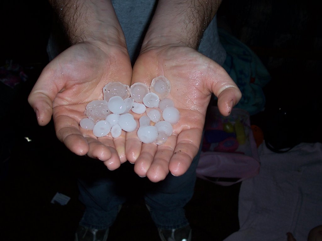
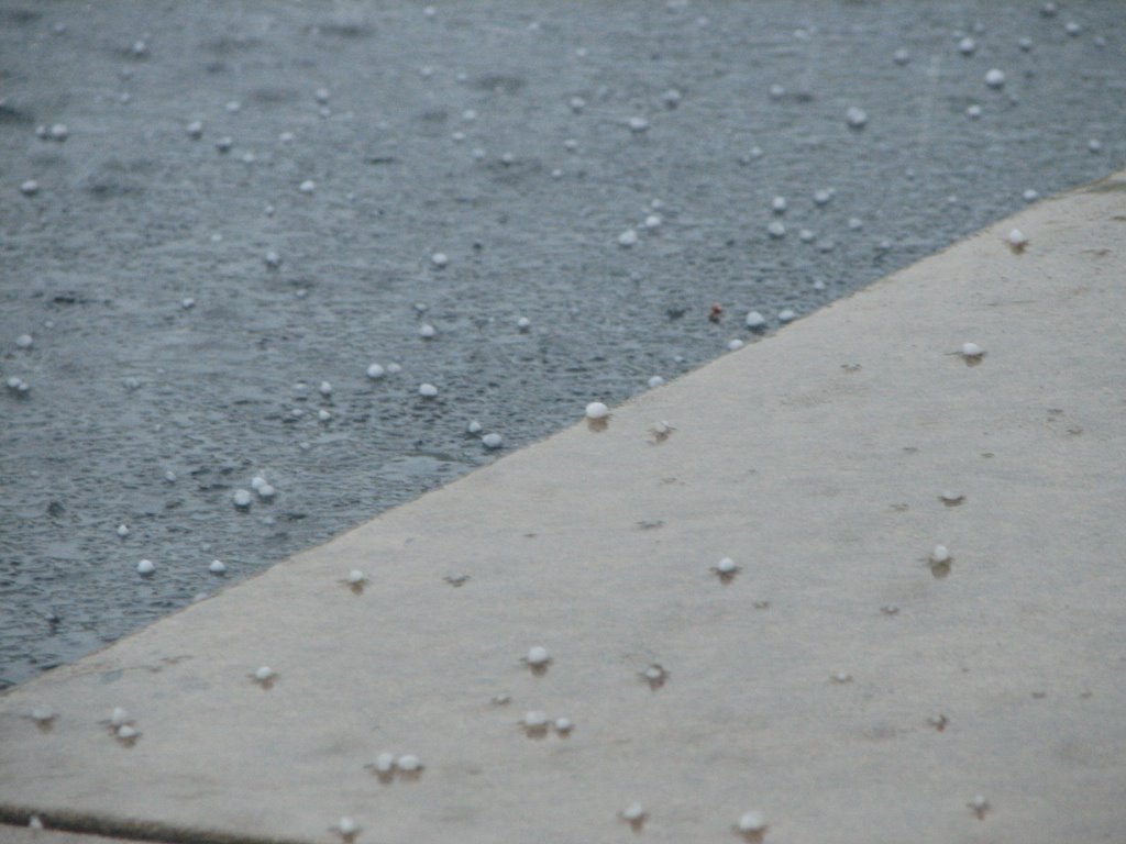
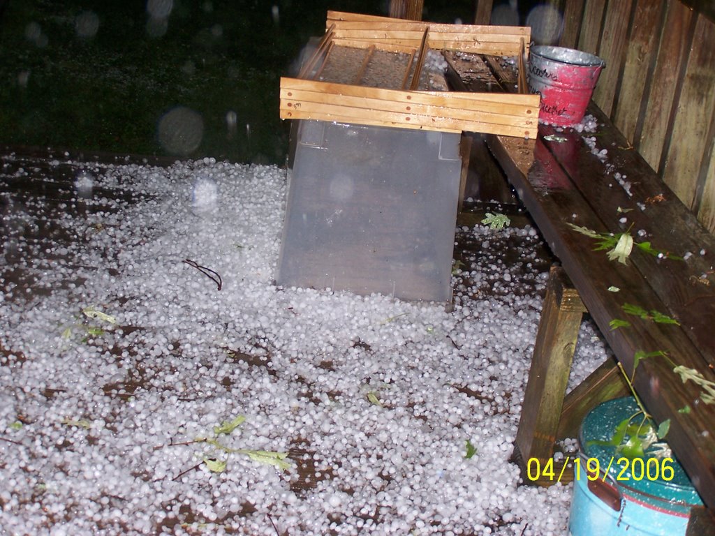
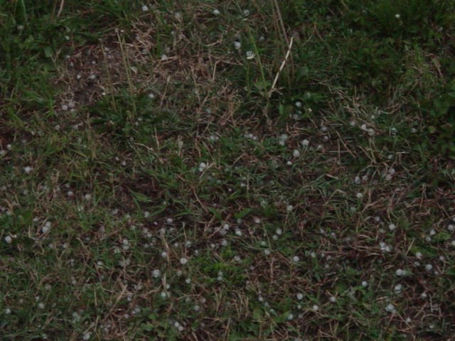
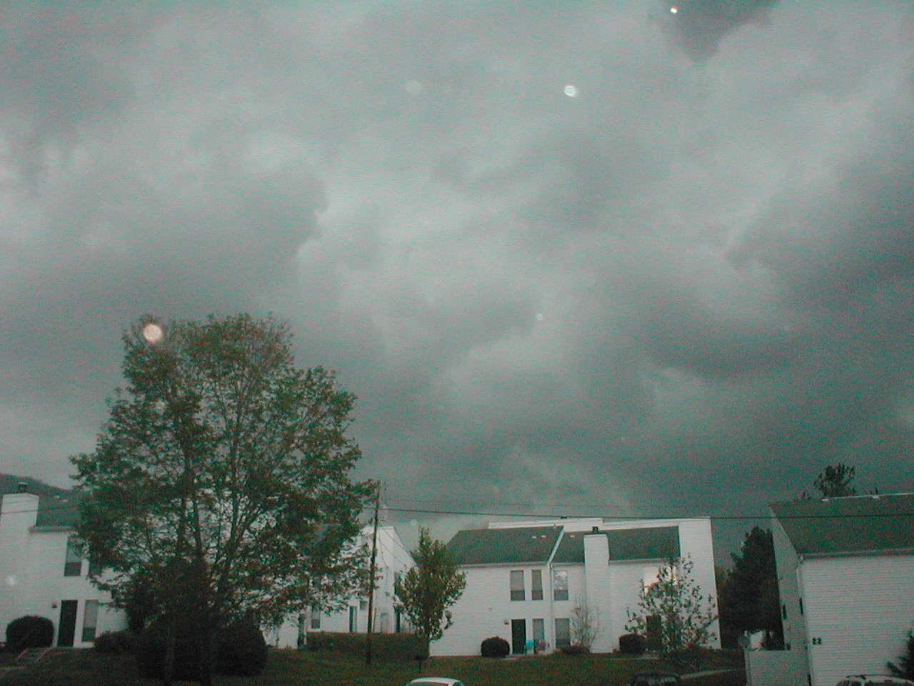
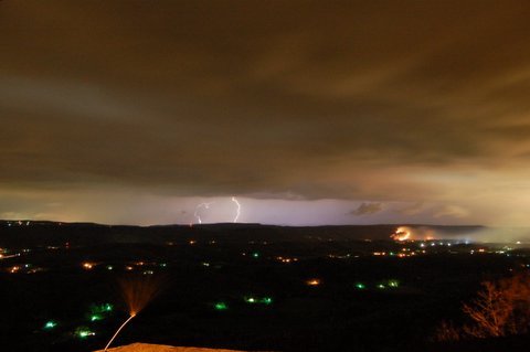
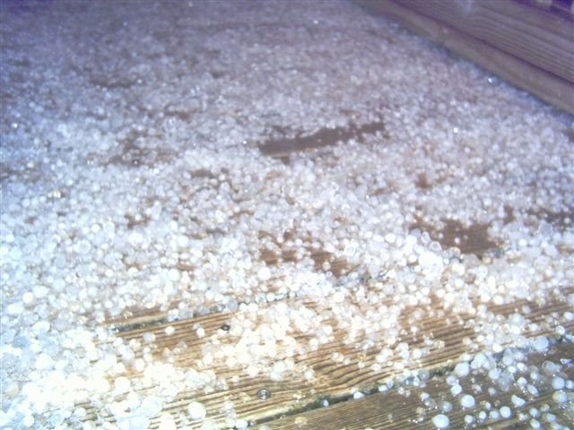
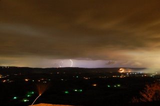
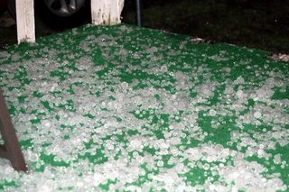
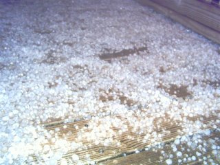
Top two pictures are thanks to Anthony Chastain from Lookout Mountain. First shot is looking west from Lookout towards Trenton, GA. Second is of the hail at Anthony's home.
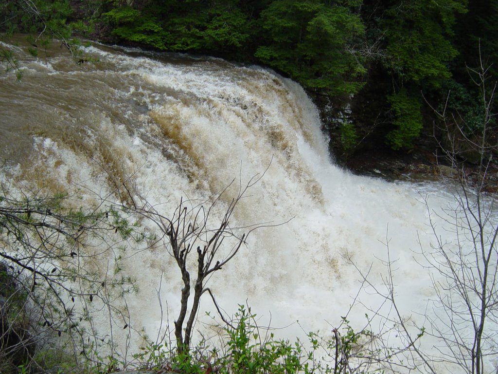
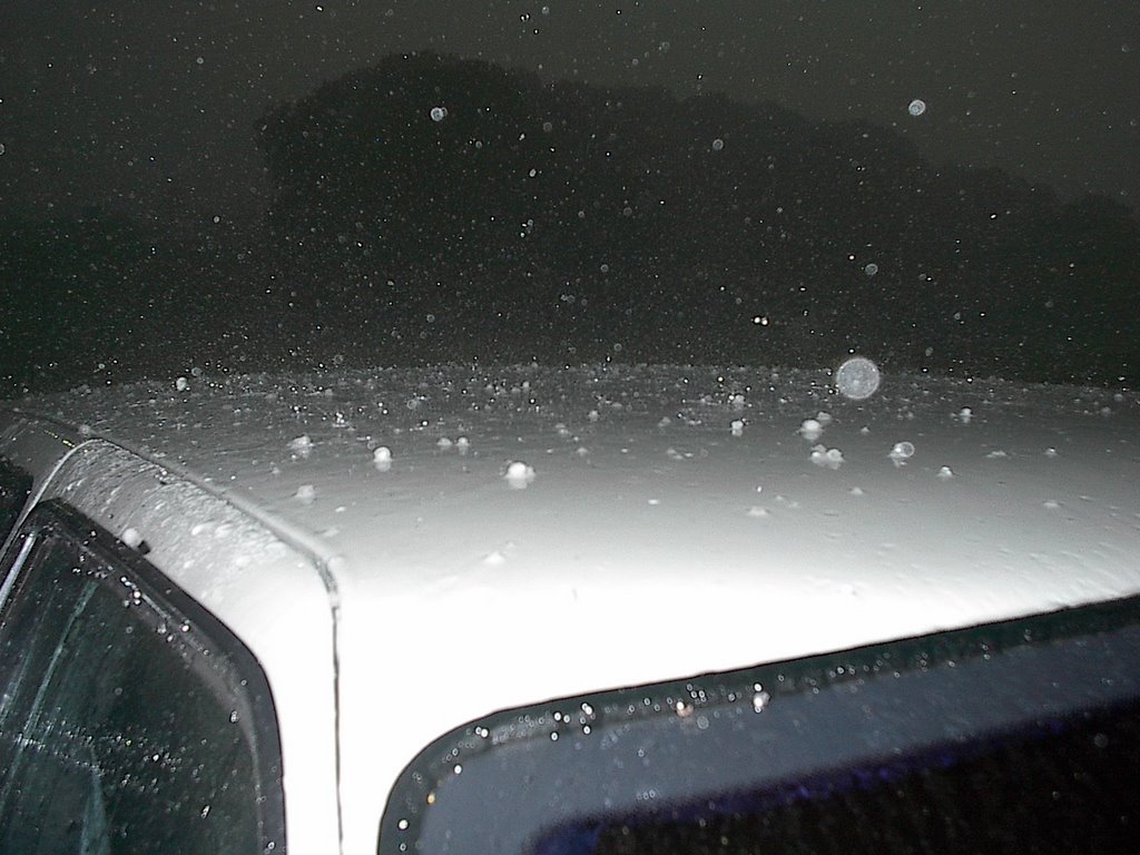
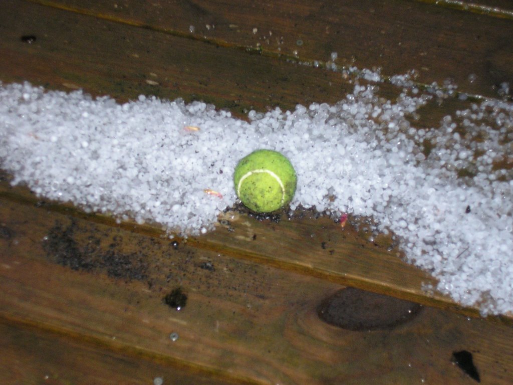
The third picture is thanks to Linda Mull. (No location given.)
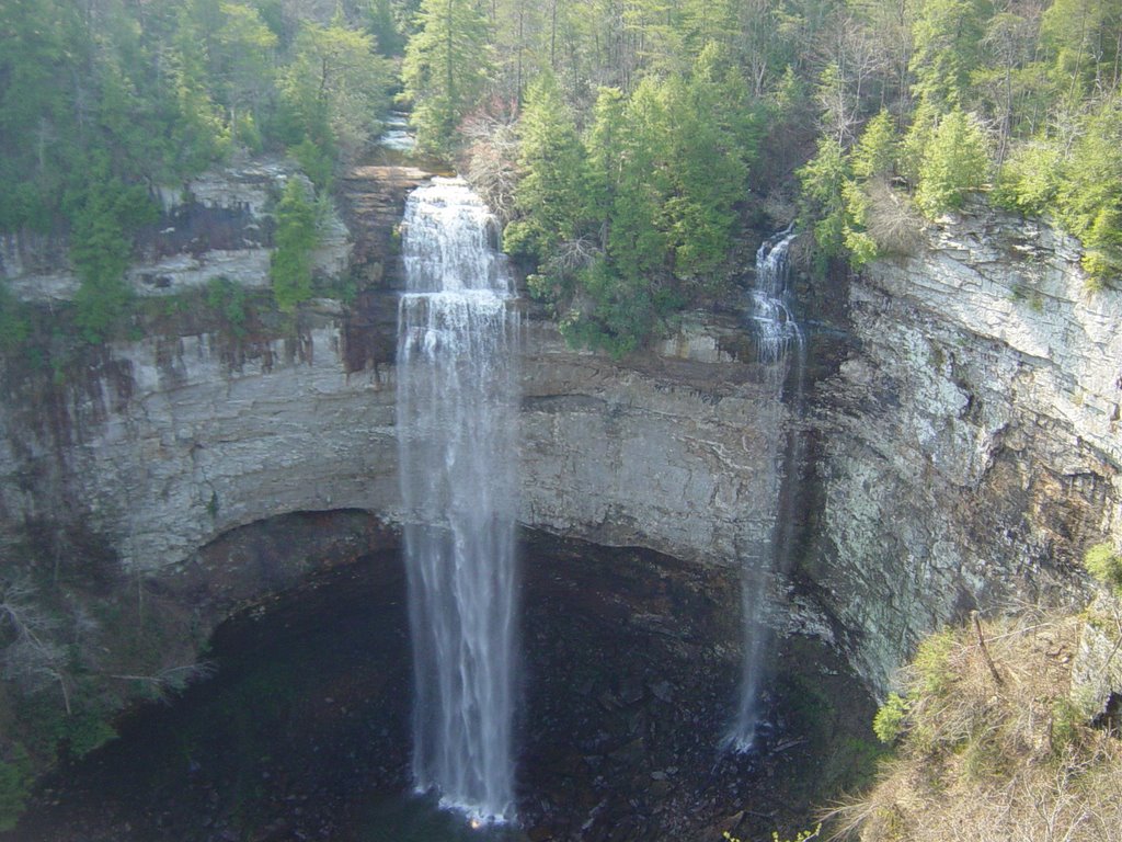
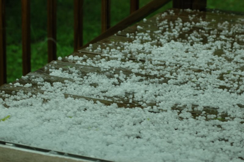
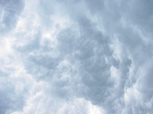
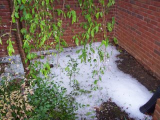
Thanks to Diane Ball of Chatsworth, GA for the fourth picture.
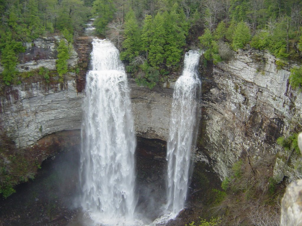
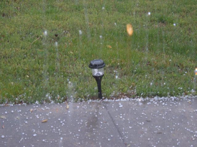
And finally, thanks to Hal Hall of Ringgold, GA for the last picture above.

Let me start off by saying I am very glad this is all we have to show for Friday's storms. For the Friday and Saturday time frame these are the preliminary figures from the Storm Prediction Center:
52 Tornadoes
515 Hail Report (At least penny sized or larger.)
160 Wind Damage Reports (58 mph or greater.)
727 Total Severe Weather Reports.
12 people lost their lives on Friday night in Tennessee.

On Talk Radio 102.3 FM this morning Jeff Styles said he felt like there was a sense of panic among people around the area Friday morning and afternoon. I wasn't out much Friday, but that wasn't exactly the read I got from seeing a lot of you on Saturday. (I met about 1,000 people at one of the kitchens on the "Tour de Jour".) I know during our Friday conversation on the radio I was stressing the need for heightened weather awareness, reviewing severe weather safety rules, and making sure the garage was cleaned out enough so your car could be pulled in without getting dinged up by hail.
I also talked about the Storm Prediction Center's definition of "High Risk" so people would understand this was a special kind of threat being outlined. (By definition, "The HIGH risk area almost always means a major severe weather outbreak is expected, with great coverage of severe weather and enhanced likelihood of extreme severe i.e., violent tornadoes or extreme convective wind events over a large area. Within a high risk area, expect at least 20 tornadoes with at least 2 of them rated F3+, or an extreme derecho causing 50+ widespread wind events (50+) with numerous higher end wind (80+ mph) and structural damage reports.)
And it was an awesome job of forecasting by the Storm Prediction Center, as most of the worst events.....including two F3 tornadoes.......were within the High Risk area. The rest were solidly within the Moderate risk area.
McMinnville which is the center of Warren County is only 50 miles northwest of Channel 3. Three of the lives lost were in Warren County. Touchdowns also occurred in Huntsville, and in the metro Atlanta area.
The question raised by Jeff on the radio is probably a good one. "Was there too much talk before the storms hit, so that next time people will be complacent here?" I hope not. And I honestly believe most people realize how very fortunate we are that scenes from Chattanooga are not being shown nationally this morning. And I would rather have folks tuned in and prepared and damage all around, but not here......than I would like to see someone get hurt or suffer damage and claim "There wasn't any warning".
And before I wrap this up, let me say most people are not aware how absolutely outstanding the area National Weather Service offices performed. The Nashville NWS was getting warnings out 15 to 20 minutes before areas were devastated. When their office was temporarily taken offline by the storms, including the Nashville NWS Doppler radar, the Morristown NWS office picked up the warning process for them while watching storms in their area. And the Huntsville NWS was outstanding before the storms with conference calls and co-ordination with the media and local EMAs.....during the storms with excellent warnings and constant updates......and after the storm with the amount of information posted on their website.
We all had our hands full.
Finally thanks to all of you who e-mailed the station to let Paul, Brian, and I know you appreciated the continuing coverage.
The rest of this week looks pretty tranquil with a gradual warming trend. By Friday and the weekend highs should reach 80 and above.
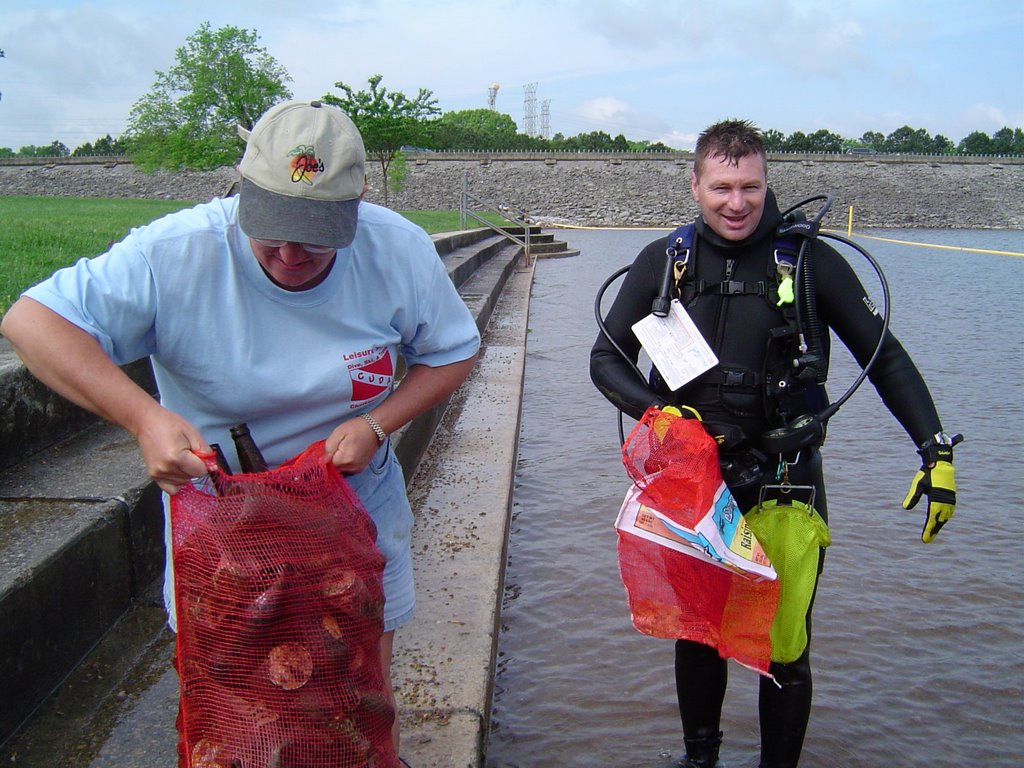
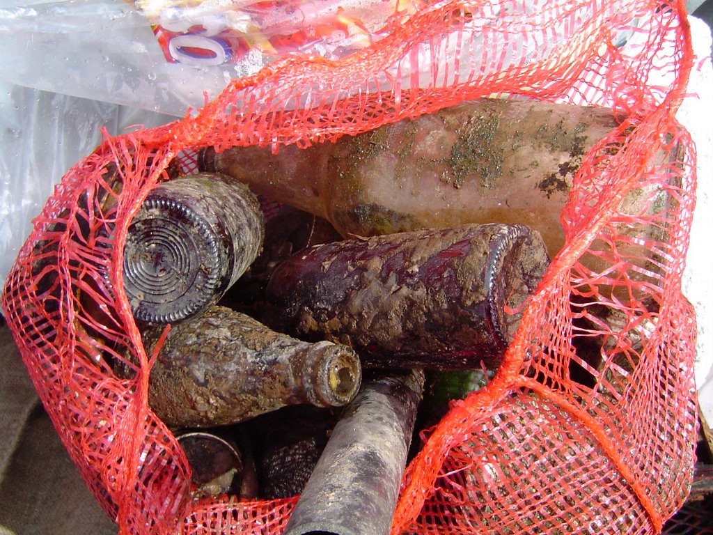
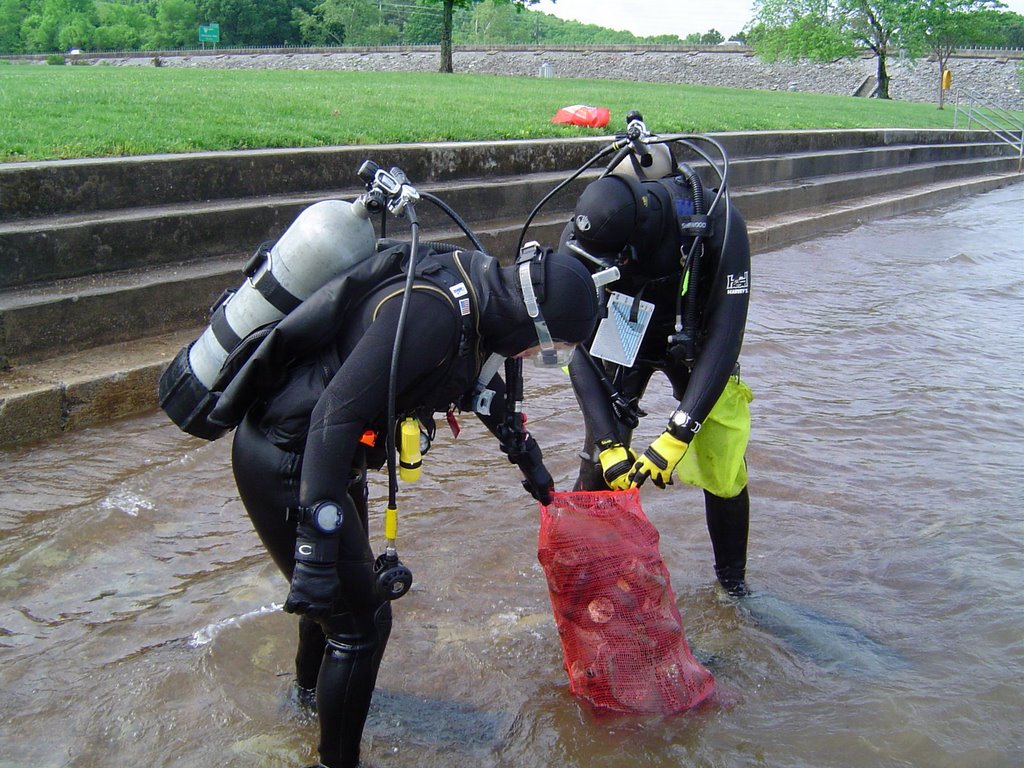
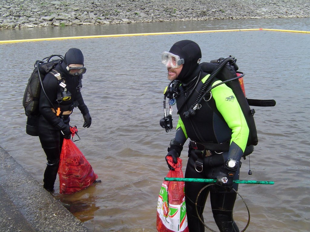
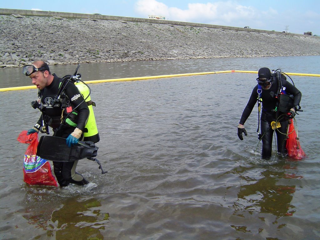
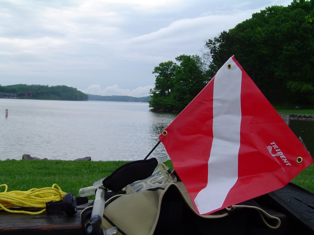
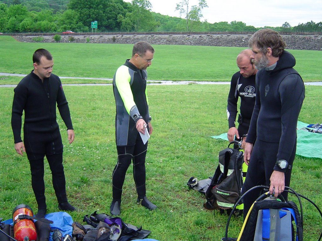
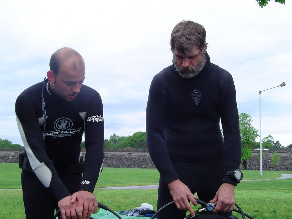
Thursday, April 06, 2006

Two Day Severe Weather Event Unfolding

Click this link to order your Storm Alert Weather Radio: http://www.wrcbtv.com/news/weather/weather_radio.cfm
This picture was taken last week in the field I mentioned in the March 14th post. The work there continues, so I'm guessing 5 to 6 homes will be built there soon. I planted some more jonquils and iris this year. Just about every Spring I've tried to add a few more to the front yard. Right now the jonquils are starting to fade, the liriope and hosta are popping up, and the phlox is looking great. I wish I could find a suitable place for more phlox. It really looks great spilling over a retaining wall or stone wall. I'm not sure what kind of tree is out by the driveway, but it's just now starting to pop with the round, pink blossoms that unfortunately don't last more than about a week. I'll try to get a few snapshots of the blooms in the next day or so and post them sometime down the road. Right now the dogwoods are starting to bloom in the valleys, but it seems like atop Signal Mountain the leaves are just starting to unfurl. But the buds are full and they'll pop quickly. I haven't had time to peek around here yet, but the morel mushrooms will also be popping soon. And with a little luck, I'll spend some time next weekend searching for a few. A cool Spring morning spent in the woods may not be heaven, but I'm hoping there's a section like that somewhere there.

A powerful storm is very evident on the satellite images this morning swirling just east of The Four Corners. This is the system that will likely generate at least two days of severe weather. The Plains states and the Midwest today and tonight. The Mid Mississippi and Tennessee Valleys Friday and Friday night. The southeast corner of the country on Saturday. The question here is, will this system have the potential to exceed what happened last weekend across the U.S.? It certainly appears there will be hundreds of reports of wind damage, very large hail, and tornadoes between now and the time this system pushes off the eastern seaboard late Saturday.
Today just a slight chance for a shower or thunderstorm with highs into the mid 70s. Quiet weather tonight with partly cloudy skies and lows around 56. Friday starts off quiet with partly cloudy skies. But clouds will thicken throughout the afternoon with highs near 75. I think thunderstorms may not move in until after 8 pm, but when they do some will be severe. And by the time the rain and storms move out Saturday afternoon, most areas will get 1.5" to 2" with locally heavier amounts. Then breezy with mostly sunny skies Sunday. Highs Sunday afternoon will end up near 70. Sunny and 71 Monday.

Posted at the top of the page is the link to get your pre-programmed Storm Alert Weather Radio. We would like to see these become as common in homes as smoke detectors.

Wednesday, April 05, 2006

Spring Perfection Followed By Looming Storm Threat

Yesterday's weather across the Tennessee Valley was spectacular. The skies around here are only this blue in the Spring and Fall, and they were perfectly cloudless yesterday. I took this picture of the brilliant yellows of the Forsythia against the cobalt blue sky. I think I'll look back on this shot when the hazy dog days of summer set in, or when the cold and grey of winter feels like it will never end. When they are in bloom, I think about one I knew years ago.
We used to have a sprawling forsythia in the back yard where I grew up. It actually made a natural arch in the corner of the yard. Coming and going from the house by way of the alley was often the preferred choice. Most of the good junk could be found along this route, along with vistas that weren't available from the street out front.
This particular bush was about 8 or 9 feet tall and made a formidable obstacle to whiffle-balls hit out to right field during the constant games played in our yard. We would spend virtually the entire summer fishing fly balls out of the forsythia and hoping my mom wouldn't get too mad when we trampled her peonies another year. (They were right in the middle of center field though. And when you're fading back to catch a long fly to deep center, the landscaping is the last thing on your mind. Besides, they grew back after getting stomped on making that incredible catch last year didn't they?) And at day's end when the games had to be called for darkness, the forsythia was the first place the lightning bugs would light up. Late night batting practice consisted of whacking lightning bugs until your whiffle ball bat was covered in glow-in-the dark spots. (Tell me we weren't the only kids who did this.)
On to the weather at hand.
Things look very nice again today although the clear blue will be streaked with a few cirrus clouds this afternoon. And after a rather chilly morning, highs will pop back into the low 70s this afternoon. Partly cloudy Thursday afternoon with a slight chance for a shower or storm as a warm front sweeps through. Highs into the low and mid 70s tomorrow afternoon. The storm system innudating California will move out into the plains and towards us by Friday night. And unfortunately that spells another severe weather outbreak for the Plains, Midwest, and maybe here. The surface low looks like it will be dropping from near Kansas City to near Nashville from Thursday through late Friday night. So we will have to watch this system and the models closely the next couple of days. The rainfall potential from Friday night into early Saturday could be between 1.5" to 2". Then breezy and cooler Sunday with highs in the upper 60s.
Longer range? A sizeable warm up may be heading our way April 12th through the 17th or 18th, which could be followed by a drop in temps. But batman is back in the garage for another year so I doubt we'll have any sustained cold. He hasn't been fooled in the Spring or Winter yet.

Tuesday, April 04, 2006

01-02-03-04-05-06 Tonight

This picture was taken at Foster Falls in Grundy County, TN. It's a great area to hike, and it's just a short flat walk to see the falls from the top. Recent rainfall should have most of the area falls running quite nicely about now. A couple of weeks ago I was surprised to see the falls at Savage Gulf State Park running. I'm going to try and post some of those pictures in the next few days.
The weather will be rather quiet here the next couple of days with cooler than average temperatures. Look for highs this afternoon into the upper 60s across the area with northwest winds between 10 and 15 mph. This morning was cool, tomorrow we may be 3 to 5 degrees colder. That would put Chattanooga down around 40, but some places could be as cold as 32 to 35 before sunrise. Then back into the low 70s Wednesday afternoon with mostly sunny skies. Thursday a warm front will move through the area, so we could see a couple of storms popping up. But the main system doesn't get here until Friday night into early Saturday morning. That's when the threat for severe weather will be present in the Tennessee Valley. So we'll have to watch conditions during that time frame. Right now Saturday and Sunday look dry and mild.
I'm not sure who thinks of these things, but one of the e-mails circulating lately touts tonight's once in a lifetime event. At 1:02:03 am, it will be 01-02-03, 04-05-06. I'm not sure why I find this amusing and interesting, but I do. And I might even set the alarm. Afterall, it's only a few minutes before I normally get up anyway. So why not? (And yes, I often stare at the odometer in the car when a big number rolls over.)

Monday, April 03, 2006

Bumpy Night, But Not Too Bad


I have to say a big howdy to everyone at North LaFayette Elementary. One of the stops I made around the area last week. In this picture are students Steven Mosier, Phillip Stansell, Robbie Wallin, and William Acuff. It was nice meeting everyone and it was such a nice day for a drive.
Severe thunderstorm warnings kept us busy overnight and into early this morning. But now things are drying out and cooling down a tad for the next few days.
Actually we were very lucky. A few hail reports, and a couple of trees or tree limbs down and that's all that has been reported here so far. And obviously a much different story in Western Tennessee and the Midwest. Preliminary data from the Storm Prediciton Center shows 63 tornado reports, 324 wind damage reports, and 326 large hail reports. As bad as the weather has been in the last 24 hours, it pales in comparison to the April 3rd and 4th so called "Super Tornado Outbreak". That's when 148 twisters touched down in 13 states killing 330 people. Another 5,484 were injured. Folks around here, especially in Bradley County, Tennessee still talk about that terrible outbreak.
For a complete look back, check out this link: http://www.publicaffairs.noaa.gov/storms/
For a complete look forward check out this link: http://www.wrcbtv.com/news/weather/index.cfm