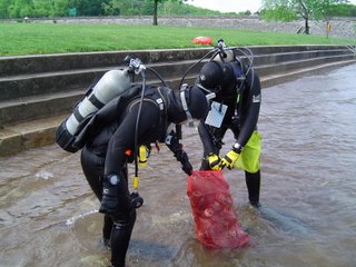
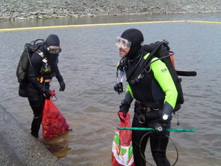
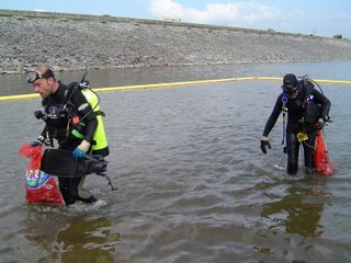
"Tanks!" CUDA Club. Low Pressure Triple Header.


 Once more "Tanks!" to the Chattanooga Underwater Divers Association for their work cleaning up the Chickamauga Dam Swimming area this past Saturday. The group was out there in the same area in October. And it's a shame to think that bags full of trash can keep coming up from the bottom, and from along the shoreline. (This junk piled up during the colder months, imagine what it's going to look like by October when River Rescue comes up again.) Somebody brought that stuff with them, why couldn't they have taken it home with them?
This is a complex weather pattern we're in for the upcoming weekend. Looking at the satellite images you can easily see three separate storms swirling over or near the U.S.. First one is off the North Carolina outer banks, second one is located over the Dakotas, and system number three is now spinning it's heels over southern Arizona and New Mexico. And inbetween is the region of high pressure keeping our skies crystal clear this morning.
So what happens next?
The low off the Carolina coast moves sluggishly backing up all the weather traffic to the west, so the weekend is not looking that bad overall.
Today: Sunny and pleasant with highs near 78 in the city.
Tonight: Partly Cloudy and cool with lows near 51.
Saturday: Some sun early, clouds increase during the afternoon. Highs around 73. Southeast winds 10 to 15 mph.
Saturday night and Sunday: We'll see mostly cloudy skies with scattered showers. Lows Sunday morning will be around 54. Highs Sunday afternoon around 64.
For a look at the rainfall potential check out the "Weather Feature" graphic here: http://www.wrcbtv.com/news/weather/index.cfm
Monday and Tuesday we'll still have a chance for some scattered storms.

0 Comments:
Post a Comment
<< Home