And Here They Come!
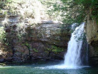
 Another shot from Savage Gulf State Park about one hour northwest of Downtown Chattanooga. They have a great ranger station when you enter the park, (And the cleanest bathrooms I've ever seen at a State Park.) and a sign in / sign out book before you hit the trail. (There are some sheer drop-offs on some of the trails, but you really don't have to get that close.) This weekend may be a great chance to see the area waterfalls like this one at Savage Gulf. A nice shot of rain on the way, with drier and cooler conditions this weekend.
So here goes:
Between 3 am and 5 am this morning we had a few isolated downpours and a couple of rumbles of thunder moving through signaling the unsettled weather to come. As of 8am, a line of thunderstorms from McMinnville to Cookeville is dropping Southeast at 35 mph. We will have a brief period of storminess this morning. Then another round could fire up this afternoon into this evening. A few storms pop again Thursday afternoon. But our biggest round of storms will be from Friday afternoon through Friday night.
Each day today through Friday we have the possibility of seeing some strong to severe storms.
Right now most areas should end up with 3 day totals between 1" to 2"+. Locally heavy rains will of course occur with thunderstorm downpours.
The good news is the latest computer models suggest that all of the rain is over Saturday morning and it stays dry through Tuesday evening. Tuesday night into Wednesday afternoon another system moves through with strong to severe storms possible again.
So after a long dry spell, here they come! And storms will likely keep us busy at times through Friday night.

0 Comments:
Post a Comment
<< Home