Ernesto Near Hurricane Strength

posted by UnderH2Owxguy at 5:10 PM
0 comments
![]()
Random thoughts from someone who loves wind and waves.


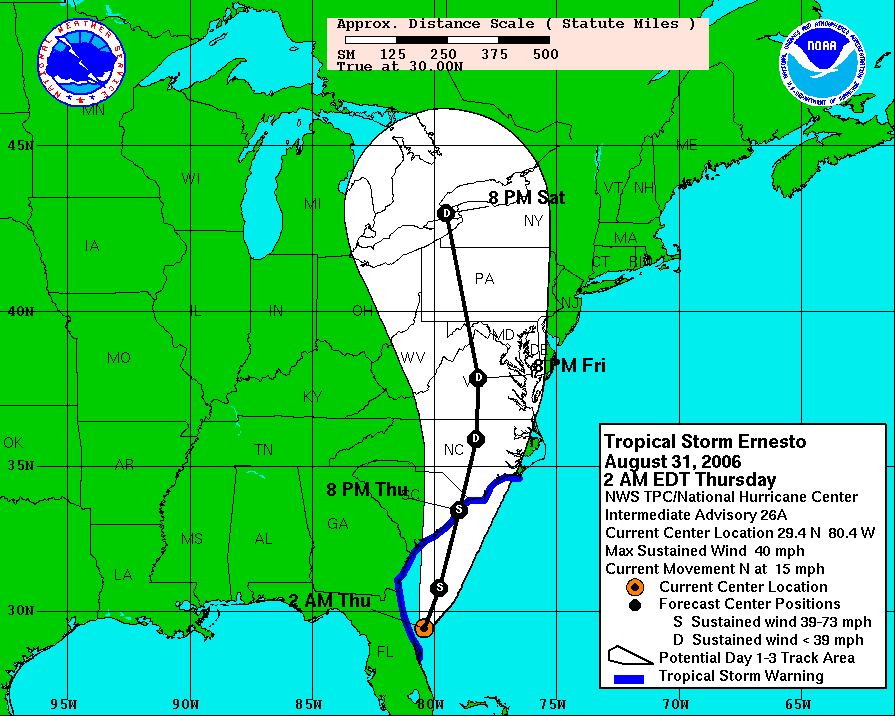
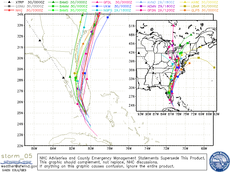
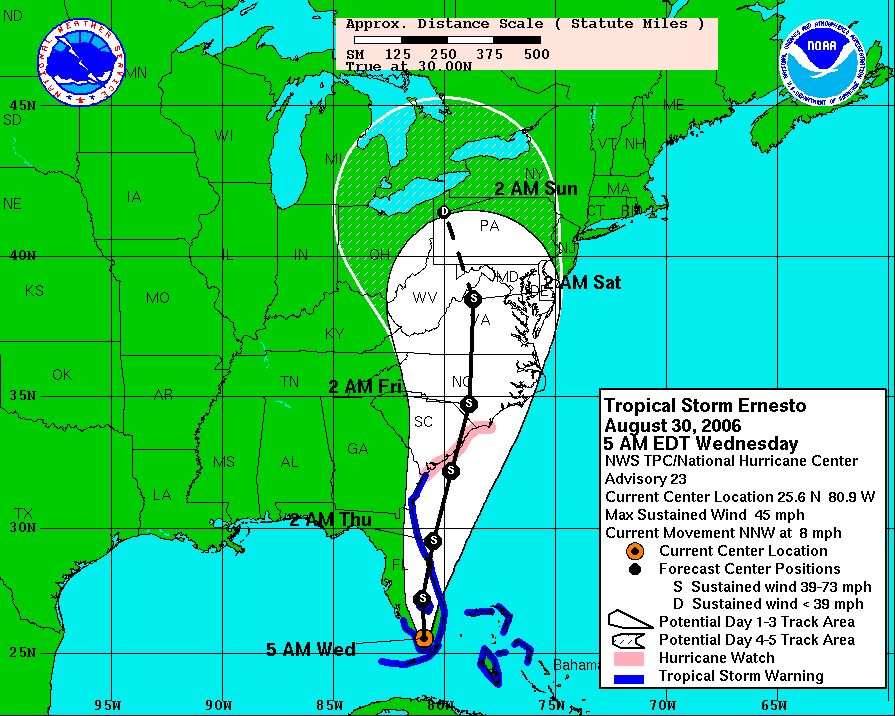
 More than 12" of rain could fall over parts of the Mid-Atlantic states as Ernesto heads north. This morning the storm has 50 mph sustained winds, and with 18+ hours over the warm waters of the Atlantic, this could be a minimal hurricane by the next landfall near Charleston, SC. Whether or not it gets that strong isn't as important as the slug of moisture heading that way.
posted by UnderH2Owxguy at 6:24 AM
0 comments
![]()
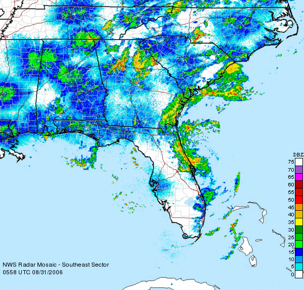
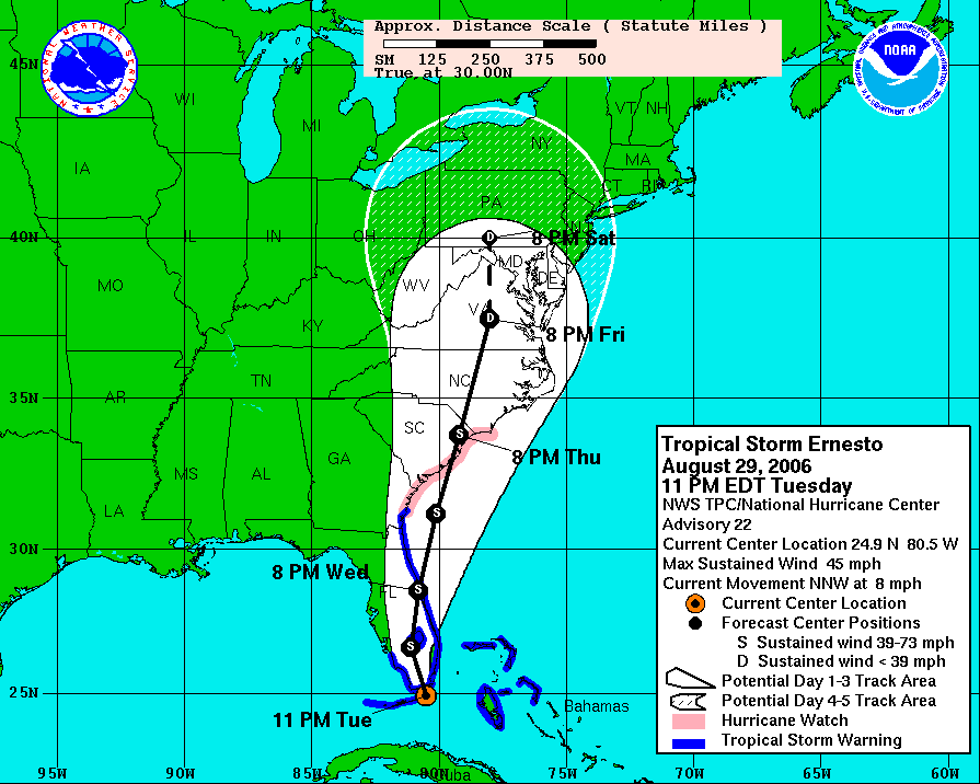
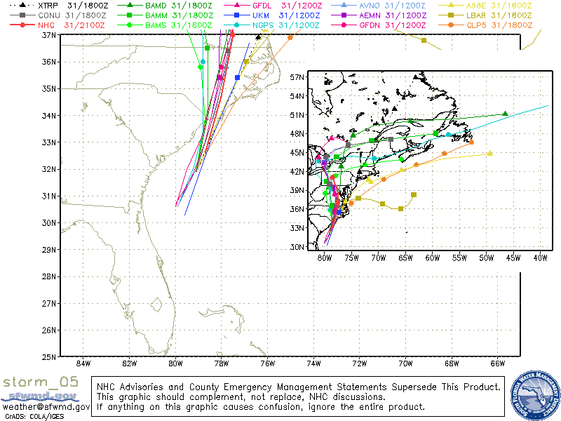
 A big slug of rain is going to be moving north from Florida today right up the east coast into the Labor Day weekend. But most of this will end up well to our east. And as Ernesto pulls away from us, I think our dewpoints will be dropping to near 60 by Sunday and Monday so things will be more comfortable for the end of the holiday weekend.
posted by UnderH2Owxguy at 5:38 AM
0 comments
![]()

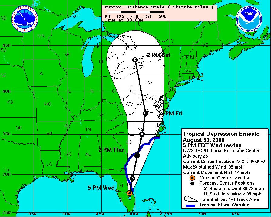
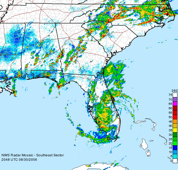
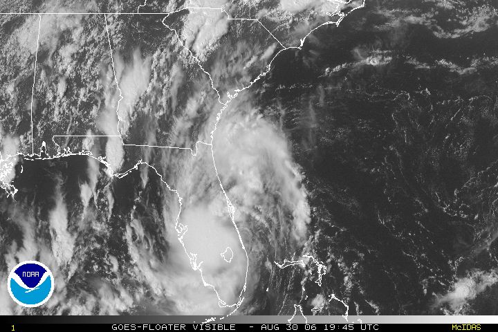
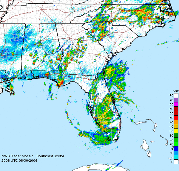
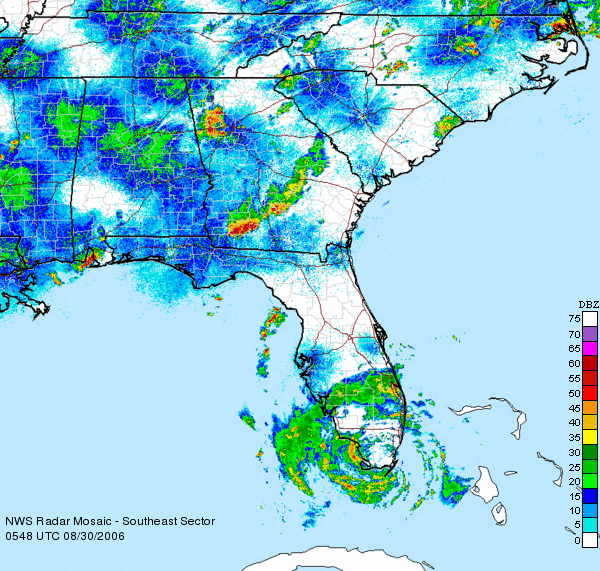
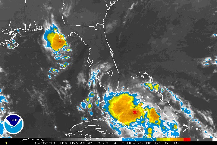
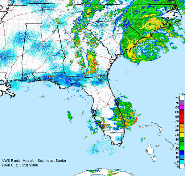
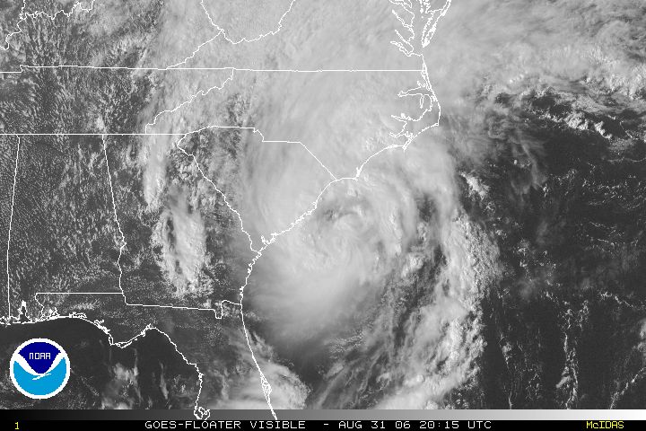
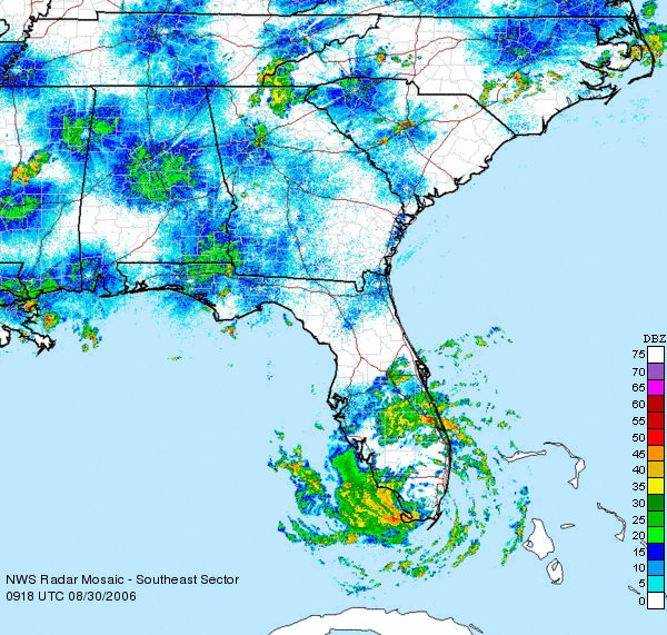
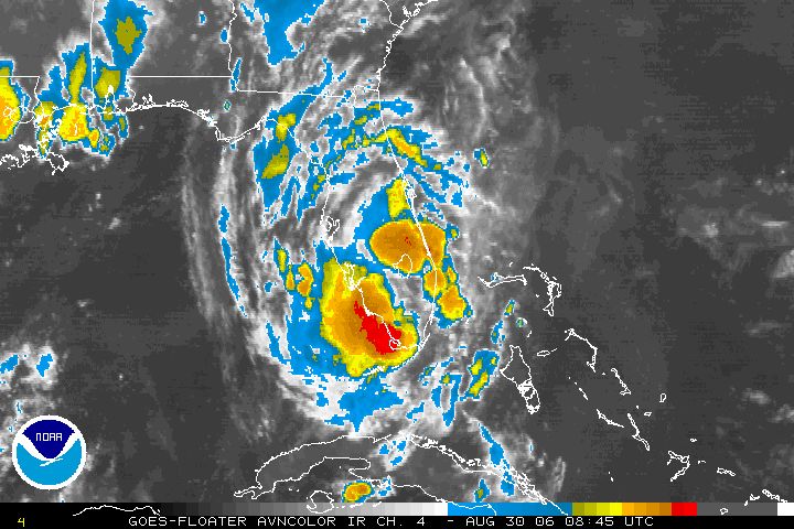
 I was away from computers for quite awhile today, so this post is a little behind schedule. But the satellite and radar image are worth the wait. It will be interesting to see how long Ernesto stays over water once he's done with Florida.
posted by UnderH2Owxguy at 7:23 PM
0 comments
![]()


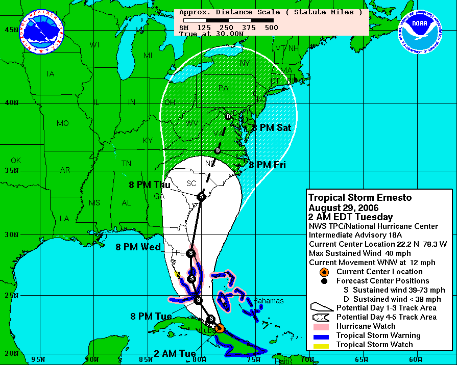
 This morning marks the one year anniversary of the landfall of Hurricane "Katrina", which will be one of those "Where were you?" events in our lives. I hope there are not many more in my lifetime. Looking back at the final report some people forget that this was a double landfalling hurricane like "Andrew". And "Katrina" was deadly as a Category 1 storm in Florida. Here are some of the storm stats:
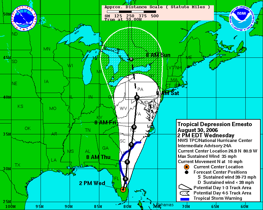
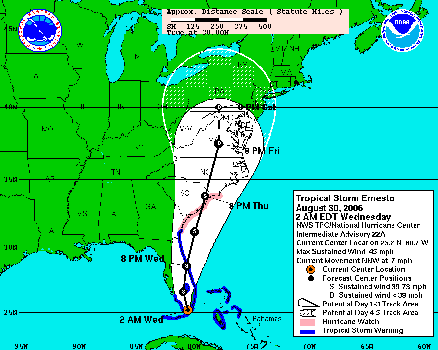
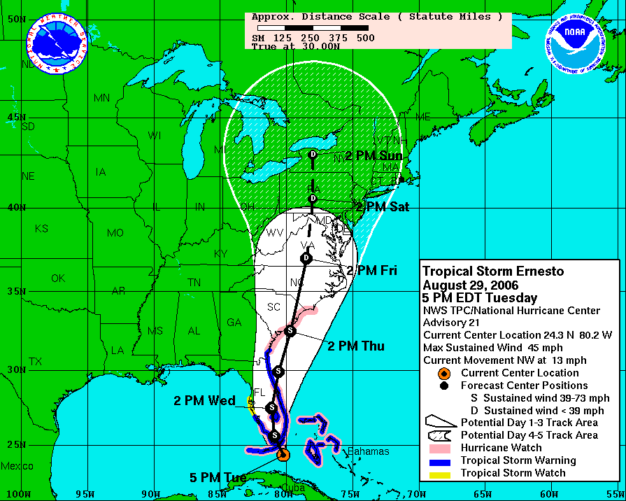
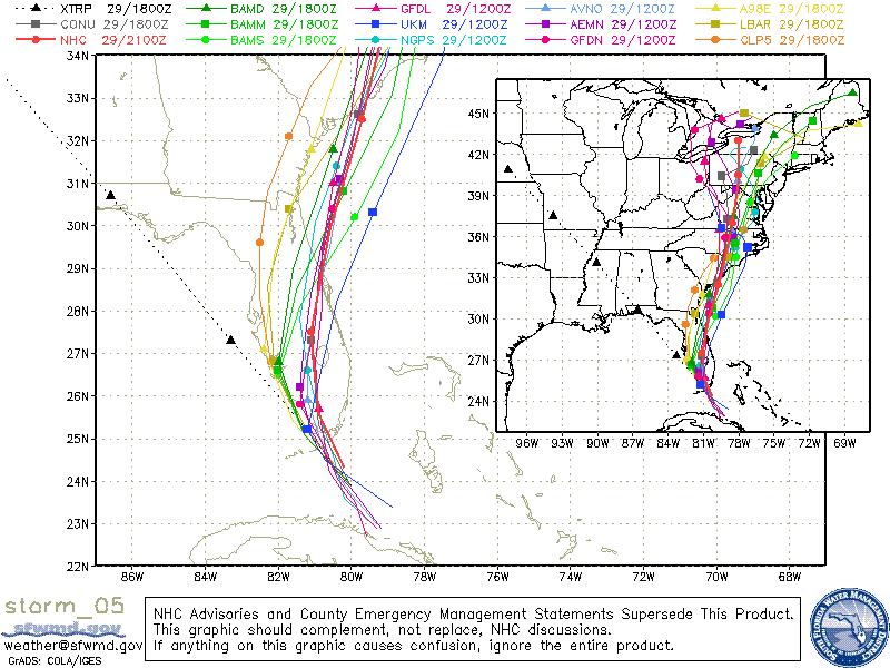
"Ernesto" is the only tropical system close to home right now, and it is a 45 mph tropical storm this morning. There are two possibilities for this storm to become a hurricane. 1) Before landfall in Florida. 2) Over the Gulf Stream off the coast of Georgia or the Carolinas. The official intensity from the National Hurricane Center would take "Ernesto" into south Florida as a strong tropical storm nearing hurricane strength. So it's not out of the question a category 1 hits there. And this storm could re-intensify once it moves out over water in the Atlantic.
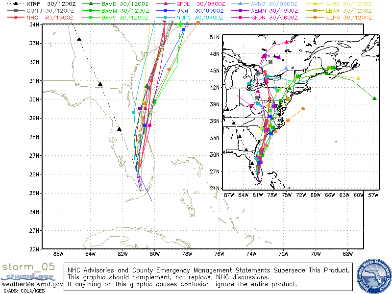
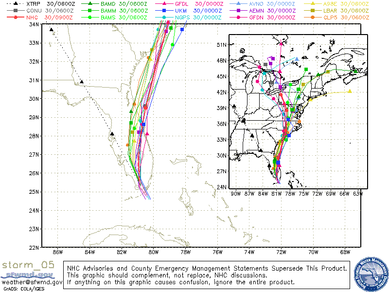
This storm has been trending east from day one, and I wouldn't be surprised if the path is on the eastern side of the forecast "cone" by days three through five. The farther east, the less rain we'll see. And that could pave the way for a very pleasant Labor Day weekend here. So we will be tracking this storm closely into the weekend here in the Channel 3 Storm Alert Center.
Today: Enough sunshine to push highs into the upper 80s this afternoon. Showers and storms become numerous this afternoon.
Tonight: Cloudy with occasional showers. Low: 73
Wednesday: Mainly cloudy with scattered showers and storms. High: 86
Thursday: Partly cloudy with 30% for storms, mainly east of the city. High: 85
Friday: Partly cloudy with 20% for storms, mainly east of I-75. High: 84
Saturday: Partly cloudy. (And less humid?) High: 85
posted by UnderH2Owxguy at 5:38 AM
0 comments
![]()
Employed By The Tennessee Aquarium; Married to - Sandie; Daughter - Misty; Dog - Dudley; Lawn - Needs Mowing