Thursday, December 29, 2005

Prolific Hailers Wrap Up 2005

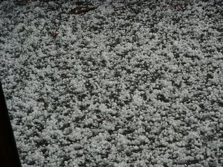

Thanks to Susan Street for e-mailing these hail pictures to the Channel 3 Eyewitness News Storm Alert Team. Susan says it hailed up on Cagle Mountain for 20 minutes straight. Yesterday's storms were prolific hail producers. In many places if you saw any hail, you got an inch or more on the ground. According to the Storm Prediction Center, there were 113 severe weather reports yesterday. Most of those in Alabama, Tennessee, and Georgia. 6 tornadoes were reported in south-central Georgia.
This morning three whirls are very evident on the satellite images. One centered over NE Ohio, (our storm system past) one centered over Wyoming, (our storm system tomorrow night / Saturday morning) and one doozy over the Pacific Ocean, (Our storm system for Monday).
Next one up is probably in and out fairly quickly with scattered showers Friday night into early Saturday morning. But the next one could be a big rain and thunderstorm maker on Monday. We'll have a few days to look at it, but another round of severe storms may be possible.
With this rapid west to east flow across the U.S. it's tough to get cold air dropping south. So look for well above normal temps into the middle of next week.
We've all heard of "Christmas In July", but right now it feels like "April In December."

Wednesday, December 28, 2005

Temperature About-Face.

Another cool picture sent in to Channel 3 Eyewitness News Today for our "Santa Paws" celebration. This is Bailey, the 4 year old miniature Yorkie all decked out by owner Becky Jankura. Becky says Bailey wasn't exactly thrilled with the photo shoot, but I'm guessing there was a nice treat waiting because Bailey looks like she was patient. Thanks again Becky for a great shot.
What a 180 we've seen on the thermometers this morning compared to last week. Some of you were in the low teens every morning, this morning most spots were above 50! Clouds and south winds are making for a very mild start. We had some spotty showers before dawn, and near Blue Ridge and Blairsville even a few rumbles of thunder. A few more showers and maybe a thunderstorm move through this afternoon and this evening. Then a dry period from tomorrow through Friday. But Friday night into Saturday another batch of rain and thunderstorms moves through. But right now it looks as though New Year's Eve (night) and New Year's Day will be dry. And looking ahead our warm readings may continue into at least the middle of next week. Could we see a 5 day stretch of 60 degreee or warmer weather? That would be a nice start to 2006.

Friday, December 23, 2005

Snow For Sleigh? Neigh. Neigh.


Some great pictures sent in by Beverly Ellis. In the top picture Nikki Ellis is on her horse Trixie. The middle picture is Mitch Ellis on Dreamer. And all ready to give Santa a lick on the face is Chewy Brown. Thanks to the Ellis family for being a part of our "Santa Paws" celebration on Channel 3 Eyewitness News Today.
Temperatures will be on the upswing the next few days so it may be better suited for horses than reindeer all the way through next week. Shoppers today will have a real weather bargain after this cold morning. This afternoon we'll see highs into the 50s with lots of sunshine. Then clouds thicken Saturday morning as rain moves in from lunchtime on. Wet for Christmas Eve, but showers taper off overnight. Christmas morning we'll have some patchy drizzle that may appear throughout the day. But with a little luck we'll see some peeks of sunshine before sunset Christmas night. Partly cloudy skies with highs back around 51 Monday afternoon. Mostly sunny with highs in the mid 50s on Tuesday.
Whether it's a one-horse open sleigh or one pulled by 8 tiny reindeer, may yours be a very Merry Christmas!

Thursday, December 22, 2005

Something To Crow About.

This is an awesome picture sent in by Nancy Hall of Hayesville, NC. It's Isabella and her pet rooster, Foghorn Leghorn aka Rooster Tooster. That's a picture that'll put a smile on your face as big as Isabella's. Thanks Nancy for sending it in for our "Santa Paws" celebration on Channel 3 Eyewitness News Today. You really made our day.
As Foghorn Leghorn would say, "I don't need your love to keep me warm Widow Hen. I have my bandages to keep me warm."
An ah-say, ah-say we need something to keep us warm this morning. Here's round three of frost watch 2005:
  • Blairsville 11
  • Decatur, Dayton, Athens, Hayesville, Murphy 12
  • Bledsoe State Forest 13
  • LaFayette 16
  • Trenton 17
  • Ringgold 19
  • Chattanooga 20

Uh ah-think, ah-say, ah-think we get the idea.

But on to bigger and warmer things. Which would be something to crow about. Southwest winds and sunshine will boost area readings into the 45 to 50 degree range this afternoon. Cold again in the morning, but not as drastic. I think Chattanooga will drop to around 25 by daybreak. But with mostly sunny skies Friday's high will top out around 56. Then only 35 Saturday morning. Still looks like some sun early Saturday with clouds thickening. Then showers move in Saturday afternoon with highs into the upper 50s. Showery Christmas Eve into very early Christmas morning. The rest of Christmas Day looks mostly cloudy with patchy drizzle and highs into the upper 40s. If we're lucky we'll see some peeks of sun. Partly cloudy Monday with highs into the low 50s.

A couple of more Foghorn favorites of mine:

"That girl's like the road between Dallas and Fort Worth. No curves."

"Did ya see that hawk after those hens? He scared 'em! That Rhode Island Red turned white, then blue. Rhode Island red, white and blue! That's a joke son. A flag waver! You're built too low. The fast ones go over your head. Ya got a hole in your glove. I keep pitchin' 'em and you keep missin' 'em."


Wednesday, December 21, 2005

Eye! Winter Begins Laddy.

Winter officially begins this afternoon at 1:35 pm EST. This picture was sent to me by my brother who lives in Dublin, Ireland. This is the Passage Tomb and Henge Stones at New Grange above the Boyne River in County Meath. I'm told the Passage Tomb was built around 3,000 BC and the Henge Stones were added about 1,000 years later. To say it's old is an understatement, this tomb was built before the pyramids in Egypt. The tomb was designed so that on the Winter Solstice the rising sun illuminates the very back inside of the structure. Check out 101 facts about this amazing structure at this link:
http://www.mythicalireland.com/ancientsites/newgrange/
I guess I'm fascinated by the fact that ancient people tracked celestial events with such accuracy and seemed to celebrate the changing seasons as we do today.
E-mail received from one of my other brothers this morning says it's 3 degrees in the cornfields of northwest Illinois. And I'm complaining about 23 here. Here are some of the other readings:
  • 12 at Dayton, Decatur and Athens
  • 13 at The Bledsoe State Forest
  • 14 at Georgetown and Fort Payne
  • 15 at Blairsville
  • 16 at Trenton and the Murphy Andrews Airport
  • 18 at Cleveland
  • 20 at Ringgold

We'll be almost as cold again tomorrow morning after a sunny afternoon today with highs in the low to mid 40s. Upper 40s to around 50 Thursday afternoon. And mid to upper 50s on the way for Friday. We should keep a lot of sunshine around until Saturday. That's when the next weather maker slides in bringing with it some showers from Saturday afternoon through very early Christmas morning. Right now it appears like all rain, that may end before sunrise Sunday morning. And Christmas Day we may see some sun poking through the clouds with highs into the mid 40s. Some of the models are trying to squeeze out a flurry late Sunday night into early Monday morning, but even that may be grasping at straws. So leave some hot chocolate out for Santa, although he won't be shivering like he would have been the last couple of mornings.

Tuesday, December 20, 2005

A Three Dog Night.

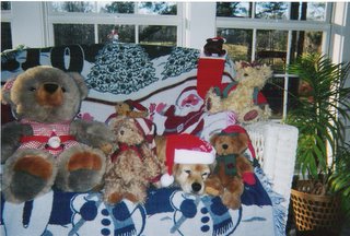
Here's a "Santa Paws" picture sent in by Cheryl Wilson of Walker County of her puppy covered up in Teddy bears. Maybe he's keeping warm. Here are a few of the morning lows across the area:
  • Bledsoe State Forest 14
  • Sale Creek Mountain 15
  • Dayton 16
  • Decatur 17
  • Trenton 18
  • Blairsville 18
  • Athens 18
  • Murphy, NC 19
  • Ft. Payne, AL 19
  • Cleveland 21
  • LaFayette 23
  • Ringgold 24

Another very cold morning tomorrow morning with lows in the city around 22. Outlying areas again should drop into the teens. Today's high will get back into the 40s except mountains which will probably stay in the upper 30s this afternoon. Then upper 40s for the valleys Wednesday afternoon. Mostly sunny skies for Thursday and Friday. Highs on Thursday will climb into the low 50s, mid to upper 50s on Friday. Another system will slide past the area Saturday and Sunday making for showery periods Christmas Eve and Christmas Day. We'll watch this system to see if there's any moisture left over by Sunday night. If there is, this may end as a mix across the area. But right now that seems like a slim chance.

Until then, put another log on the fire for a three dog night again tonight.

Monday, December 19, 2005

Great Scot! Where's my ascot?

We have been showing "Santa Paws" pictures on Channel 3 Eyewitness News Today. And this is Peanut all bundled up for the holidays in a pretty awesome sweater. Thanks to Bethany Mulkey of Soddy Daisy for sending Peanut's picture in. And with morning lows down into the low 20s this morning we might be like ol' Peanut and say with a Thurston Howell accent, "Great Scot! Where's my ascot?" Could be worse though. My brother e-mailed this morning that it was near zero this morning at his house. Not too much farther north from his place it's below zero from Wisconsin into Minnesota. Actually he e-mailed at around 5 am his time. And as of 7 am central time it had dropped to -2 at Moline, IL and -6 at Rockford Illinois. And westerly winds are making it feel more like -15 to -20. OUCH!
Nothing that numbing headed our way, but it will be cold in the morning all week long.
So far this month the daytime highs have been below normal 16 of the first 18 days. And I think we may not get above normal again until Thursday and Friday. Sprawling high pressure will cover us up and keep us dry this week. Christmas Eve we may see a few showers move through. And right now it looks like Christmas Day will be dry.

Friday, December 16, 2005

Extra Holiday Time For Some

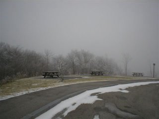
Special thanks this morning to Phil Dyar who sent this shot in of the Cherohala Skyway. That's the scenic highway that runs between Tellico Plains, TN and Robbinsville, NC. Phil's picture was taken Monday morning as he crossed over into Graham County, NC. I have never been over there in Winter before, but you do get above a mile high on the way so it's a sweet spot for snowlovers. I like the trip in the Fall, but it's a great ride in the summer as well. For the most part the Cherohala is lightly traveled. So if you're looking for a Smokies experience without the traffic and without the distance, the Skyway is the road to drive. Check it out at this link:
http://www.cherohala.com/
A little test for drivers this morning as yesterday's moisture re-froze on the roads over night. And as it turns out it was a test many motorists failed or at least did poorly. And gave a lot of kids extra holiday time off. But the next two days look o.k.. We'll see the clouds thickening on Saturday, but still a decent day ahead of our next forecast challenge. Right now it appears low pressure will track along the Gulf coast and head across south Georgia. The rain shield extends northward to about Chattanooga by Sunday morning. So I think there's a reasonable chance that we'll see a winter mix across the area at that time. North of the city not much is expected, but the farther southeast you travel from here the heavier it gets. Does this system move far enough north to give us problems? Probably not but it bears watching. Then quiet weather appears to be ahead. But the European model (and this morning even the NAM) is trying to squeeze out some flurries or snow showers Monday evening or Monday night. Again another weak system for us that just keeps us on our toes.

Wednesday, December 14, 2005

Winter Only 7 Days Away

I didn't spend much time outside yesterday, but the short stroll with Dudley was a pleasant one. The sun had finally poked through the clouds and the front yard was full of birds. I might have missed the variety except right off the bat a pileated woodpecker caught my eye. He would have been close enough for a nice portrait but alas, no camera on hand. I also noticed several robins clustered in the trees. Probably a sign of the transition to Winter. A mockingbird popped his head out of nest in one tree-top as several chickadees and cardinals flitted about. And while all that was going on, I could hear the distant call of some sandhill cranes. I couldn't see them through the trees, but it sounded like they were on the move. There's little doubt they were deciding that it's warmer somewhere else. That got me to thinking about the cooing sound of the sandhill's call, and the haunting sound of the loon. Which I think is one of the most phenomenal sounds in nature. It's been years since I've been to the north woods to actually hear one, but there's a little lake that's pictured above that has the look and feel of Wisconsin or Minnesota. And I'm sure there are those who talk about the sound of the loons when we're camped there. That's a couple of friends from our group in the picture, Lupe Flores and Dan Vance.
This morning's weather was an odd mix of Fall fighting to hang on and Winter trying to sneak in. We had a couple reports of a flurry and one mountain report of a few snow grains falling. They were described as being about the size of a pinhead. Needless to say the precip was pretty light. But it will be showery and cool the rest of the day, with a break in the showers from late afternoon into early tonight. All of the models like the idea of low pressure forming near the Gulf tonight through early Thursday. This system is expected to sling a lot of rain our way. Many areas should average 1" to 1 1/2" from this storm. That dries out late Thursday afternoon and we should stay dry through Saturday. Another system may slide by our south Saturday night and early Sunday with a rain/snow mix for the area. And if the European model is correct there could be a more significant winter weather maker sometime around next Tuesday.
Maybe the weather will have us all feeling a bit looney by then.

Tuesday, December 13, 2005

Twin Spins Contain Rain

Two systems swirling on the satellite pictures this morning. One is moving out of Saskatchewan, (Which should be on any spelling bee list.) and into North Dakota and Manitoba. The second system is spinning to the northwest of Albuquerque. (Actually it's a lot closer to Ogden, Utah but I had to go with tough to spell theme.) Both systems move into the plains today and continue eastward Wednesday. And these twin spins contain rain for us probably moving into the Sequatchie (Another toughie.) River valley by early afternoon. Rainy periods will stick with us through early Thursday afternoon, producing average rainfall amounts of at least one inch for many spots. One the other side of the mountains there could be some icy spots like Boone, NC. Folks there will be thinking about traveling to Chattanooga for the Division 1-AA Championship game on Friday. A longer haul from Cedar Falls Iowa where showers tonight will fall, changing to a healthy band of snow Wednesday morning from the northern system. They'll be in the teens Friday and Saturday mornings with highs struggling back into the low to mid twenties. More reasons why a trip to Chattanooga would seem appealing. Actually I'm rooting for the Panthers. Only because I was in the UNI-Dome one time to see The Who. I don't remember anything about the campus, but that concert was AWESOME. So points go to the school that rocks - the UNI Panthers. I'm not sure if Appy State has played host to anyone from the British invasion. My Alma Mater NIU - once hosted The Kinks. Another show that rocked Chick Evans Fieldhouse.
The next system may slide through late Saturday night and early Sunday morning. That one has the potential to create a wintry mix of precip. So we'll watch it as we head through the next couple of days. To quote The Who - "It's just another tricky day for you, fellah.

Monday, December 12, 2005

Sweater Weather....Indoors

Saturday morning I got up early and took a short walk through the back yard out into the trees behind the house. The ground and chopped up leaves have been wet recently so there was a distinct crunching coming from beneath my feet. Not the soft, muffled crunch that comes from a mid-Fall walk in the woods. No, this was the harsh crunch that comes from several hours when the night air drops into the teens. Later as I was walking Dudley, I was amused at his footfalls in the leaves. His prancing tapped out a staccato rhythm that was different from the swishing sound leaves make when they're not frozen.
We normally don't run the heat that high in the house, but lately it's felt extra chilly inside. So it's been sweater weather indoors. (Although to be honest it's really sweatshirts.) And it really has been cold so far this month.
Daytime highs in December have been below average 10 of the first 11 days.
We have had 8 days 7 degrees or colder than average.
And I don't see us above average this week. We'll stay dry today and tomorrow with highs 48 to 50. Tomorrow morning will be frosty across the area with lows in the 22 to 28 degree range. Two systems join forces to create wet weather here Wednesday afternoon through at least the first half of Thursday. But things should dry out again on Friday.
Things could be worse though. Chicago Illinois has only had 2 hours this month above 32. Which makes me wonder how much corn my brother is going through these days. He has a corn burning furnace to help heat his home. If it's cheap enough, this year he might consider converting his garage into a corn crib.

Friday, December 09, 2005

Better Weather For The Weekend

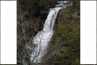
I took this picture a couple of years ago up at Fall Creek Falls State Park. Sometimes people miss opportunities to take a walk in the woods because it's late Fall or Winter. But to be honest, this is some of the best hiking weather of the year. Yes, you have to bundle up a bit. (Especially today.) But when the trees and brush are bare, the vistas open up. And mosquitoes and flies won't be literally bugging you constantly. And after a nice rain like we had yesterday the area waterfalls present nice photo opportunities. I have a book at home that features area waterfall hikes. One day I'll make it to all the locations listed between the covers. I found a great website that's worth checking out if you're looking for some waterfall walks:
http://www.waterfallwalks.com/
Today will be quite chilly with highs struggling to get back into the upper 30s and low 40s across the area. And we'll have brisk north winds at 10 to 20 mph during the first half of today making it feel even colder.
By morning we'll have frosty windshields to deal with as lows in the city drop to around 22, outlying areas will dip into the teens.
Southwest winds help boost temps into the upper 40s to low 50s Saturday afternoon.
Sunday we'll start off with partly cloudy skies, and then see a few more clouds late in the day as another clipper system passes us by to our north.
Next week starts off cooler than normal with very little chance for any precipitation.
Have a great weekend. And if you get a chance, take a hike.

Tuesday, December 06, 2005

Jr. Forecaster Teaching Mini-Meteorologists

Here's a little surprise for Paul Barys. Last Thursday I went to Pennville Elementary in Trion, GA to speak to the students there. I was invited by Mrs. Peggy Hicks whose on the left side of the picture, on the right is Mrs. Kari (Witt) Groce. In 1989 Kari was one of Paul's Jr. Forecasters and today she's teaching at Pennville. In fact they are covering their weather unit right now, so I thought it was pretty cool that his former Jr. Forecaster is now teaching a little weather to those who could be tomorrow's meteorologists.
One of the things we talked about was how wild November was weather-wise and how busy December could be.
And the models this morning still like the idea of a storm brewing in the Gulf over the next couple of days.
Here's the way I see this evolving as of early this morning:
  • Sunny today with highs into the upper 40s.
  • Mostly Sunny Wednesday with highs in the upper 40s.
  • Clouding up Wednesday night and early Thursday.
  • Rain developing Thursday morning into Thursday afternoon.
  • Rainy periods Thursday Evening until around midnight, when some snow could mix in especially north and west of the city.
  • Rain / Snow mix overnight Thursday night and into Friday morning, but ending west to east across the area Friday morning.

Too early to call for accumulation amounts, but I think it's reasonable to say light accumulations are possible along the Cumberland Plateau and even Lookout and Signal Mountains. But mainly on grassy surfaces and above ground objects. Northern valleys may even see some light accumulations north of a Dayton to Athens line. And accumulations may also occur in the mountains east of I-75.

This forecast will continue to be refined so stay tuned to the Channel 3 Storm Alert Team for the latest on this storms path.

Don't forget to join the Channel 3 Eyewitness News Team at the First Tennessee Pavillion tomorrow from 5 am to 6:30 pm for Share Your Christmas 2005. We need your help to re-stock the shelves at the Chattanooga Area Food Bank. See You Tomorrow!

Monday, December 05, 2005

Uggh, Ahhh, Uggh.

Jerry Johnson of Ringgold, Ga sent in this picture that we showed for "Photo Friday" last week on Channel 3 Eyewitness News Today. It was taken on a recent family trip to Carrollton, Ga. Thanks Jerry for sending us a little sunshine after a dreary last couple of days.
I think the headline above fits the mood of most of us when it comes to where we've been and where we're going weather-wise the next 5 days.
Uggh - This past weekend was a mess. Saturday morning the mountain tops awoke to freezing rain lightly coating trees and powerlines. Saturday night we had some severe storms. And Sunday turned out cool and wet as expected. This morning more chilly rain, and up near Crossville a few wet flakes mixed in.
Ahhh - Sunshine returns for Tuesday and Wednesday, but temps will be cold. We'll start out in the mid 20s the next couple of mornings, then bounce back into the mid to upper 40s.
Uggh- Another system is showing up on the models this morning developing over Texas Wednesday, spreading rain into the area Thursday and maybe changing to snow Thursday night and Friday. This potential storm is a real hair puller for meteorologists, as the exact path and intensity could mean everything from a near miss to a doozy of a storm. So maybe we should add another word to describe the forecast.......arrrggghhhh!
***Be sure to join us Wednesday for Share Your Christmas at the First Tennessee Pavillion***

Friday, December 02, 2005

Watching The Pattern Like A Hawk

Photo Friday on Channel 3 Eyewitness News Today and this picture was taken by Steve Felts, our Channel 3 Skywatcher in Murphy, NC. He saw this guy near his house while on a walk. You'll see quite a few red-tail hawks this time of year with fewer leaves on the trees. But getting close enough to get a picture of one is a different story. I've tried several times but usually they take off long before my camera is ready. There has been a pair of red-tail hawks in the woods at my in-laws house. For years I would only see them one at a time. Then this past summer both of them were on the edge of the woods. There was a lot of squawking going on back in the trees. There were a total of five hawks. Three appeared to be juveniles so maybe they had a very successful clutch. They are very neat birds to watch, especially when they are fledglings.
And we're watching the computer models like a hawk for this weekend and next week.
This weekend's set-up features rainy periods beginning Saturday morning and lasting through early Monday. There will even be a few flashes and rumbles as thunderstorms move through as well. Three day rainfall amounts will likely average more than 1 1/2" by the time it wraps up on Monday. And as the precip. ends, there will likely be some snow flurries or snow showers in the higher elevations.
Then much of next week we'll see colder than normal temperatures. In fact Thursday's high might not get out of the 30s in some spots. So our hawk eyes look for any moisture and there's still some potential for shenanigans late Thursday and into Friday. A lot could change before we get there, but this morning's GFS model suggests an accumulating snow for most of the area early Friday. It bears watching given the overall pattern. Stay tuned to the Channel Storm Alert Team for the latest on this situation. See ya on Monday!

Thursday, December 01, 2005

Autumn Gold To Winter Cold?

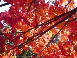
I'm glad I grabbed the camera and took as many pictures around the yard as I did. This one shows the trees between the house and the street and the warm golds they were displaying for what seems like all too short a time frame this year.
A new month today and climatologically we're headed in this direction:
  • The average high and low for December 1st 56 / 36
  • The average high and low for December 31st 49 / 30
  • The average precipitation for December 4.81"
  • The record high for December is 78 set on Dec. 7th 1951
  • The record low for December is -2 set on Dec. 13th, 1962 & Dec. 25th, 1983

I think December will present more forecast challenges than normal this year. The evidence popped up on the Storm Alert Live Doppler Radar and VIPIR this morning. A few flurries raced across the area during the pre-dawn hours. And after a few morning sprinkles, the rest of the day will be partly cloudy and become windy. (The old addage of not liking the weather and waiting a minute for it to change applies here.)

Friday looks chilly, but with mostly sunny skies. Then clouds increase Friday night ahead of the next weather maker. And here's the challenging part. Right now it looks like we see showery periods off and on from Saturday through Sunday night. By Monday morning most of the rain is southeast of here, but there's enough moisture and cold air left over for this system to end as some mountain flurries.

Beyond that next week looks pretty cold especially when compared to average.