Dry Conditions Shown By What's Missing.
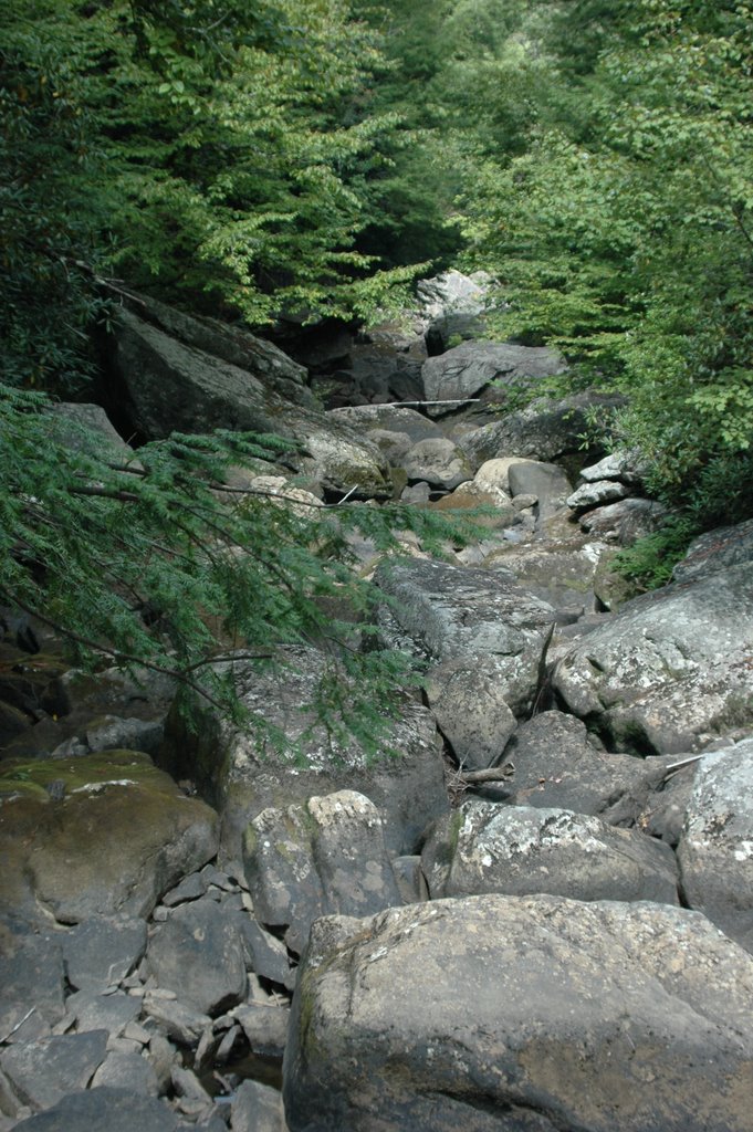


 Todd Yakoubian our former weekend meteorologist was in town last week, and we took a quick trip up to Savage Gulf to spend a very pleasant afternoon hiking. I visited the park back in April, and I was telling Todd how nice the waterfalls were up there. Unfortunately, being nearly 10 inches below average rainfall has some drastic effects on streams on the plateau. In fact we initially took the wrong trail, hiking right past what was a roaring falls back in April. So I'm posting two sets of pictures this morning so you can see the difference between April '06 and September '06. There is still plenty to see at Savage Gulf, so I still think it's worth the trip....especially with this kind of weather. But it's going to take some big time rainfall to get the water rushing down the mountain again.
Morning lows in the higher elevations were down into the 40s this morning. And even Dayton and Murphy dropped into the upper 40s shortly before sunrise today. And the cooler air is still moving into the area, so by morning we should see lows in the upper 40s in the city. Outlying areas may drop into the mid 40s briefly. That's a bit nippy after such a lonnnnnnnnnng hot summer. Our average low tomorrow morning is 60. The record low is 44 set in 1956. The last time Chattanooga was officially in the 40s was May 19th when the airport fell to 46. That's 124 days ago! (And if the GFS model is right, there could be a REAL COLD shot coming up around the first of October. First lows in the 30s? But that could end up being a figment of the models imagination.)
Enjoy this weather while it lasts.
Today: Sunny, cool and breezy. North wind 10 to 15 mph and gusty. High: 73
Tonight: Clear and chilly. Low: 49
Thursday: Mostly sunny and pleasant. High: 78
Friday: Increasing clouds. High: 79 Slight chance for a shower Friday night. Low: 66
Saturday: Clouds and some sun. 30% chance for a shower. High: 83
Sunday: Mostly cloudy with a 50% chance for showers and storms. High: 82
By the way check out your local PBS station tonight and next Wednesday for a special on our National Marine Sanctuaries. It's called "America's Underwater Treasures" and it will feature all of 14 sites including the Flower Garden Banks National Marine Sanctuary which is supposed to be featured tonight. You should get a good idea how close the Tennessee Aquarium has come to re-creating this natural wonder.
posted by UnderH2Owxguy at 6:30 AM
![]()

0 Comments:
Post a Comment
<< Home