Very Efficient Clipper Last Night. Wow Ahead?
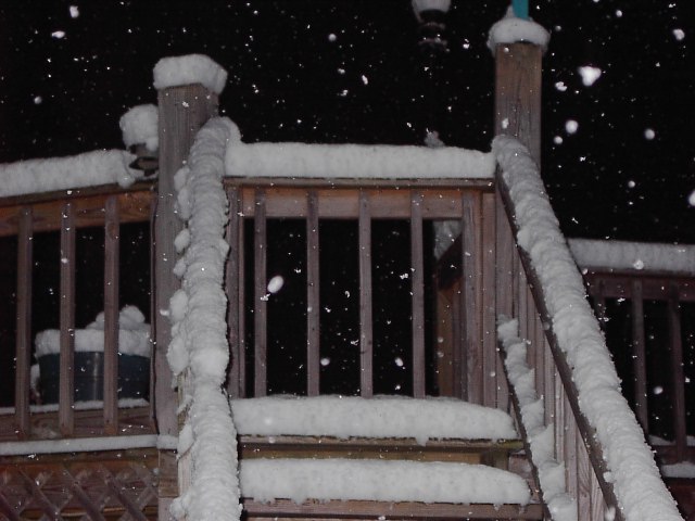 Thanks to everyone who sent pictures in to the Channel 3 Storm Alert Team. I want to thank Jeremy Byers for sending this shot in. Apparently Jeremy was the big winner in the preliminary round of February Clipper Bowl 2006. He ended up with 4 1/2" of snow in just 3 hours. (And this was taken last night. There might have been some minor addition to that overnight and very early this morning.)
If you look back to yesterday's post you'll see how this system was very efficient in it's snowmaking ability. The air ahead of the storm was bone dry. Only .15" liquid was being generated by the models, and 1" to 1.5" of snow ended up falling in the mountains, with Jeremy's place seeing the big bullseye. Northern valleys did end up with the projected 1/4", but the mountains were over achievers it seems.
The rest of day and most of tomorrow chilly but dry.
Now February Clipper Bowl 2006 Part II:
The next system has two parts, one north with the cold air, and one south with the moisture. Questions as always are timing and position of lows.
The read I'm getting from this morning's models is .5" to .75" liquid. This should start off as a rain/snow mix tomorrow evening, and change over to snow for many areas after midnight. And there's still quite a bit of liquid left around the area Saturday morning. So if this system can manage to be as efficient as this last clipper, I don't think it's unreasonable to think mountains north and west of the city could see a 5 inch snow. And it may be possible to get a couple of inches in the valleys.
This is a fluid situation, so be sure to catch all the updates with Paul Barys on Channel 3 Eyewitness News, Live at 5, 5:30, 6 and Channel 3 Eyewitness News at 11. And again tomorrow morning on Channel 3 Eyewitness News Today. See ya then!
posted by UnderH2Owxguy at 8:38 AM
![]()

0 Comments:
Post a Comment
<< Home