More Hail Pics, First 90 Degree Day Ahead.
 A few more hail shots for you this morning.
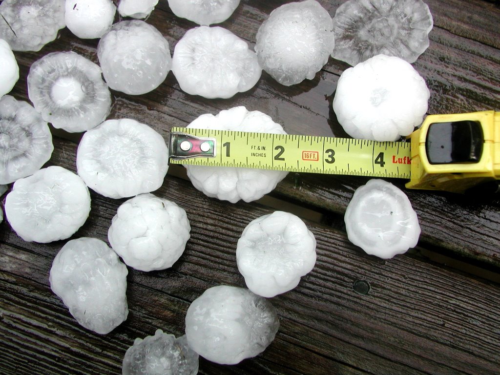
First thanks to Ricky Crews for the nice shot on top of the 2 1/4" hail that fell at his house in Cleveland, TN.
The middle picture was taken in Hopewell, TN near Cleveland. Thanks to Erin Earnest for that shot. Erin says the huge hail fell for a full 5 minutes!
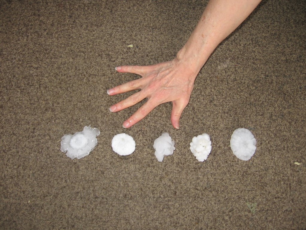
And finally thanks to Keith Stalcup who lives in Eastern Bradley County. And that's 4 year old Novalee Stalcup holding one of the baseball sized chunks of hail that fell at their house.
There is a certain beauty to the close-ups of the hail. Click on the top photo for a full-sized view and you can appreciate the almost geode look to some of the stones. And the frozen- fused look of the small stones that clumped together and fell as one chunk of ice.
When I was in West Texas we used to have this kind of hail 3 or 4 days a year. Back then, one of my skywatchers was Chris Roach. Chris was a retired meteorologist from the National Weather Service, and had done upper air soundings for White Sands Missile Range. Chris knew weather, and always had valuable storm information. One storm was pummeling the Paint Rock, Texas area one June day with softball sized hail. This was before the national lightning dectection network was up and available to television stations. So when Chris called I wasn't surprised by what he had to say at first. "Thom I heard that storm coming before it got here." "I bet you did. That thing probably had a ton of lightning and thunder with it.", I replied. Chris said, "No sir. I heard the hail-stones drumming the ground as it was approaching." There was that much hail it was literally telegraphing it's approach by pounding out a rhythm on the hard Concho Valley ground.
No threat for storms with hail for the next two days though.
We'll see mostly sunny skies today and tomorrow, with temps jumping from the low 80s this afternoon to the upper 80s Friday afternoon.
Scattered storms could move in as early as Thursday morning. And then we'll have scattered storms both Thursday and Friday afternoons. Additional clouds and scattered storms should hold highs down a bit. Look for mid 80s both days.
Then for the Memorial Day weekend things look steamy with highs in the upper 80s to near 90. With summer heat and humidity, we'll have to keep a slight chance for an isolated afternoon storm or two in the forecast for the entire holiday weekend.
A lot of folks will be flocking to the lakes and campgrounds this weekend. And for the most part it looks like typical summer weather for all. Enjoy!
posted by UnderH2Owxguy at 5:51 AM
![]()

0 Comments:
Post a Comment
<< Home