Katrina Deals Blows From Gulf To Home
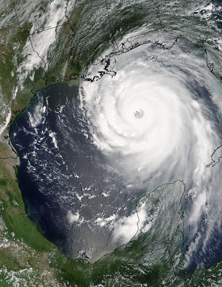
This visible satellite image of Hurricane "Katrina" is from Sunday afternoon when the storm was near it's peak intensity.
As of this morning 10,000 Electric Power Board customers are without power, a result of the area being buffeted by gusty winds. Doppler radar indicates that some of the area mountains may have had gusts over 58 mph.
We will be able to clean up relatively quickly and put this storm behind us. Our weather will be very nice for the upcoming Labor Day weekend.
But it will be a long time (for some maybe never) until those along the Gulf Coast are able to rebuild, restart, and get back to normal. I cannot imagine what they are going through.
Before "Katrina" made landfall I saw news reports from Florida. Many people there have FEMA blue tarps on their roofs from last years hurricanes. The only reminder I have from last years season of storms is the remnants of a red oak that blew down in the back yard during "Ivan". I have been complaining about the firewood I have cut up and can't give away. I'd like to get it out of the yard. How trivial an inconvenience. When I'm mowing around the logs the rest of this year, and probably next Spring, I'll want to gripe. But now my lips are sealed by the knowledge that others are without loved ones and homes.
posted by UnderH2Owxguy at 8:47 AM
![]()

1 Comments:
Angela - There are two answers to your question. First scientists are researching the Atlantic Multi-Decadal Oscillation or AMO. This is a El-Nino like event that occurs over tens of years in the Atlantic ocean. Basically there is a warmer than normal phase, and a colder than normal phase. Warmer than normal - more hurricanes. Colder than normal - fewer hurricanes. The second part is location. We have had active Atlantic seasons before 2004, but most of the storms stayed away from the U.S.. Unfortunately, the last two years have seen disasterous landfalls.
Post a Comment
<< Home