Once, Twice, Three Times A Hurricane?
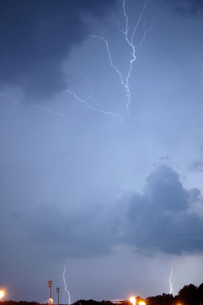 Hats off today to Greg and Angela Burrows of Grundy County, TN for this awesome shot of the storm that moved through their neighborhood on Saturday. I am amazed at the quality of pictures we continue to receive at WRCB-TV 3. Thanks to everyone and keep them coming!
I used to spend a lot of time at night out on a country road waiting for a shot like this. Just me and a 35 mm Minolta. I can't tell you how many blank negatives I have at home somewhere. One time about two o'clock in the morning I was standing out in the middle of a cotton field in West Texas. Here comes a DPS trooper stopping by to see what's going on. The scanner traffic was probably pretty entertaining......."This is unit 12, I have a suspicious subject in a field......Oh wait a minute....It's just the weatherman trying to get hit by lightning."
"Katrina" is a storm that will have people photographing a lot of flooding in the next few days over central and southern Florida.
It's always interesting to track these storms, especially when computer models always have different ideas about what's going to happen. Right now "Katrina" is expected to become a hurricane later today. As it moves across south Florida it will weaken, but should re-gain hurricane status this weekend in the Gulf. One of the long-range scenarios takes the storm out over Norfolk, VA where the storm has a slim chance to re-gain hurricane status. So to borrow from the Commodores (and to give it a tropical flair), "Katrina" could be once, twice, three times a hurricane.
posted by UnderH2Owxguy at 7:15 AM
![]()

0 Comments:
Post a Comment
<< Home